
26.9
PDI
11.2 mi
DISTANCE
4,150 ft
GAINED
6.9 %
AVG. GRADE
FULL CLIMB STATS
INTRO
Cormet d'Arêches (Granier) climbs 18.0 km (11.2 mi) out of Aime, in the Tarentaise valley of France's Savoie department, gaining 1,265 m (4,150 ft) at a 6.9% average grade. This route follows the paved side of the road toward the Cormet d'Arêches, a pass in the Beaufortain massif, passing through the small mountain hamlet of Granier partway up before topping out around 1,944 m (6,378 ft) - just short of where the pavement ends.
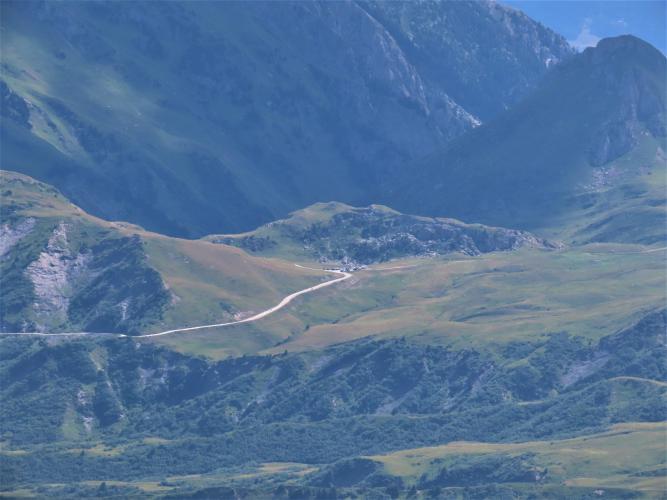
The lower kilometers out of Aime climb gradually through the valley, but the character changes noticeably once the road reaches Granier: from there the grade steadies into a sustained 8-10% through open alpine pasture, with views back toward the Roche à Thomas ridge. Beyond this climb's finish, the road narrows further and turns to unpaved track at Plan Pichu for the final stretch to the true Cormet d'Arêches pass at roughly 2,109 m - covered separately on our Cormet d'Arêches page for riders equipped for gravel.
This is the quieter, tamer neighbor of the Cormet de Roselend a short drive away - Roselend draws the crowds and the Tour de France history, while this Aime-side approach to Arêches stays genuinely lightly traveled. It also sits at the edge of the Beaufortain, the massif that gives its name to Beaufort, the alpine AOP cheese still produced in this valley.
PLAN YOUR ROUTE
 We've partnered with Sherpa-Map.com to bring you the best route planning tool. With a PRO Membership you can use this climb as a reference when creating your route.
 This climb gains 1,265 m (4,150 ft) over 18.0 km (11.2 mi) at a 6.9% average grade. The lower slopes out of Aime are the gentlest part of the climb; the grade steps up noticeably once the road passes through Granier, holding a sustained 8-10% for several kilometers. The steepest mile averages 10.0% and the steepest kilometer 10.5%, both coming in this upper section.
Roadway: The road is paved for the entire distance covered by this climb. Beyond this climb's finish point, the road continues but narrows and eventually turns to unpaved track at Plan Pichu for the last stretch to the true Cormet d'Arêches pass - not part of this route. Like the rest of the high Beaufortain, this road is seasonal, generally rideable from around mid-June through mid-October and closed by snow the rest of the year.
Traffic: Traffic is light throughout. This is a quiet valley and alpine-pasture road with none of the tour-bus or heavy cyclotourist traffic of nearby Cormet de Roselend.
Parking: Aime, at the base in the Tarentaise valley, is a working valley town with its own train station on the line toward Bourg-Saint-Maurice, making it an easy car-free base. Roadside parking is available near the town center and again in Granier partway up the climb.
The upper kilometers through open alpine pasture are exposed to wind and can be noticeably cooler than the valley floor in Aime, so a light packable jacket is worth carrying even in summer. There are no shops or water sources between Aime and Granier, so top off bottles before you start.
Before heading out on any cycling adventure check out our Things to Bring on a Cycling Trip and use our interactive check list to ensure you don't forget anything.
Aime has its own train station on the Bourg-Saint-Maurice line, making this one of the more transit-friendly Tarentaise climbs to reach without a car. The town also anchors a cluster of other PJAMM climbs nearby, including La Plagne's classic Tour de France approach and the Col de Plan Bois - worth combining into a multi-day loop, and our Routes in the Area tool is a good way to see what else is within reach.
The Beaufortain massif this climb edges into is Beaufort cheese country - the AOP alpine cheese is still produced in cooperatives around Beaufort and Arêches, and is worth seeking out at a local fromagerie either before or after the ride.
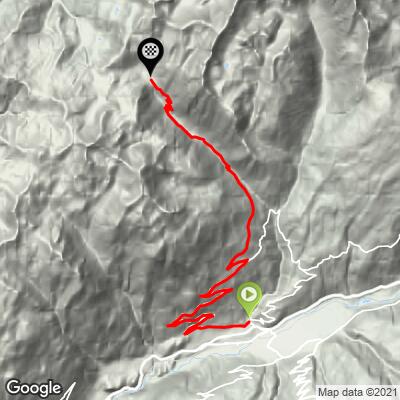
ROUTE MAP
MEMBER RATING
CURRENT WEATHER
PJAMM TRIPS ADVENTURE STARTER BUNDLES
Check out PJAMM Adventure's prepackaged (self-guided) cycling trips. They will help you plan, document and conquer your next adventure.
NEARBY CLIMBS (0) RADIAL PROXIMITY
FROM No Climbs Found
MEMBER REVIEWS & COMMENTS
Let us know what you thought of this climb. Signup for our FREE membership to write a review or post a comment.
Already have an account?
LOG IN HERE
