
15.4
PDI
9.1 mi
DISTANCE
2,787 ft
GAINED
5.8 %
AVG. GRADE
FULL CLIMB STATS
INTRO
The Saint-Cergues side of the Voirons has 4 km of gravel forest road in the middle. This one, from Bons-en-Chablais, is the road-bike way up: tarmac from the edge of town to the car park by the monastery, 14.7 km (9.1 mi) and 849 m (2787 ft) of climbing at 5.8%.
It's a slow build. For the first 7.5 km the Avenue des Voirons climbs at a steady 4-5% out of Bons, past houses and pasture, with views north over the Chablais toward Lake Geneva. Then it hands over to the Route du Monastère, a single lane that wanders through the hamlets of Clavel and La Salle at almost nothing, with one flat stretch and a little dip. The climbing proper is the last 5 km: from La Salle it's mostly 7.5-9% in the forest to the top, with the steepest kilometer at 8.9%.
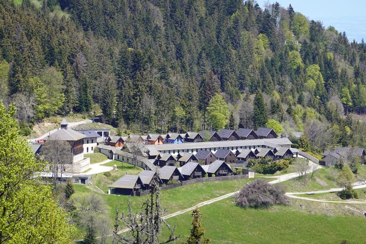
The road ends at the walkers' car park below the monastery of the Sisters of Bethlehem, at 1419 m (4654 ft). The Signal itself, at 1480 m (4856 ft), is a walk up the ridge path, and it's worth the cleats-on stroll for the view over Geneva, the Jura and, on a clear day, Mont Blanc. Up here snow can linger on the verges into May.
PLAN YOUR ROUTE
 We've partnered with Sherpa-Map.com to bring you the best route planning tool. With a PRO Membership you can use this climb as a reference when creating your route.
Signal des Voirons from Bons-en-Chablais is 14.7 km (9.1 mi) long and climbs from 574 m (1882 ft) to 1419 m (4654 ft), a gain of 849 m (2787 ft) at an average of 5.8%.
The steepest 500 m average 9.6%, the steepest kilometer 8.9%, the steepest 2 km 8.4% and the steepest 5 km 8.2%.
Km 0-7 (Avenue des Voirons): a steady 4.5-5% - every kilometer within half a percent of the last.
Km 7-9.5 (Route du Monastère): 1-6%, with a flat stretch around km 8.5.
Km 9.5-14.7 (Route du Monastère, then Route des Voirons): mostly 7.5-9%, with the steepest pitches between km 13 and 14.5 and a slight easing to 6.3% at the very end.
Km 7-9.5 (Route du Monastère): 1-6%, with a flat stretch around km 8.5.
Km 9.5-14.7 (Route du Monastère, then Route des Voirons): mostly 7.5-9%, with the steepest pitches between km 13 and 14.5 and a slight easing to 6.3% at the very end.
Roadway: Tarmac from bottom to top, on three roads of very different character. The Avenue des Voirons out of Bons is a proper two-lane road with a center line. The Route du Monastère through Clavel and La Salle is a single lane of older, patched asphalt in the trees, and the upper Route des Voirons is narrow too, cracked in places. Expect leaves, needles and damp patches in the forest, and snow and ice on the top section through the colder half of the year.
Traffic: Busiest at the bottom, where the Avenue des Voirons serves the residential edge of Bons. Higher up it's quiet, and the top road mostly carries cars heading for the monastery and the ridge walks, more of them on weekend afternoons.
Parking: Bons-en-Chablais has a Léman Express station about 1 km from the start, on the line to Annemasse and Geneva, so you can leave the car at home. Drivers can park in town. At the top, the Parking du Prieuré where the route ends is the walkers' car park for the monastery and the Signal.
Gear: Easy to get right: the long lower half is big-chainring territory for most riders, and the final 5 km never go much past 9%, so a compact with a 28 or 30 is plenty. The top is 845 m above the start and in the trees, so carry a layer - the descent starts cold.
Provisions: Stock up in Bons. You won't pass a shop or a bar on the way up, and the monastery at the top has a craft shop, not a cafe, so fill both bottles before you leave town.
Before heading out on any cycling adventure check out our Things to Bring on a Cycling Trip and use our interactive check list to ensure you don't forget anything.
Bons-en-Chablais sits between Geneva and Thonon-les-Bains, and Thonon, on the lake, is the obvious base if you want a hotel and a waterfront to ride home to. In Bons itself, the thing to see is the Tour de Langin, an 18 m round keep from the 1260s on a hill at Les Granges, about 2 km west of the start - all that's left of the Langin castle, destroyed in 1591. It's on private land, so you look from the lane rather than go in.
At the top, the monastery chapel and its black Virgin story, and the ridge walk to the Signal, are on our Signal des Voirons (Saint-Cergues) page. For a loop, the Route des Voirons carries on down to Boëge in the Vallée Verte, and the gentle Col de Saxel brings you back over to Bons.
To string the Voirons together with the Col de Cou, the Col de Saxel and the other Chablais climbs around Bons, open Routes in the Area on this page.
ROUTE MAP

MEMBER RATING
CURRENT WEATHER
PJAMM TRIPS ADVENTURE STARTER BUNDLES
Check out PJAMM Adventure's prepackaged (self-guided) cycling trips. They will help you plan, document and conquer your next adventure.
NEARBY CLIMBS (0) RADIAL PROXIMITY
FROM No Climbs Found
MEMBER REVIEWS & COMMENTS
Let us know what you thought of this climb. Signup for our FREE membership to write a review or post a comment.
Already have an account?
LOG IN HERE
