
17.8
PDI
10.9 mi
DISTANCE
3,295 ft
GAINED
5.4 %
AVG. GRADE
FULL CLIMB STATS
INTRO
The Col de Merdassier is the high, quiet extension of one of the Tour de France's favorite Aravis climbs. From Thônes, this route climbs 17.6 km (10.9 mi) with 1004 m (3295 ft) of gain - most of it on the Col de la Croix Fry road through Manigod - then carries on past the Croix Fry to the Col de Merdassier at about 1510 m (4954 ft) and up to the hamlet of Tête de la Capieu at 1567 m (5141 ft).
The first 14 km are the Croix Fry: a gentle start along the valley, an irregular climb up to Manigod, then the hardest three kilometers just above the village at 8-10%. Where the Tour riders crest the Croix Fry, you turn right onto a narrow dead-end road for the last 3.5 km - a couple of kilometers of false flat and a short dip, then a final kick to the finish. The Croix Fry's crowds stay behind, and riders who have done both say the Merdassier views are the better of the two.
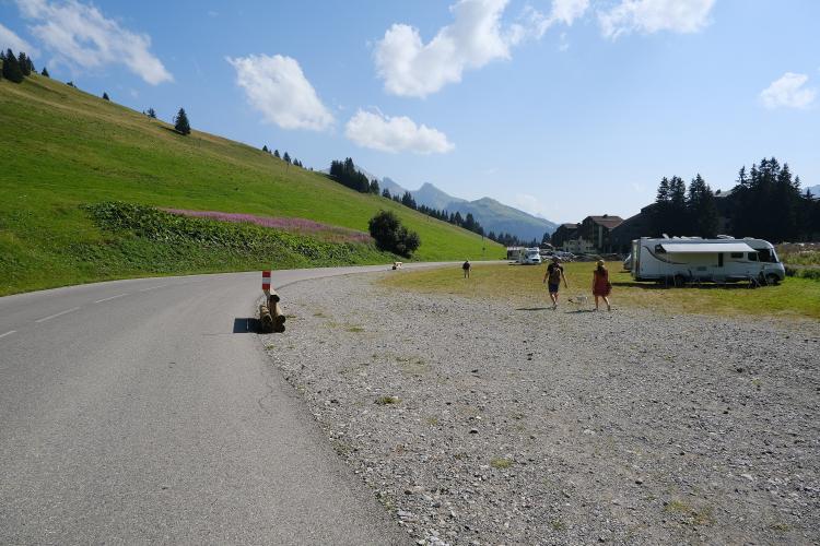
The col sits in high pastures beneath L'Étale and the Pointe de Merdassier, with Mont Charvin in view and the Manigod valley spread out below. It is also the base of Manigod's small Merdassier ski sector, so expect chalets and lift stations rather than a lonely summit sign. The Croix Fry itself has been on the Tour route six times since 1994, most recently on Stage 15 in 2023.
PLAN YOUR ROUTE
 We've partnered with Sherpa-Map.com to bring you the best route planning tool. With a PRO Membership you can use this climb as a reference when creating your route.
The Col de Merdassier from Thônes is 17.6 km (10.9 mi) long with 1004 m (3295 ft) of climbing, from 624 m (2048 ft) to 1567 m (5141 ft). The 5.4% average hides a climb of very different parts.
The first 2 km along the valley are nearly flat at 1-2%. From there the road climbs irregularly at 5-8% to Manigod, with a breather through the village around kilometers 6 and 7. The hardest section starts just above Manigod: kilometers 8 to 10 average about 9.2%, with kilometer 9 at 10.3%, before the grade settles to a steady 7-8% up to the Col de la Croix Fry around the 14 km mark.
After the Croix Fry, the next 3 km are gentle - false flat, a short dip and a gradual rise past the Col de Merdassier - before the final kilometer kicks up again at about 7.4% to Tête de la Capieu.
Steepest sections: 10.5% for the steepest kilometer, 9.9% for the steepest 2 km and 8.6% for the steepest 5 km. The steepest mile (1.6 km) averages 9.9%. The climb is currently ranked #1251 in the world in our database.
Roadway: The road is paved the entire way. The D16 up to the Col de la Croix Fry is a regular Tour de France road, and recent rider reports describe the pavement as very good. Beyond the Croix Fry, the Route du Col de Merdassier is narrower, serving the ski area and a scattering of chalets, and it ends as the paved Route de la Capieu at Tête de la Capieu - a dead end, so you return the way you came.
Traffic: Light for most of the season but busier in July and August, when the Croix Fry draws tourists, campervans and plenty of other riders. Once you turn off for Merdassier, traffic drops to the odd chalet owner or restaurant visitor, with no through traffic at all.
Parking: Thônes is a lively market town at the foot of the Aravis, so park in town and ride from the center. If you would rather start higher, Manigod carries the Accueil Vélo label for cycle-friendly villages and has bike racks, a repair kit with a pump and a bike-washing station.
Provisions: Thônes has everything at the start, Manigod has a cafe in the village, and the Col de la Croix Fry has several restaurants. At the Col de Merdassier itself, La Vieille Ferme serves Savoyard staples - raclette, fondue and tartiflette - but it keeps seasonal hours and closes between seasons, so check before you count on it.
Gear: The steep section above Manigod is where you will want a compact crankset and a 28- or 30-tooth cog. The finish is more than 900 m (2953 ft) above Thônes and riders have reported 5°C in cloud at the Croix Fry in summer, so bring a wind jacket and gloves for the long descent.
Before heading out on any cycling adventure check out our Things to Bring on a Cycling Trip and use our interactive check list to ensure you don't forget anything.
Thônes calls itself the capital of the Aravis and of Reblochon, and its Coopérative du Reblochon Fermier, with its shop Le Farto, is the place to see how the cheese is made: an exhibition and video on farmhouse Reblochon, guided cellar tours by reservation, and a shop open every day.
Up top, the Col de Merdassier is a fine place to linger. The Tour de la Tête de Cabeau is a 7.3 km (4.5 mi) loop walk from the col with 318 m (1043 ft) of climbing and wide views over the Manigod valley, and the pastures below L'Étale are at their best in autumn colors. In autumn, Manigod's cows, goats and sheep also come down from the summer pastures in a transhumance parade through the village, bells and all.
For a longer day, roll back over the Croix Fry and down to La Clusaz to add the Col des Aravis, or link in the Col de Plan Bois from Manigod. Our Routes in the Area tool can show other climbs nearby and help you build a route from here.
ROUTE MAP

MEMBER RATING
CURRENT WEATHER
PJAMM TRIPS ADVENTURE STARTER BUNDLES
Check out PJAMM Adventure's prepackaged (self-guided) cycling trips. They will help you plan, document and conquer your next adventure.
NEARBY CLIMBS (0) RADIAL PROXIMITY
FROM No Climbs Found
MEMBER REVIEWS & COMMENTS
Let us know what you thought of this climb. Signup for our FREE membership to write a review or post a comment.
Already have an account?
LOG IN HERE
carlinguernsey
This is basically the Col de la Croix Fry plus another 2k of easy climbing up to the Merdassier. Once you reach the top of the Croix Fry from Thones, look for the right hand turn to the Col de Merdassier after all of the parking lots (just as the descent starts). Merdassier has an interesting little ski village with some good views.
