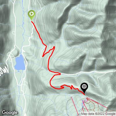
13.7
PDI
5 mi
DISTANCE
2,001 ft
GAINED
7.6 %
AVG. GRADE
FULL CLIMB STATS
Page Contributor(s): Carl Hansen, Guernsey, UK; Niamh Mooney, Pyrenees Cycling Lodge, Saint Savin, France. .
INTRO
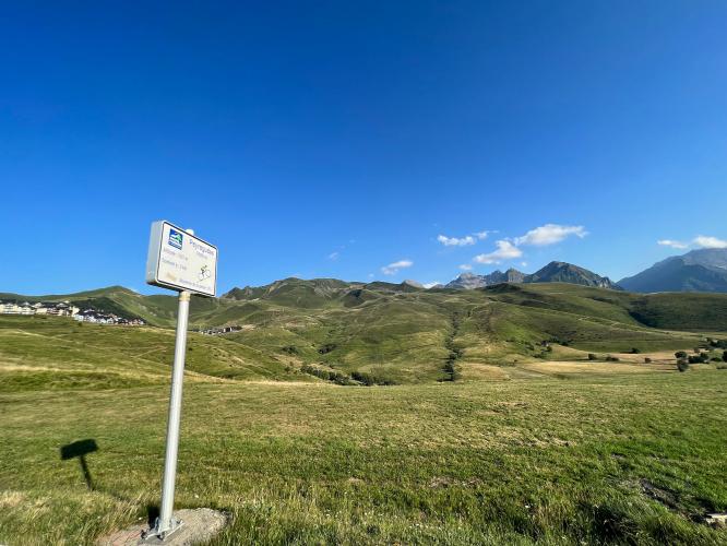
Station de Peyragudes is a modern Tour de France classic, perched above the Col de Peyresourde and accessed via a steep turnoff from the D618 near Avajan. The toughest gradients hit after leaving the main road, making this deviation a true test for climbers. Since its debut as a summit finish in 2012, Peyragudes has featured at the Tour four times—2012, 2017, 2022, and now returns for its fifth appearance in 2025. Legendary moments have unfolded here, including victories by Valverde, Bardet, and Pogačar. In 2025,
Peyragudes is the finish of Stage 13 on Friday, July 18—an individual mountain time trial from Loudenvielle to the iconic ski resort hotel and lodge. With 10.9 km and brutal ramps up to 16%, this stage promises to be a decisive battle for the GC contenders.
PLAN YOUR ROUTE
See more details and tools regarding this climb's grade via our interactive Profile Tool.
Roadway: The roadway is in good shape all the way up to the ski station.
Traffic: There is moderate traffic in the summer on the D618. The road to the ski station has very little traffic.
Parking: You can park in Bagneres de Luchon, Arreau, Avajan and in some other places along the side of the road on both sides and the top of the Col de Peyresourde. You can also park at the Peyragudes ski station at the top of this climb.
Summer in the Pyrenees is normally warm and sunny, even at higher elevations. However, there are some periods of low clouds that can make the climbs quite damp. Bring warm clothes just in case. There are bike shops in Bagneres de Luchon and in St Lary Soulon. Water is available in Bagneres de Luchon, Arreau, and some of the smaller villages along the route.
Before heading out on any cycling adventure check out our Things to Bring on a Cycling Trip and use our interactive check list to ensure you don't forget anything.
There are places to stay in Bagneres de Luchon, St Lary Soulon, and some of the smaller villages in the area. Bagneres de Luchon and St Lary Soulon (and some of the other villages) also have restaurants and shops for food. There are usually some shops open at the ski station during the middle of the day in summer.
ROUTE MAP
MEMBER RATING
CURRENT WEATHER
PJAMM TRIPS ADVENTURE STARTER BUNDLES
Check out PJAMM Adventure's prepackaged (self-guided) cycling trips. They will help you plan, document and conquer your next adventure.
NEARBY CLIMBS (0) RADIAL PROXIMITY
FROM No Climbs Found
MEMBER REVIEWS & COMMENTS
Let us know what you thought of this climb. Signup for our FREE membership to write a review or post a comment.
Already have an account?
LOG IN HERE


