
23.1
PDI
8.4 mi
DISTANCE
3,403 ft
GAINED
7.7 %
AVG. GRADE
FULL CLIMB STATS
INTRO
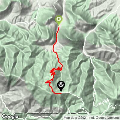
Col Issarbe climbs 13.5 km (8.4 mi) from the hamlet of Barlanès, in the Barétous valley of the Pyrénées-Atlantiques, up to a high pass on the boundary between the Béarn and the Basque Soule. It gains 1,037 m (3,403 ft) at a 7.7% average grade, a long, sustained pull with no real flat sections to recover on.
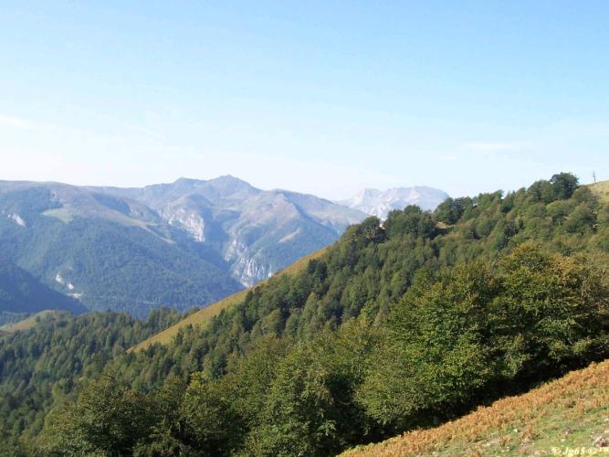
Roughly two-thirds of the way up, the road passes right by the Espace Nordique d'Issarbe, a small cross-country skiing area that's the closest thing to a landmark on an otherwise quiet, forested mountain road. Past there, the climb eases onto more open pastureland as it nears the top, with the Barétous valley falling away behind and the peaks of the western Pyrenees opening up ahead.
This is genuinely remote Pyrenean terrain - the road connects two sparsely populated valleys rather than serving as a route between towns, so don't expect much company. Like most Pyrenean passes above 1,400 m, it's a fair-weather road: snow closes the upper reaches for a good part of the year, and the Issarbe cross-country area itself only operates in winter conditions.
PLAN YOUR ROUTE
 We've partnered with Sherpa-Map.com to bring you the best route planning tool. With a PRO Membership you can use this climb as a reference when creating your route.
 From Barlanès, Col Issarbe gains 1,037 m (3,403 ft) over 13.5 km (8.4 mi) at a 7.7% average grade. The opening quarter-mile is the steepest stretch, averaging 12.4%, and the first half-mile still averages 11.8%.
From there the grade holds remarkably steady rather than easing off: the first mile averages 11.1%, the first 4 km (2.5 mi) average 9.8%, the first 8 km (5 mi) average 9.2%, and the first 10 km (6.2 mi) still average 8.9% - a climb with very little letup from bottom to top. This climb's #707 world-difficulty ranking reflects that sustained, rarely-easing grade over more than 8 miles.
Roadway: Paved the entire way, narrow but in good condition based on recent street-level imagery of the route. It's a winding forest road for the first two-thirds before opening up onto pasture near the top.
Traffic: Very light. This road mainly serves the Issarbe Nordic ski area and a handful of remote farms, so outside of the winter ski season you'll likely have it to yourself.
Parking: There's a parking area at the Espace Nordique d'Issarbe partway up if you'd rather start higher, but most riders will park in Barlanès or nearby Lanne-en-Barétous and ride the full climb from the valley floor.
Gear: Bring a wide-range cassette - this climb barely lets up anywhere, holding 9% or steeper for most of its length, so there's little chance to shift into a bigger gear and recover.
Provisions: Nothing along the route itself outside of the ski season, when the Espace Nordique d'Issarbe's lodge may be open. Stock up in Lanne-en-Barétous or Arette, in the valley, before you start.
Before heading out on any cycling adventure check out our Things to Bring on a Cycling Trip and use our interactive check list to ensure you don't forget anything.
Lanne-en-Barétous and Arette, down in the valley, are the practical bases here - small Béarn villages rather than resort towns, with a handful of local shops and cafes. The area is better known for the larger La Pierre-Saint-Martin ski resort a few valleys over than for Issarbe's smaller Nordic area, so this climb tends to be a quiet, locals-only kind of road even by Pyrenean standards.
For anyone looking to link this with other climbs in the Haut-Béarn, our Routes in the Area tool is a good way to see what else is within reach nearby.
ROUTE MAP
MEMBER RATING
CURRENT WEATHER
PJAMM TRIPS ADVENTURE STARTER BUNDLES
Check out PJAMM Adventure's prepackaged (self-guided) cycling trips. They will help you plan, document and conquer your next adventure.
NEARBY CLIMBS (0) RADIAL PROXIMITY
FROM No Climbs Found
MEMBER REVIEWS & COMMENTS
Let us know what you thought of this climb. Signup for our FREE membership to write a review or post a comment.
Already have an account?
LOG IN HERE
