
27.6
PDI
14.9 mi
DISTANCE
4,786 ft
GAINED
6 %
AVG. GRADE
FULL CLIMB STATS
INTRO
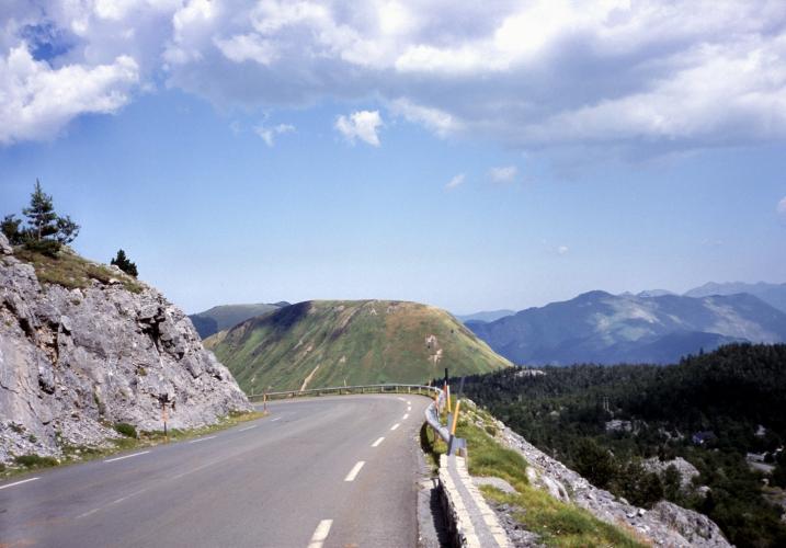
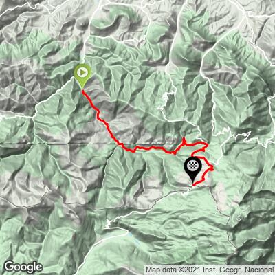
The Col de la Pierre-Saint-Martin sits on the France-Spain border in the Basque Pyrenees, and the D113 is its wilder, quieter eastern approach, climbing 24.0 km (14.9 mi) from the village of Licq-Athérey and gaining 1,459 m (4,786 ft) at a 6.0% average grade to the pass at 1,764 m (5,785 ft).
Unlike the col's western approach from Arette - which hosted the Tour de France's first-ever stage finish here in 2015, won by Chris Froome - the D113 climbs through the remote Soule valley past the village of Sainte-Engrâce, home to an 11th-century Romanesque church and the entrance to the Kakouetta gorges, a dramatic limestone canyon whose walls run up to 350 m deep. The road rolls gently for the first several kilometers before the real climbing starts past Sainte-Engrâce, gaining roughly 900 m (2,953 ft) over the final 11 km (6.8 mi) with long stretches over 12%.
Every July 13th since 1375, the Tribute of the Three Cows (Tribut des Trois Vaches) - one of Europe's oldest surviving treaties - is still reenacted at a border stone near the summit, where French and Spanish shepherds meet to settle centuries-old grazing rights. It's a striking bit of living history waiting at the top of a genuinely difficult Pyrenean climb.
PLAN YOUR ROUTE
 We've partnered with Sherpa-Map.com to bring you the best route planning tool. With a PRO Membership you can use this climb as a reference when creating your route.
 The D113 climbs 24.0 km (14.9 mi) from Licq-Athérey to the Col de la Pierre-Saint-Martin, gaining 1,459 m (4,786 ft) at a 6.0% average grade. The first stretch through the Soule valley toward Sainte-Engrâce is gentle, rarely exceeding 3%, which makes the second half feel even harder by contrast. From Sainte-Engrâce to the pass, the road gains roughly 900 m (2,953 ft) in about 11 km (6.8 mi), with sustained sections over 12%. The steepest continuous mile averages 10.8%, and the steepest kilometer averages 11.2%, both on this upper section as the road climbs past the Pierre-Saint-Martin ski station to the border ridge.
Roadway: The D113 is paved the entire way and has been in good condition on this eastern approach, though it narrows through the Kakouetta gorge section and again above Sainte-Engrâce. Watch for loose gravel or rockfall debris after heavy rain, which isn't unusual in this limestone valley.
Traffic: Traffic is light through the Soule valley and stays that way for most of the climb, since this side sees far less tourist traffic than the Arette/D132 approach that hosted the Tour de France. Expect a few more cars near the Kakouetta gorges parking area and around the Pierre-Saint-Martin ski station in the final kilometers, especially during winter ski season.
Parking: Licq-Athérey is a small village with roadside parking near the D113 junction by the restaurant Chez Bouchet, a natural starting point. There's also a parking area partway up at the Kakouetta gorges viewpoint, though the gorges themselves have been closed to visitors since 2020, with a reopening planned for 2027, so it currently serves only as a scenic pull-off.
There's no store or fountain along the D113 between Licq-Athérey and the ski station at the top, so fill bottles before you start - Tardets-Sorholus, a few kilometers off-route, is the nearest town with a proper bike shop. Weather can turn quickly on this exposed limestone ridge; even on a warm Béarn summer day, pack a wind layer for the pass and the descent, since the border ridge often sits in cloud when the valley below is clear.
Before heading out on any cycling adventure check out our Things to Bring on a Cycling Trip and use our interactive check list to ensure you don't forget anything.
Sainte-Engrâce, about two-thirds of the way up, is worth a slow ride-through rather than a blur on the way past - its 11th-century Romanesque church is one of the architectural highlights of the Basque Country, and the entrance to the Kakouetta gorges sits just beyond the village (the gorges are closed to visitors until a planned 2027 reopening, but the approach road and viewpoint remain accessible). For lodging on this side of the mountain, Tardets-Sorholus and the surrounding Soule valley villages are the practical base - the western approach from Arette has its own well-known cyclist lodge if you're building a longer trip around both sides of this col. If you're stringing together several of the area's cols in one trip, our Routes in the Area tool is a good way to see what else is nearby.
ROUTE MAP
MEMBER RATING
CURRENT WEATHER
PJAMM TRIPS ADVENTURE STARTER BUNDLES
Check out PJAMM Adventure's prepackaged (self-guided) cycling trips. They will help you plan, document and conquer your next adventure.
NEARBY CLIMBS (0) RADIAL PROXIMITY
FROM No Climbs Found
MEMBER REVIEWS & COMMENTS
Let us know what you thought of this climb. Signup for our FREE membership to write a review or post a comment.
Already have an account?
LOG IN HERE
