
19.4
PDI
14.7 mi
DISTANCE
3,852 ft
GAINED
4.9 %
AVG. GRADE
FULL CLIMB STATS
INTRO
Col de Jau from the east climbs 23.7 km (14.7 mi) from Catllar, just outside Prades, to the 1506 m (4941 ft) col (1502 m on our profile), gaining 1174 m (3852 ft) at a 4.9% average. The D14 links the Têt valley with the upper Aude valley near Axat, climbing the length of the Castellane valley before cresting the ridge into the Aude.
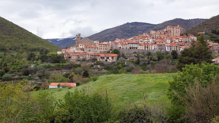
The climb comes in two halves. The first 13 km are a gentle false flat averaging about 3.5%, passing the spa village of Molitg-les-Bains and then Mosset, a hilltop village classified among the Plus Beaux Villages de France. Past Mosset the road narrows and the real climb begins: the final 10 km average 6.7% through hairpins and forest, with no single brutal pitch but no real rest either. Traffic is light the whole way and almost disappears above Mosset.
Look back on the way up - the Canigou is visible behind you for much of the climb and again from the top. Riders consistently name the wind as the real difficulty here, with the tramontane often blowing down the valley, and the col can be cold even in summer.
PLAN YOUR ROUTE
 We've partnered with Sherpa-Map.com to bring you the best route planning tool. With a PRO Membership you can use this climb as a reference when creating your route.
Col de Jau (east) averages 4.9% over 23.7 km (14.7 mi), gaining 1174 m (3852 ft) from 334 m (1096 ft) to 1502 m (4929 ft).
The first 13 km average about 3.5%, with a couple of 5.5% kilometers around Molitg-les-Bains (km 4 and 5) and easier stretches in between. From km 14 the gradient steadies at 6-7.5% almost all the way to the top - the final 10 km average 6.7% - before the last few hundred meters ease to 5.7%.
The steepest 500 m averages 8.3%, the steepest kilometer 7.9%, the steepest 2 km 7.4% and the steepest 5 km 6.9%. Nothing here is truly steep; the challenge is the length, the wind and the lack of recovery in the second half.
Roadway: The D14 is paved the entire way. Most riders rate the surface good, though a few sections are rougher, and the road becomes noticeably narrow above Mosset. Riders have reported loose gravel on the descent of the far side toward Sainte-Colombe-sur-Guette, so take care if you continue over the top. At 1506 m (4941 ft) the col can hold snow into spring - one rider found snow 4 km (2.5 mi) below the summit in April.
Traffic: Light. There are a few cars as far as Mosset, including some impatient drivers on the narrow road around the village, and very little traffic beyond it - riders describe the upper half as having the road to themselves, especially in September.
Parking: Catllar is a small village on the edge of Prades, so the simplest option is to park in Prades, the main town of the Conflent, and ride the short distance to the start. Riders who want a shorter climb often start from Molitg-les-Bains or Mosset instead.
Provisions: Stock up in Prades before you start. Mosset has a public fountain right on the route at about km 10 - the last reliable refill before the col, with 13 km (8.1 mi) of climbing still to go.
Gear: Pack a wind layer. The tramontane often blows through here, and the summit is noticeably colder than Prades - riders recommend dressing warmly for the top and the descent. The upper hairpins are partly shaded by forest, but the second half of the climb is long, so carry enough food for a long, steady effort.
Before heading out on any cycling adventure check out our Things to Bring on a Cycling Trip and use our interactive check list to ensure you don't forget anything.
Mosset is the stop to plan for. The village grew up around a 12th-century castle that guarded the old France-Aragon border; its remains are now private homes, but you can still walk past the Tour Mascarda, sections of the ramparts and the rebuilt church of Saint-Julien-et-Sainte-Basselisse. The Tour des Parfums, a small museum devoted to scent, doubles as the village tourist office, and the Jardin Parfumé and the July lavender festival keep the theme going.
Lower down, Molitg-les-Bains is a spa village with a thermal spa and the grand Château de Riell hotel - a fine recovery stop after the ride. Back in Prades, the Romanesque abbey of Saint-Michel-de-Cuxa sits just outside town, and Villefranche-de-Conflent, covered on our Col de Mantet page, is a short drive up the Têt.
For a bigger day, the road continues over the col and down into the Aude via Sainte-Colombe-sur-Guette; one rider recommends a loop via Axat and the Col d'Aussières. Given how much the wind matters here, check current conditions before you go with our Weather tool.
ROUTE MAP

MEMBER RATING
CURRENT WEATHER
PJAMM TRIPS ADVENTURE STARTER BUNDLES
Check out PJAMM Adventure's prepackaged (self-guided) cycling trips. They will help you plan, document and conquer your next adventure.
NEARBY CLIMBS (0) RADIAL PROXIMITY
FROM No Climbs Found
MEMBER REVIEWS & COMMENTS
Let us know what you thought of this climb. Signup for our FREE membership to write a review or post a comment.
Already have an account?
LOG IN HERE
