25.1
PDI
12.8 mi
DISTANCE
4,316 ft
GAINED
6.2 %
AVG. GRADE
FULL CLIMB STATS
Page Contributor(s): Ard Oostra, Montreux, Switzerland
INTRO
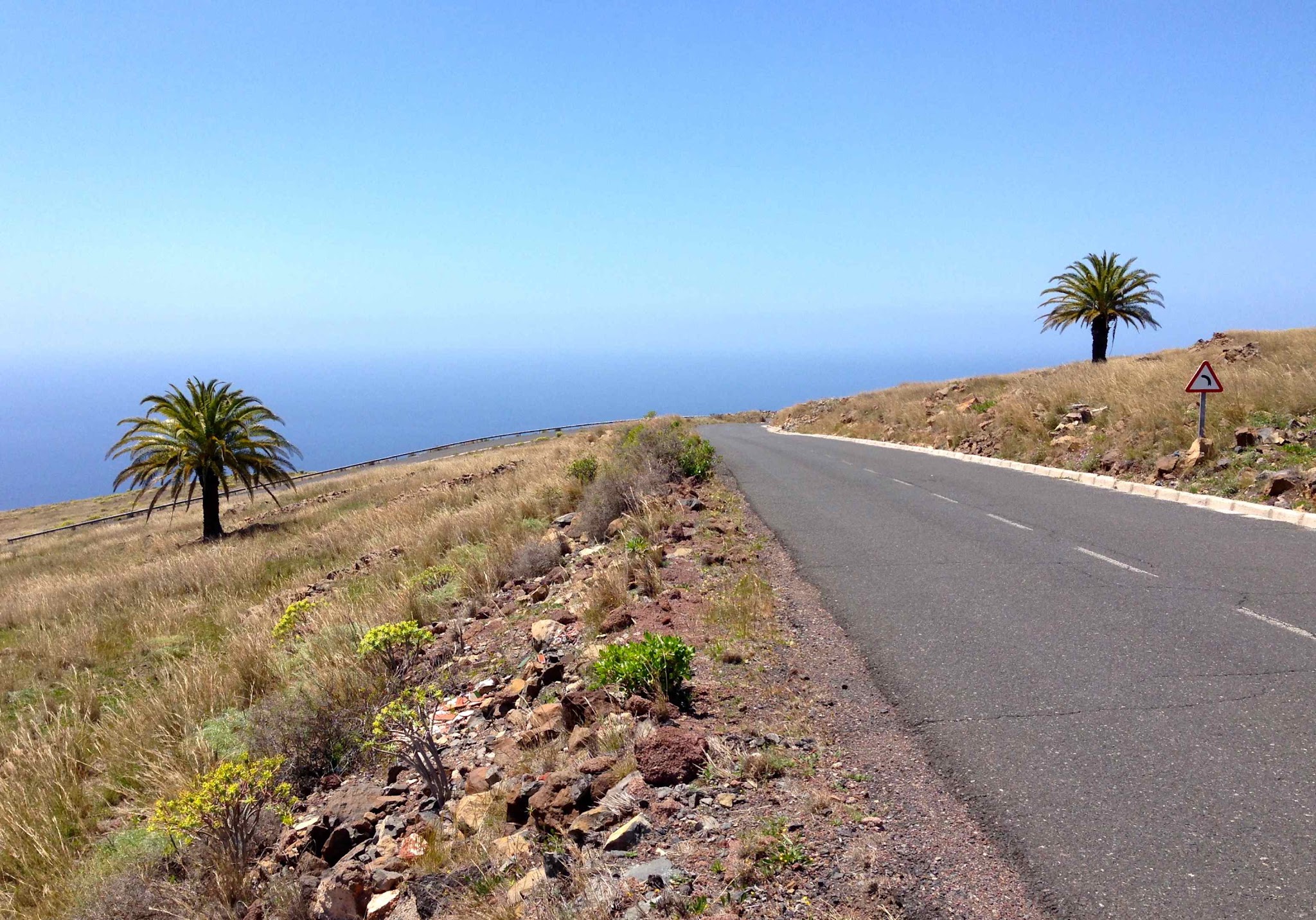
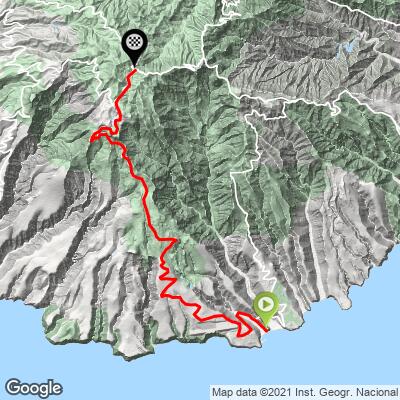
Garajonay climbs 20.6 km (12.8 mi) from the black-sand resort town of Playa de Santiago, on La Gomera's south coast, up to the high point of Garajonay National Park - a UNESCO World Heritage laurisilva (laurel) cloud forest and the highest ground on the island. The route gains 1315 m (4,316 ft) at a 6.2% average grade, from 55m (182 ft) near the Atlantic to roughly 1330 m (4,364 ft) on the mountain.
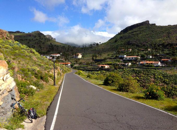
The GM-3 leaves Playa de Santiago's seafront and works inland past La Gomera's small airport before reaching Alajeró, a hillside town at roughly 810 m (2,657 ft). From there the road climbs through eight hairpins between roughly km 11 and 16 that average 6.7%, before easing into pine and laurel forest for the final kilometers. The last kilometer to the road's high point switches from asphalt to old cobblestone paving - a distinctive, rougher finish worth being ready for.
This is the fourth paved approach to Garajonay's summit area in La Gomera, joining routes from Hermigua, Valle Gran Rey, and San Sebastián de La Gomera - see our Routes in the Area tool if you want to string together more than one way up. Playa de Santiago is a quieter base than those towns, with regular ferry service linking it to both.
PLAN YOUR ROUTE
 We've partnered with Sherpa-Map.com to bring you the best route planning tool. With a PRO Membership you can use this climb as a reference when creating your route.
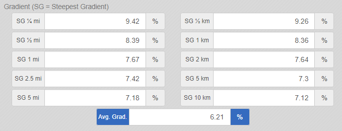
 The grade isn't a steady grind. After a rolling first couple of kilometers out of town past the airport, the steepest kilometer of the climb - starting around km 2.7 - averages 8.4%. The middle section eases before a run of eight hairpins between roughly km 11 and 16 that average 6.7% as the road gains the island's central ridge. The final kilometer to the high point is markedly rougher than the rest, running over old cobblestone paving rather than asphalt - worth dropping a gear and staying seated for.
Roadway: The GM-3 is paved the entire way from Playa de Santiago to within a kilometer of Garajonay National Park's high point, where the surface changes to old cobblestone for the final stretch. The road has been a focus of island infrastructure work in 2026 - the Cabildo de La Gomera carried out emergency repairs across the GM-1, GM-2, and GM-3 network after storm Therese in May, and the GM-3 corridor through Alajeró and Paredes has also seen ongoing construction in recent years - check the Cabildo's road-status announcements before you go in case of localized closures.
Traffic: Light to moderate near Playa de Santiago and past the airport, where the GM-3 is the main link between the coast and Alajeró. Traffic thins out considerably above Alajeró as the road climbs toward the national park, and is generally quiet outside of midday tourist hours.
Parking: Playa de Santiago has ample parking along the seafront and near the ferry dock, a natural place to start. There's additional roadside parking in Alajeró if you'd rather split the climb, and informal pull-offs near the road's high point where the GM-3 meets Garajonay National Park.
Playa de Santiago has a supermarket and pharmacy in town, plus harborside fish restaurants and cafes for a pre-ride coffee or post-ride meal - it's the last reliable resupply point before the road starts climbing in earnest.
Hotel Jardín Tecina in Alajeró, about a third of the way up, has a small shop for basics, though it's set up more for hotel guests than passing cyclists.
Above Alajeró there's no services of any kind until the top, so top off water bottles before you leave town - the climb gains 1,315.5 m (4,316 ft) with little shade once you're past the lower switchbacks. The last kilometer's cobblestone surface is rough enough that wider tires are worth considering if your setup isn't already built for it.
Before heading out on any cycling adventure check out our Things to Bring on a Cycling Trip and use our interactive check list to ensure you don't forget anything.
Playa de Santiago is La Gomera's quieter southern resort town, split between an older fishing quarter by the harbor and the newer development around Hotel Jardín Tecina - a lower-key alternative to San Sebastián de La Gomera or Valle Gran Rey if you'd rather avoid crowds.
A ferry links Playa de Santiago to both of those towns and on to Tenerife, making it a workable base for combining more than one of La Gomera's routes to Garajonay without relocating.
La Gomera's small regional airport sits right alongside the GM-3 partway up this climb, making Playa de Santiago one of the more direct arrival points on the island if you're flying in rather than taking the ferry from Tenerife.
Road access on the south side of the island can be affected by organized events - in September 2026, the Cabildo closed sections of the GM-3 and CV-11 for the Gomera Paradise Skyrunning World Championship. Check the Cabildo de La Gomera's traffic advisories before you go if your visit lines up with a race or festival.
ROUTE MAP
MEMBER RATING
CURRENT WEATHER
PJAMM TRIPS ADVENTURE STARTER BUNDLES
Check out PJAMM Adventure's prepackaged (self-guided) cycling trips. They will help you plan, document and conquer your next adventure.
NEARBY CLIMBS (0) RADIAL PROXIMITY
FROM No Climbs Found
MEMBER REVIEWS & COMMENTS
Let us know what you thought of this climb. Signup for our FREE membership to write a review or post a comment.
Already have an account?
LOG IN HERE