
23.5
PDI
10.8 mi
DISTANCE
3,766 ft
GAINED
6.6 %
AVG. GRADE
FULL CLIMB STATS
INTRO
Rasos de Peguera climbs 17.3 km (10.8 mi) from the edge of Berga to the old Rasos de Peguera ski station at 1889 m (6,199 ft), gaining 1148 m (3,766 ft) at a 6.6% average. It's one of the hardest and most storied climbs in Catalonia - rated as a special-category (HC) climb when raced from Berga - and it sits in the pre-Pyrenean Berguedà, an easy drive from Barcelona.
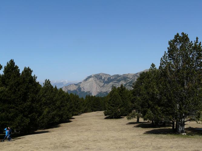
After a gentle first 4 km around Berga, the climb turns onto the BV-4243 at Font Negra and barely lets up for the next 13 km: there are very few recovery sections, and most kilometers average more than 6%. The road climbs past Espinalbet, the Font Freda campsite and the Xalet-Refugi dels Rasos de Peguera, and threads the Pas dels Lladres - the "thieves' pass," a narrow gap between big boulders. Near the top the road splits into a one-way loop before the final ramp to the Creu del Cabrer, the big roadside cross that marks the summit.
The cross gives the climb its other name. Local legend has it that Josep Costa, "El Cabrer," a 19th-century goatherd turned Robin Hood-style bandit, hid in the caves of this mountain and was finally caught here through betrayal. The summit has also hosted three Vuelta a España stage finishes: Vicente Belda won in 1981, Éric Caritoux in 1984 on his way to a surprise overall victory, and Alex Zülle in 1999.
Rasos de Peguera was one of the first places in Catalonia where people skied, and it was long the closest ski area to Barcelona. The alpine resort operated from 1975 until 2004, when it closed for lack of reliable snow, but the station area and its car park still draw big weekend crowds of hikers, sledders and snowshoers.
PLAN YOUR ROUTE
 We've partnered with Sherpa-Map.com to bring you the best route planning tool. With a PRO Membership you can use this climb as a reference when creating your route.
 Rasos de Peguera is 17.3 km (10.8 mi) long and gains 1148 m (3,766 ft) at a 6.6% average, from 742 m (2,434 ft) near Berga to 1889 m (6,199 ft) at the old ski station. The signed official climb, from Font Negra, is 13.1 km (8.2 mi) at about 7.4%.
Km 0-5: the warm-up - 3.1-5.9% per kilometer around Berga and onto the BV-4243 at Font Negra, about 4 km in.
Km 5-9: the hardest sustained stretch, 7.1-9.5% per kilometer, including a long, psychologically tough straight in the 9-10% range.
Km 9-13: a little more broken, alternating between 5.1% and 7.9%.
Km 13-17.3: the sting in the tail - 9.3% for km 13-14, then 7.0-8.5% through the final hairpins and the one-way loop to the cross.
Steepest sections: 100 yd (91 m) at 11.2%, 0.5 km at 9.9%, 1 km at 9.3%, 2 km at 8.8%, 5 km at 8.1% and 10 km at 7.5%.
Roadway: Paved the entire way. The lowest 3.5 km of the BV-4243 above Font Negra got a six-month safety upgrade from the Diputació de Barcelona starting in February 2025, widening the tighter bends and rebuilding the junction with the BV-4242. Near the top the road splits into a one-way loop: keep right on the way up and follow the loop around on the way down. In winter the road can close for snow clearing - a lit sign on the BV-4242 near the old Hostal del Guiu shows whether it's open.
Traffic: Light on weekdays. Weekends are a different story, especially from late morning into early afternoon, when day-trippers head up to the old ski area; in snowy periods, cars parked along the road edge near the top can squeeze it down to a single usable lane.
Parking: Berga has street parking and public car parks close to the start by the C-16. At the top, the old station car park is large - use only the marked spaces, since roadside parking there is the main cause of weekend jams.
Gear: There's no truly savage ramp here - the steepest 100 yd tops out around 11% - but there's almost nowhere to recover for 13 km, so a compact with a 30- or 32-tooth cog makes the long 8-9.5% stretch above Font Negra far more manageable. The first 4-5 km of the BV-4243 are largely shaded; above that the climb is mostly open to the sun, so start early on hot summer days, and bring a layer for the long descent from nearly 1900 m (6,234 ft).
Provisions: Stock up in Berga. Along the way, the Font Freda campsite and the Xalet-Refugi dels Rasos de Peguera near the top are the only places that may have food and drink, so check their hours before counting on either.
Before heading out on any cycling adventure check out our Things to Bring on a Cycling Trip and use our interactive check list to ensure you don't forget anything.
Berga is the natural base, and it's worth timing around its calendar: every year around Corpus Christi the town stages La Patum, a festival of fire, giants and drums recognized by UNESCO as intangible cultural heritage. It's spectacular, but lodging fills up and streets close, so plan accordingly.
Early in this climb you pass the turnoff for the Santuari de Queralt, perched on a cliff above Berga - a short, punchy add-on of about 4.5 km at 7.5%, with the best view over town. Higher up, a side road toward Castellar del Riu leads to the Pi de les Tres Branques, the three-trunked pine long treated as a symbol of Catalan unity.
Rasos de Peguera is number one on the Berguedà tourist board's list of mountain passes and is signposted at both the start and the summit. From the top, a mostly unpaved track continues north past the abandoned village of Peguera toward Fumanya - not a road-bike link, but a reminder of how close this summit is to the Creu de Fumanya climb. The summit sits close to 1900 m and weather changes quickly here, so check current conditions before you go with our Weather tool.
ROUTE MAP

MEMBER RATING
CURRENT WEATHER
PJAMM TRIPS ADVENTURE STARTER BUNDLES
Check out PJAMM Adventure's prepackaged (self-guided) cycling trips. They will help you plan, document and conquer your next adventure.
NEARBY CLIMBS (0) RADIAL PROXIMITY
FROM No Climbs Found
MEMBER REVIEWS & COMMENTS
Let us know what you thought of this climb. Signup for our FREE membership to write a review or post a comment.
Already have an account?
LOG IN HERE
