27.6
PDI
13 mi
DISTANCE
4,608 ft
GAINED
6.4 %
AVG. GRADE
FULL CLIMB STATS
Page Contributor(s): Ard Oostra (Big 108), Switzerland
INTRO
Dalsnibba is the mountain above Geiranger whose access road ends at the Geiranger Skywalk, widely cited as the highest fjord viewpoint reachable by road in Europe. From the village of Geiranger, the climb runs 21.0 km (13.0 mi) and gains 1,405 m (4,608 ft) at a 6.4% average grade, with the steepest continuous mile averaging close to 10.0%.
The route leaves Geiranger on the Ørnevegen ("Eagle Road"), a stack of hairpin switchbacks that climbs the valley wall above the Geirangerfjord before settling into a long, steady pull past the Flydalsjuvet gorge and Djupvatnet lake. At Djupvasshytta the road forks onto Nibbevegen, a narrower toll road that gains the final 438 m (1,437 ft) over 4.6 km (2.9 mi) through eleven more hairpins to the summit plateau. Cars pay a toll at the gate, but cyclists are waved through free of charge.
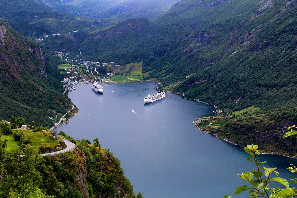
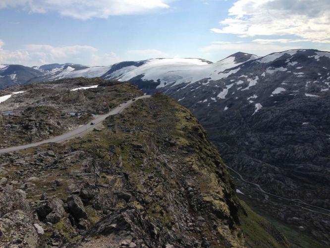
The payoff is one of the most photographed views in Norway: the Geirangerfjord laid out nearly 1,500 m below, with the Geiranger Skywalk's glass-railed platform jutting out over the drop. The road is only open roughly mid-May through October - it's gated and snowed in the rest of the year - and even in midsummer it's common to ride between walls of snow banked several meters high near the top. The climb has its own dedicated event, Geiranger - From Fjord to Summit, which races cyclists from sea level at the fjord to the Dalsnibba summit each year.
PLAN YOUR ROUTE
 We've partnered with Sherpa-Map.com to bring you the best route planning tool. With a PRO Membership you can use this climb as a reference when creating your route.
 Dalsnibba climbs 21.0 km (13.0 mi) from Geiranger, gaining 1,405 m (4,608 ft) at a 6.4% average grade. The Ørnevegen switchbacks out of Geiranger are the steepest sustained section of the main road, easing into a long, more moderate grind past Flydalsjuvet and along Djupvatnet lake toward Djupvasshytta. The steepest continuous mile of the climb averages 10.0%, and the steepest kilometer averages 10.7%, both concentrated on the final Nibbevegen side road - a narrower toll route that gains the last 438 m (1,437 ft) over 4.6 km (2.9 mi) at closer to 10-12%, working through eleven additional hairpins on grooved pavement to the summit plateau. There is no flat or descending recovery section until the very top, where the road levels out at the parking area near the Geiranger Skywalk.
Roadway: Both Geirangervegen (Fv63) and the Nibbevegen side road are paved the entire way. Nibbevegen is narrower, with grooved concrete near the top, and it opens seasonally - typically mid-to-late May through October - staying gated and snowed in the rest of the year, so check Statens Vegvesen's road status page before a spring or fall attempt.
Traffic: Fv63 out of Geiranger carries steady tourist and coach traffic in summer, especially through the switchbacks and near the Flydalsjuvet viewpoint pullouts, thinning out considerably past Djupvasshytta. Nibbevegen sees a mix of tour buses and rental cars headed to the Skywalk, but cyclists roll through the toll booth free of charge and the narrow road's low speed limit keeps things manageable.
Parking: There's no need to park before starting - most riders begin right from Geiranger's harborside lots or their hotel. For those doing an out-and-back by car, day parking is available near the toll booth at Djupvasshytta and again at the summit lot beside the Skywalk viewing platform.
Geiranger has grocery stores, cafes, and several bike-friendly hotels, so stock up on food and water before you start - there's nothing along the route until the small cafe and gift shop at the Dalsnibba/Geiranger Skywalk complex itself. Temperatures at the 1,400 m+ summit run noticeably cooler than at fjord level, and even in July it's common to ride between snowbanks near the top, so pack a windproof layer and arm/knee warmers regardless of how warm it is at the start. The final Nibbevegen switchbacks are narrow with no shoulder, so lights and bright kit are worth having if cloud or fog rolls in, which happens often at this elevation.
Before heading out on any cycling adventure check out our Things to Bring on a Cycling Trip and use our interactive check list to ensure you don't forget anything.
Geiranger is a small, seasonal cruise-ship and ferry village, so it gets busy with day-trippers in July and August - riding early in the morning avoids both the tour-bus traffic and the crowds at the fjord-front viewpoints. The Flydalsjuvet gorge overlook (about 4 km up Fv63) and the Ørnesvingen viewpoint across the fjord are both worth a stop on the way up or down. If you want to extend the day, the seasonal car ferry across the Geirangerfjord to Hellesylt (roughly May-September) makes for a scenic return route instead of descending the same switchbacks. Given the exposed, high-elevation finish, it's worth checking conditions at the summit with our Weather tool before you set out - Nibbevegen can be socked in fog or wind even when Geiranger itself is clear.
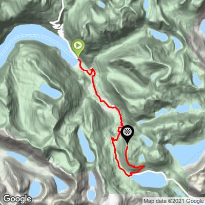
ROUTE MAP
MEMBER RATING
CURRENT WEATHER
PJAMM TRIPS ADVENTURE STARTER BUNDLES
Check out PJAMM Adventure's prepackaged (self-guided) cycling trips. They will help you plan, document and conquer your next adventure.
NEARBY CLIMBS (0) RADIAL PROXIMITY
FROM No Climbs Found
MEMBER REVIEWS & COMMENTS
Let us know what you thought of this climb. Signup for our FREE membership to write a review or post a comment.
Already have an account?
LOG IN HERE