
15
PDI
10.6 mi
DISTANCE
2,911 ft
GAINED
5.2 %
AVG. GRADE
FULL CLIMB STATS
INTRO
By the time you roll into Buseu you've climbed more than 700 m and passed through two villages, and the second one had a single registered resident at the last count. That's the character of this road: a thin strip of asphalt that leaves the Noguera Pallaresa just south of Gerri de la Sal and climbs into the empty hill country of the Baix Pallars, with almost no reason for anyone to drive it.
It's 17.1 km (10.6 mi) from the valley floor at 575 m to a finish at 1453 m (4768 ft) on the road toward Sarroca de Bellera, a gain of 887 m (2911 ft) at 5.2%. Most kilometers sit between 5% and 7.5%, so it's steady work rather than a fight, and there are two places to catch your breath: an easier kilometer around km 5-6, and a flat stretch at about 1300 m as you pass Buseu. The hardest part comes after Baén - around km 9 to 12, with the steepest kilometer at 7.6% and one short ramp near 15%.
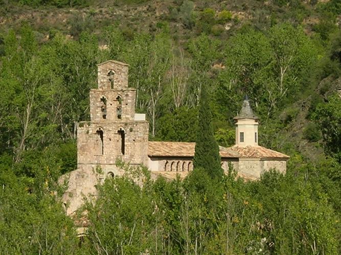
Baén is the bigger of the two villages, which isn't saying much: nine residents in 2024, the church of Sant Andreu, and a history of answering to the abbots of Gerri down in the valley. Above it the road keeps going up with the valley dropping away behind you, and the last 3 km beyond Buseu head on toward Sarroca de Bellera, over in the Pallars Jussà.
There's no café, no col sign and nobody waiting at the top. If you like hearing your own breathing more than engines, this is your kind of climb.
PLAN YOUR ROUTE
 We've partnered with Sherpa-Map.com to bring you the best route planning tool. With a PRO Membership you can use this climb as a reference when creating your route.
Km 0-5 (575 m to 872 m): A steady start away from the N-260, 5-6% with km 3 the steepest at 7.3%.
Km 5-9 (872 m to 1066 m): The grade drops to 2.9% for a kilometer, then builds again - 4.3%, 5.6%, 6.7% - as you climb toward Baén.
Km 9-12 (1066 m to 1258 m): The meat of the climb. 5.3%, then 7.6% (the steepest kilometer) and 6.4%, with a short ramp of about 15% just past Baén.
Km 12-14 (1258 m to 1300 m): 4% and then a flat kilometer at about 1300 m past Buseu.
Km 14-17.1 (1300 m to 1453 m): One more push at 7.3%, then 3.7% and 4.4% to the finish on the ridge road toward Sarroca de Bellera.
Roadway: Paved throughout. The climb follows the Carretera de Baén and then the Carretera de Buseu, minor local roads that exist to serve a handful of hamlets, so expect a narrow lane rather than a highway. Above 1300 m snow and ice are possible in winter, and nobody is in a hurry to clear a road this quiet - plan this one for spring to autumn.
Traffic: Next to none once you leave the N-260. You may meet a resident, a farm vehicle or a hiker's car. The N-260 at the bottom is the main road through the Noguera Pallaresa valley, so the short stretch on it is the only busy part of the ride.
Parking: Park in Gerri de la Sal and roll a few minutes south on the N-260 to the turn-off for Baén.
Provisions: Baén and Buseu are tiny hamlets with nothing to buy, so leave the valley with full bottles. Sort, the comarca capital up the N-260, is the place to stock up before you drive down.
Gear: The grade rarely goes past 8%, so an ordinary compact is all the gearing you need. Pack a layer for the descent - the finish is almost 900 m above the river, and 17 km of freewheeling from up there gets chilly outside high summer.
Before heading out on any cycling adventure check out our Things to Bring on a Cycling Trip and use our interactive check list to ensure you don't forget anything.
Gerri de la Sal is worth an hour on either side of the ride. Salt was produced here from the Middle Ages until recent times, and the Reial Alfolí, the royal salt warehouse and the largest civil building in the Pallars, now houses the village museum; the council runs guided visits to the salt pans. Across the river, the church of Santa Maria de Gerri is what's left of a Benedictine monastery founded in 1149 - step inside for the carved capitals.
This stretch of the valley is full of quiet side roads. Our Peracalç (Gerri de la Sal) climb starts almost next door, and further up the valley Sort is the base for our Sort-Rubió and Port Ainé pages. Routes in the Area on this page shows how many of them you can tie together without riding more than a few kilometers of the N-260.
ROUTE MAP

MEMBER RATING
CURRENT WEATHER
PJAMM TRIPS ADVENTURE STARTER BUNDLES
Check out PJAMM Adventure's prepackaged (self-guided) cycling trips. They will help you plan, document and conquer your next adventure.
NEARBY CLIMBS (0) RADIAL PROXIMITY
FROM No Climbs Found
MEMBER REVIEWS & COMMENTS
Let us know what you thought of this climb. Signup for our FREE membership to write a review or post a comment.
Already have an account?
LOG IN HERE
