
15.8
PDI
12.4 mi
DISTANCE
3,257 ft
GAINED
4.5 %
AVG. GRADE
FULL CLIMB STATS
INTRO
Les Valls d'Aguilar has about 260 people spread across 124 square kilometers of the Catalan Pyrenees, and on this road you'll see very few of them. Super Junyent starts with the main valley road out of Noves de Segre and then branches off it, climbing past three hamlets of dark stone houses and slate roofs to Junyent, a village that turns up in medieval documents as Coniuncta and still has nearly every house in good repair.
It's a long one: 19.9 km (12.4 mi) with 993 m (3257 ft) of climbing, averaging 4.5%. It doesn't climb evenly. The first 8 km up the valley road are gentle, with a couple of 6 to 7% kilometers and one that's almost flat. Then you turn onto the Carretera de Castellàs and get the hardest kilometer of the day straight away, 9% toward Espaén, followed by 5 to 7% climbing up to around 1250 m.
From Castellàs the road levels out along the mountainside for 4 km, barely 2% for most of it, a good place to eat something and look back down the valley. It picks up again to Junyent, and past the village the lane narrows and kicks up at more than 8% for the final kilometer before topping out at 1512 m. Nothing up here is busy, and that's the point.
PLAN YOUR ROUTE
 We've partnered with Sherpa-Map.com to bring you the best route planning tool. With a PRO Membership you can use this climb as a reference when creating your route.
From Noves de Segre at 620 m to the finish above Junyent at 1512 m (2034 to 4961 ft), the climb covers 19.9 km (12.4 mi) and gains 993 m (3257 ft) at an average of 4.5%.
Kilometers 1 to 8 on the valley road: 3.3%, 3.7%, 6.2%, 2.5%, 7%, 5.8%, 1.9% and 4%. After the turn onto the Carretera de Castellàs: 9%, 4.6%, 5.4% and 7.4% for kilometers 9 to 12. Then the long easy stretch past Castellàs - 2.9%, 2.1%, 1.5% and 2.3% - before 3.5%, 4.6% and 4.4% up to Junyent and 8.3% over the final 0.9 km.
The steepest 1 km averages 8.5% and the steepest 0.5 km 11.9%; the steepest 5 km averages 6.1%. Very short pitches reach the mid-teens. Eat on the flat stretch past Castellàs and save something for the last kilometer above Junyent.
Roadway: The valley road from Noves de Segre to the Castellàs turn is good asphalt with painted edge lines and guardrails along the drops. The Carretera de Castellàs is narrower, still paved and lined, winding along the hillside through the hamlets. Above Castellàs it becomes a single lane with no markings and a rougher surface in places. Past Junyent, the final 2.4 km toward Freixa is the most remote part of the ride - take it at an easy pace and watch for gravel and fallen stones after storms.
Traffic: Very light. Beyond the first few kilometers you'll mostly meet residents, the odd farm vehicle or a forestry truck. Above Castellàs you may not see a car at all. The C-14 at the bottom is the only busy road, and you only touch it to get to the start.
Parking: Park in Noves de Segre near the junction where both valley climbs start - there's no formal car park, so leave room for tractors (more on our La Guàrdia d'Ares page).
Gear: A compact with a 28 or 30 at the back covers the gradients - this is about length and pacing, not steepness, though the 9% kilometer after the turn and the final ramp above Junyent will have you reaching for the easiest gear. Pack a jacket: the finish is nearly 900 m above the Segre valley and the descent is long.
Provisions: Stock up in La Seu d'Urgell or Organyà; the hamlets on the way have no shops or bars. There's a water fountain at the exit of Junyent on the road toward Freixa, handy for the final kilometer and the ride back down. On a hot day in the Segre valley, start with two full bottles regardless.
Before heading out on any cycling adventure check out our Things to Bring on a Cycling Trip and use our interactive check list to ensure you don't forget anything.
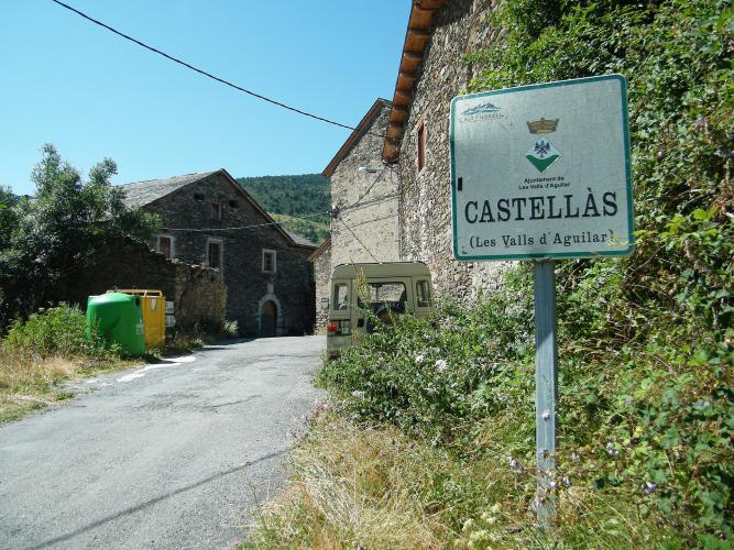
Junyent is worth a slow roll through before the final ramp: a small hamlet of stone houses around the church of Sant Esteve, which was its own parish until the early 20th century and now belongs to Noves de Segre. Castellàs, a few kilometers lower, is similar - a handful of slate-roofed houses and barns right on the road.
For a two-climb day in the valley, our La Guàrdia d'Ares page climbs the other branch from the same junction to a hilltop church and castle ruins - ride one, descend to Nyus and take the other. Further up the Segre, the Castellbò climbs to the Sant Joan de l'Erm nordic area are the next big options, with La Seu d'Urgell as the base for the lot.
If you need a rest day, the Dinosfera paleo-environment center in Coll de Nargó, a short drive down the Segre past Organyà, covers the dinosaur fossils found around the town and the extinction that ended their era.
ROUTE MAP

MEMBER RATING
CURRENT WEATHER
PJAMM TRIPS ADVENTURE STARTER BUNDLES
Check out PJAMM Adventure's prepackaged (self-guided) cycling trips. They will help you plan, document and conquer your next adventure.
NEARBY CLIMBS (0) RADIAL PROXIMITY
FROM No Climbs Found
MEMBER REVIEWS & COMMENTS
Let us know what you thought of this climb. Signup for our FREE membership to write a review or post a comment.
Already have an account?
LOG IN HERE
