
18.2
PDI
8.7 mi
DISTANCE
3,013 ft
GAINED
6.5 %
AVG. GRADE
FULL CLIMB STATS
INTRO
Coll d'Ares (sur) climbs 14.0 km (8.7 mi) from Àger up the south face of the Montsec d'Ares, gaining 918 m (3013 ft) at a 6.5% average from 614 m (2016 ft) to 1520 m (4988 ft) at the pass. It is the more popular of the two roads over the Coll d'Ares and is currently ranked #1188 in the world in our database. Our Coll d'Ares (norte) page covers the other side, which drops to Alsamora and the Pallars Jussà.
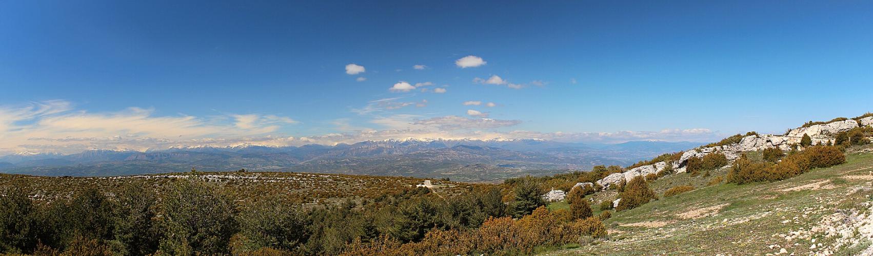
The Montsec is a long limestone wall rising above the Àger valley, and this road climbs it in twelve hairpins through dry scrub and open rock with almost no shade. About 3.5 km (2.2 mi) up you pass the Parc Astronòmic del Montsec, Catalonia's public astronomy center, set here because the Montsec is considered the best place in Catalonia to observe the night sky - the range is also a Starlight reserve. Above it the road gets quieter and the views widen, first back over the Àger valley and the plains of Lleida, then, from the ridge, north to the snow-capped Pyrenees.
The grade is steady rather than savage: mostly 6-8%, with one welcome flat kilometer two-thirds of the way up and the steepest pitch saved for the last 2 km (1.2 mi). The Àger valley is also a world-renowned paragliding center, so on a good day expect to see wings circling above you as you climb.
PLAN YOUR ROUTE
 We've partnered with Sherpa-Map.com to bring you the best route planning tool. With a PRO Membership you can use this climb as a reference when creating your route.
Coll d'Ares (sur) is 14.0 km (8.7 mi) long and gains 918 m (3013 ft) at a 6.5% average, from 614 m (2016 ft) in Àger to 1520 m (4988 ft) at the pass. The steepest 1 km averages 9.3%, the steepest 0.5 km (0.3 mi) 10.5%, and the steepest 100 yards (91 m) 13.5%. The hardest 5 km (3.1 mi) average 7.6%.
The first 3 km (1.9 mi) ease you in at 4-6% as the road leaves Àger and heads for the foot of the Montsec. From the Parc Astronòmic, at about 3.7 km (2.3 mi) and 827 m (2713 ft), the grade settles into a long, steady 7-8% through the hairpins, peaking at 8.5% around the 9 km mark.
Kilometer 10 is almost flat - a genuine chance to recover at around 1240 m (4068 ft). Two more kilometers at 5-7% follow, then the hardest kilometer of the climb, at about 9.5%, before a final 6% run up to the col.
Roadway: The road is paved all the way to the col - it was fully asphalted in 2007. The lowest 3.5 km (2.2 mi) double as the access road to the Parc Astronòmic del Montsec, which is open to visitor cars and even motorhomes. Above the park it becomes a narrower mountain road climbing the limestone face in twelve hairpins. Riders have described the pavement on the pass as worn in places, so take the descent steadily.
Traffic: Light. Most of what you will meet on the lower section is visitors heading to and from the Parc Astronòmic, especially around its evening sessions. Above it the road carries very little beyond the occasional car heading over the ridge or up to the paragliding launch near the summit.
Parking: Start from Àger itself - the climb begins on the western edge of town, so park in town and ride out. Don't use the Parc Astronòmic car park as a base; it is reserved for visitors, with no overnight stays. At the col there is only open ground, a small, stony area used by paragliders.
Provisions: Àger is the only place to stock up, so fill your bottles and buy food in town before you start. The Parc Astronòmic has vending machines with snacks and cold drinks for its visitors but no bar or café, and there is nothing at all above it. The south face has almost no shade and gets very hot on sunny days, so carry more water than the distance suggests.
Gear: The steady 7-8% grade suits a compact chainring with a 28 or 30-tooth largest cog. Sun protection is a must from spring through autumn. The col at about 1520 m (4988 ft) is open to the wind and much cooler than the valley - the observatory itself warns visitors that nights here are cold even in summer - so pack a layer for the descent, especially if you ride late in the day.
Before heading out on any cycling adventure check out our Things to Bring on a Cycling Trip and use our interactive check list to ensure you don't forget anything.
The Parc Astronòmic del Montsec is the stop that makes this side special. Its Centre d'Observació de l'Univers, 3.5 km (2.2 mi) up the climb, is a public astronomy center with an observation area and the Ull del Montsec ("Eye of the Montsec"), a 70-seat planetarium whose dome retracts to open onto the real sky. Its scientific twin, the Observatori Astronòmic del Montsec, sits on the far side of the ridge at 1570 m (5151 ft) in Sant Esteve de la Sarga, with an 80 cm (31 in) telescope used for research. Online booking closes the day before your visit and places are limited - pairing a morning ride with an evening session is a great way to spend a day in Àger.
Àger itself is worth a slow loop. The walled old town keeps most of its medieval wall, and the arcaded Portal del Pedró is its most photographed corner. Above it, the Collegiate Church of Sant Pere, founded in the 11th century by the count Arnau Mir de Tost on the site of an Arab castle, has a crypt and a Gothic cloister; guided visits run through the town. The Sant Vicenç parish church holds a 3rd-century Roman sarcophagus. From the col, a track continues to Sant Alís (1675 m / 5496 ft), the highest point of the Montsec d'Ares, where on clear days you can see from Montserrat to the Aneto. For other climbs nearby, including the Montsec's other passes, try our Routes in the Area tool.
ROUTE MAP

MEMBER RATING
CURRENT WEATHER
PJAMM TRIPS ADVENTURE STARTER BUNDLES
Check out PJAMM Adventure's prepackaged (self-guided) cycling trips. They will help you plan, document and conquer your next adventure.
NEARBY CLIMBS (0) RADIAL PROXIMITY
FROM No Climbs Found
MEMBER REVIEWS & COMMENTS
Let us know what you thought of this climb. Signup for our FREE membership to write a review or post a comment.
Already have an account?
LOG IN HERE
