18.3
PDI
7.6 mi
DISTANCE
2,885 ft
GAINED
7.2 %
AVG. GRADE
FULL CLIMB STATS
Page Contributor(s): Ard Oostra, Switzerland.
INTRO
Opp Strynefjellet - "up Strynefjellet" - climbs out of Hjelledalen, the valley east of Stryn, to the edge of the Strynefjellet mountain plateau. It covers 12.3 km (7.6 mi) and gains 879 m (2,885 ft) at a 7.2% average grade, from 160 m (526 ft) to 1,039 m (3,410 ft) beside the Stryn Sommerski summer ski area. It ranks #11 in Norway by our rankings.
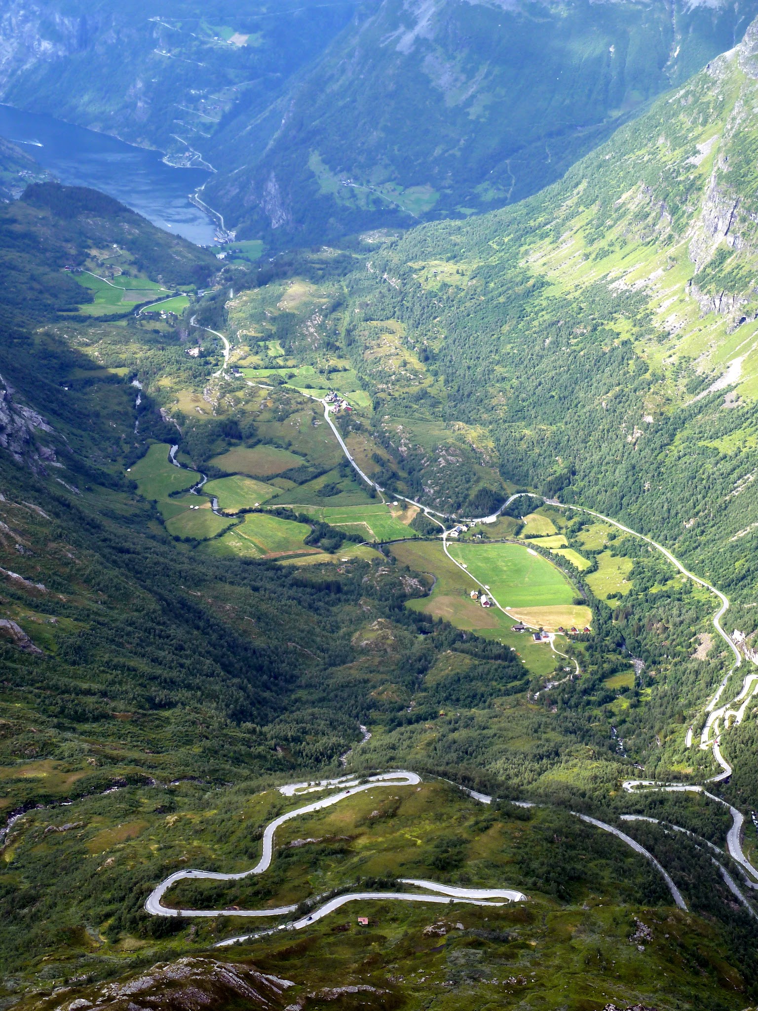
The first 4.8 km (3.0 mi) follow the modern Rv 15 up the valley. Then the route turns onto Gamle Strynefjellsvegen, the old mountain road built largely by hand between 1889 and 1894 and replaced as the main route over the mountains in the late 1970s. Today it is a protected Norwegian Scenic Route, and it is the reason to ride here: a narrow road shored up with high dry-stone walls and lined with stone guard posts, climbing the steep mountainside in a long series of hairpins past Hotel Videseter and the Videfossen waterfall.
This is a summer-only climb. The old road is closed to traffic in winter, normally from October until late May or June, and the finish sits beside snowfields that are skied well into the summer. Once you leave the Rv 15 it is also a quiet one - tourist coaches are no longer allowed on the old road - so you share the hairpins mainly with cars, motorhomes and other riders taking in the views back down Hjelledalen.
PLAN YOUR ROUTE
 We've partnered with Sherpa-Map.com to bring you the best route planning tool. With a PRO Membership you can use this climb as a reference when creating your route.
Opp Strynefjellet averages 7.2% over 12.3 km (7.6 mi), gaining 879 m (2,885 ft) from 160 m (526 ft) to 1,039 m (3,410 ft).
It's a climb in two parts. The Rv 15 section up Hjelledalen is the gentler opening, with each of the first four kilometers averaging 5.4-6.7%. The real work starts at about km 4.8, where the route turns onto the old road: the steepest 500 m (0.3 mi) average 8.9% and the steepest kilometer 8.5%, both beginning right at that turn, and from there every kilometer to the top averages between 6.8% and 8.2%. The steepest 100 m (109 yd) reaches 10.7%.
The steepest 2 km (1.2 mi) average 8.2%, the steepest 5 km (3.1 mi) 7.7% and the steepest 10 km (6.2 mi) 7.5%. There is no flat section to recover on once the hairpins begin, so pace the lower valley road conservatively.
Roadway: The first 4.8 km (3.0 mi) are on the Rv 15, a two-lane main road with no tunnels on this lower stretch - the Rv 15's tunnels lie higher up, beyond the point where this route leaves it. From there the climb follows Gamle Strynefjellsvegen (Fv 258), a narrow road about 3.5-4.5 m (11-15 ft) wide, paved on this western side, with dry-stone walls and stone guard posts on the bends; the heritage gravel section is farther east, past the summer ski area toward Grotli. The old road is closed in winter, normally from October to late May or June depending on snow, and it can also close at night or in bad weather after opening, so check Statens vegvesen's road reports (traffic information +47 815 48 991) before you go.
Traffic: Moderate on the Rv 15, the main road between Nordfjord and eastern Norway, which carries trucks and summer tourist traffic. Light on the old road: since 2019 vehicles longer than 8 m (26 ft) or with an axle load over 8 tonnes have been banned and tourist coaches no longer use it, leaving mostly cars, motorhomes and cyclists.
Parking: There's a new free car park at the Videfossen viewpoint on the old road, about 6.4 km (4.0 mi) into the climb - the most practical place to leave a car if you only want to ride the hairpins. Hotel Videseter charges for parking in its own lots. Stryn Sommerski at the top has parking for anyone meeting riders, and for the full climb from the valley floor, Hjelle has a lakeside rest area about 6 km (3.7 mi) before the start.
Provisions: Stock up in Stryn or Hjelle before you start. On the climb, Hotel Videseter (open spring to early autumn) serves food and drinks on a terrace overlooking Hjelledalen, and the Stryn Sommerski cafeteria at the top serves hot and cold food while the ski area is running - but both are seasonal, so carry what you need.
Gear: A compact chainset with a 30- to 32-tooth largest cog keeps the steady 8% hairpins comfortable. You finish beside summer snowfields at over 1,000 m (3,281 ft), where it can be cold, wet and windy even in July, so bring a rain shell and warm layers for the descent, plus a rear light for the Rv 15 in poor visibility.
Before heading out on any cycling adventure check out our Things to Bring on a Cycling Trip and use our interactive check list to ensure you don't forget anything.
Two stops on the old road are worth building into the ride. Hotel Videseter, a historic seasonal hotel about 6.2 km (3.9 mi) into the climb, looks straight out over Hjelledalen and the Videfossen waterfall. Just above it, the Videfossen rest area - a cliff-edge viewpoint designed by the architects Jensen & Skodvin as part of the Norwegian Scenic Routes program - looks down the valley toward Skålafjellet (1,848 m / 6,063 ft).
At the top, Stryn Sommerski is a summer ski area: it opens once the road is cleared and stays open as long as the snow lasts, with a chairlift from about 1,080 m to 1,300 m (3,543-4,265 ft) and catskiing higher up, and the Tystigbreen glacier lies just south of the road. Beyond the ski area, Gamle Strynefjellsvegen continues on gravel across the plateau to Grotli - a fine gravel-bike extension, though the Rv 15 back over the mountain runs through long tunnels, so plan to return the way you came.
For the big climb up from Geiranger on the far side of the mountains, see our Dalsnibba (Nibberittet) page. Conditions on Strynefjellet can be very different from Stryn, so check the forecast at the top with our Weather tool before you go.
ROUTE MAP

MEMBER RATING
CURRENT WEATHER
PJAMM TRIPS ADVENTURE STARTER BUNDLES
Check out PJAMM Adventure's prepackaged (self-guided) cycling trips. They will help you plan, document and conquer your next adventure.
NEARBY CLIMBS (0) RADIAL PROXIMITY
FROM No Climbs Found
MEMBER REVIEWS & COMMENTS
Let us know what you thought of this climb. Signup for our FREE membership to write a review or post a comment.
Already have an account?
LOG IN HERE