Pal Fritsvold
- Dyranut
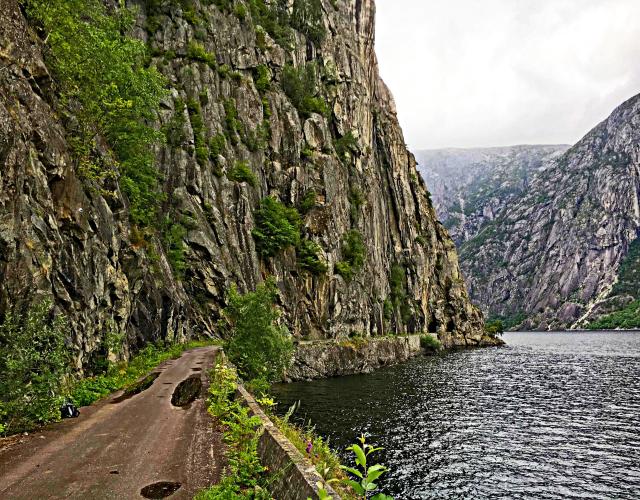
Ridden first part. This is a part of the Norseman extreme triathlon. Epic hill going partly on old roads but also in tunnels.
Strava: https://www.strava.com/segments/672810
Race (triathlon): http://nxtri.com
Google picture searc: Vøringsfossen
![Liste over høyeste veier i Norge – Wikipedia]()
PJAMM note: there appears to be a 1.4 km tunnel from km 4-5.4. Please independently investigate this climb before doing it and bring taillights if you do the climb. Additionally, no one has recorded this climb on Strava since 2012 so we have our doubts - do NOT do this climb without further and independent verification. Please pass any information you have on this climb to johnson@perrylaw.net
Best to have SAG to get you through the tunnel at km 4.5.
Pal Fitsvold writes:
In Dyranut there are tunnels. I’m not sure if they are illegal to ride or not, but they are for sure not recommendable to ride without extra lights in the back of your bike, reflex-vests and a car with blinkers behind you. No lights in the floor of these tunnels.
In the first tunnel by Eidsfjordvatnet (Dyranut01.jpg) you take off from the main road on to the old tunnel and ride through it. Keep you helmets on, the tunnel is old...
After the tunnel it starts climbing. You can stay on the cyclepaths where there are. I rode in the road as I was Stravaing.
For the next tunnel, you take off to the old road on the left (Dyranut02.jpg). It is beautiful. After that the problems starts.
For the 3rd tunnel, the old road further on is closed. I am not sure how bad it is there, because I did not jump it to og on. There was too much consrtuction work with too many people there at that time. If the entire road is gone or if there is only rocks in the road, I don't know that my alternative was the tunnel, and it was not very tempting riding. I called my girlfriend in the car back to pick me up. The chances for being able to dump off again in the other side of the tunnel and ride the rest With a screaming kid in the back and a pissed girlfriend was close to 0, but I asked. I don't have to tell you the response....”
https://urldefense.proofpoint.com/v2/url?u=https-3A__www.strava.com_activities_631342906&d=DwIDaQ&c=euGZstcaTDllvimEN8b7jXrwqOf-v5A_CdpgnVfiiMM&r=K92nEM1R093JLzlYQf_JPwEufAMEZ3H9QtXk20qy8tE&m=n9ZX0VDvfO6X0ZTJvSd0BPBfULn7UJd7J2fZzNKsVnk&s=_oJCtN06x15e3KFrKCLWHcNrAoc1fTVjsGJjBZufdS8&e=
Map: red X’s indicate problematic tunnel.

 We've partnered with Sherpa-Map.com to bring you the best route planning tool. With a PRO Membership you can use this climb as a reference when creating your route.

