Climb Summary
![]()
Views of Dollach as we ascend the first couple kilometers
This is a lovely climb out of Dollach which we believe is one of the great hubs for top bike climbs in the world (See Routes in Area accessed from the Climb Page for other climbs in the area).
The first half of the climb is through ranch land along a narrow road with very little traffic.
![]()
![]()
At the 8.7 km mark (5 miles) there is a gate that blocks the road to vehicular traffic. There are no signs that suggest you are trespassing if you hop the gate or that hiking or cycling is prohibited.
![]()
The 7 km (4.2 miles) from the gate to the second reservoir at the end of the climb averages nearly 11% which is why this climb ranks as one of the top 75 in the world. We encountered no person or vehicles after the gate (and very few up to the gate) which made the climb a bit spooky as I was on my own for this one and took it on in the late afternoon which resulted in my return to Dollach after dark.
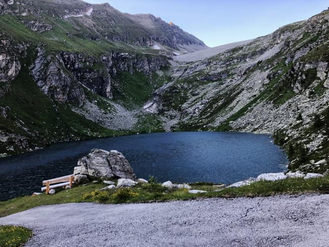
At the top of the climb there are two reservoirs and excellent views of the roadway we travel to reach the reservoirs as well as the surrounding mountains.
![]()
![]()
Roadway surface and traffic: As noted above, there is no traffic on this road. The road is paved to the top but has some blemishes in it and many metal drainage/expansion grates at about 30 meter intervals for several kilometers beginning at the top - impares the descent just a bit.
Overall this is an exceptional climbing experience which we highly recommend.
Steepest Gradients by Distance
![Grade.JPG]()

 We've partnered with Sherpa-Map.com to bring you the best route planning tool. With a PRO Membership you can use this climb as a reference when creating your route.

