![]()
Cycling Sweeney Ridge
Ride 3.1 miles gaining 931’ at 5.2% average grade (6.3% climb only)
![]()
The climb starts at the intersection of Sneath Ln and Skyline Blvd. Many miles south Skyline Blvd is a small road with little traffic, but here it is a four lane boulevard with lots of cars. Luckily, Sneath Ln becomes a bike trail in the direction we are going, so there aren't many cars going our direction, cars aren't allowed on the trail.
![]()
The first mile of the climb is through a residential area, with wide lanes. At the end of the residential area there is a short downhill section, which brings us to the beginning of the trail. There is a small parking lot, if you want to start here instead, but there is plenty of street parking in the residential area so if you are driving it is easy to park and start at Skyline Blvd.
![]()
The trail is paved and in good condition. You will likely encounter people walking along the trail, so you can't do a fast descent on the way back, but that's ok because it's more about soaking in the scenery on the way back. There are nice views of the South San Francisco area and SFO airport but they are much easier to see going downhill than going uphill. There is a bit of climbing here, with a quarter mile of double digit gradient, so it is easier to focus on the climbing going up, and the scenery going down.
![]()
![]()
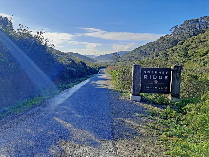
Near the top of the climb Sneath Ln Trail meets up with Sweeney Ridge Trail. There is a restroom here, but no water, unfortunately. Sweeney Ridge Trail is less steep and we soon arrive at the top of the climb. We can ride along the ridgeline for a quarter mile or so past the top and arrive at the Nike Missile Sites. The missile sites are just slabs of concrete these days, not much to see, but there are good views of South San Fransisco and Pacifica. Sweeney Ridge Trail continues past the missile sites but it is dirt, the pavement ends at the missile sites.
![]()
Overall, this is a nice ride, with decent climbing and sweeping vistas, well worth doing.

 We've partnered with Sherpa-Map.com to bring you the best route planning tool. With a PRO Membership you can use this climb as a reference when creating your route.

