
16
PDI
8 mi
DISTANCE
2,741 ft
GAINED
6.4 %
AVG. GRADE
FULL CLIMB STATS
INTRO
Ask a rider in Pontremoli which way to go and they'll probably point you at the Cisa. Passo Mistadella is the other way out of town: a narrow provincial road that leaves from the Santissima Annunziata church on the south edge of Pontremoli, works its way up through the woods to the hilltop hamlet of Arzelato, and slips over a grassy saddle into the Zeri valley. It's 12.8 km (8 mi) with 835 m (2741 ft) of climbing at 6.4%, topping out at 1032 m (3386 ft).
The first kilometer out of town is a warm-up. After that the road gets down to business and stays there - seven kilometers that rarely dip under 6%, finishing with the hardest one, 9.2%, just below Arzelato. Past the village it goes almost flat for a kilometer or so, the only real breather, then kicks up again at 6-7% before the last few hundred meters ease off to the pass.
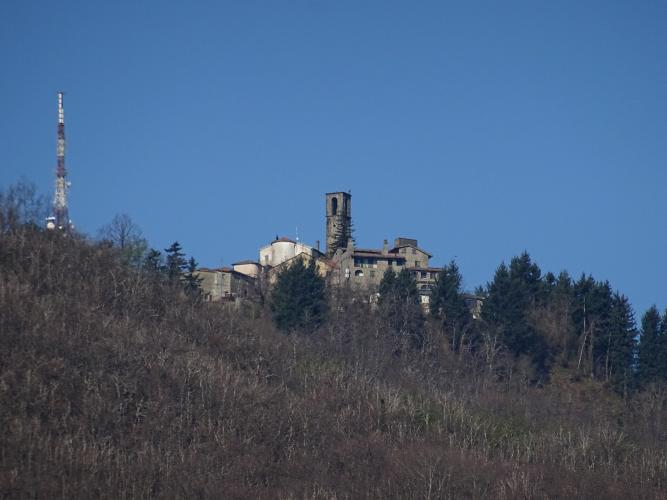
Arzelato is worth lifting your head for. The name comes from the Latin arx elata, a raised stronghold, and the hamlet has given up old stone box tombs and one of the carved statue-stele that Lunigiana is known for - the museum in Pontremoli's Piagnaro castle is full of them. The lower slopes are wooded and stay shaded in the morning; from Arzelato to the top the trees thin out and you get views down both sides of the ridge. There's nothing to buy at the pass, and most days you'll have it to yourself.
PLAN YOUR ROUTE
 We've partnered with Sherpa-Map.com to bring you the best route planning tool. With a PRO Membership you can use this climb as a reference when creating your route.
Passo Mistadella climbs 12.8 km (8 mi) from 221 m (725 ft) in Pontremoli to 1032 m (3386 ft), with 835 m (2741 ft) of climbing at an average of 6.4%.
km 0-1: 4.4% - out of town past the church
km 1-2: 8.8% - the first proper ramp
km 2-7: 6.2 to 8.3% - steady work up through the woods, rarely easing
km 7-8: 9.2% - the hardest full kilometer, just below Arzelato
km 8-9: 6%
km 9-10: 1.3% - nearly flat past Arzelato
km 10-12: 5.9% then 7.4%
km 12-12.8: about 2.5% to the pass
The steepest kilometer anywhere on the climb averages 10.7%, the steepest half kilometer 12.7%, the steepest 2 km 9% and the steepest 5 km 7.8%.
Roadway: The SP36, signed Via Pradalinara, is asphalt from the church to the pass. It's a narrow mountain road from the start, and above Arzelato it closes down to a single lane through the woods, with guardrail on the drop side and stone walls in the hamlets. Expect leaves and damp patches under the trees in autumn and after rain, and take the blind bends carefully on the way down. The road continues over the pass and down into the Zeri valley.
Traffic: Light. Beyond the first few hundred meters at the edge of Pontremoli, the road only serves Arzelato and a few smaller hamlets, so you'll mostly meet local cars and the odd farm vehicle.
Parking: There's a car park right at the start beside the Santissima Annunziata church (map). If it's full, park anywhere in Pontremoli - the town center is a short spin from the start.
Gear: This is a steady climb rather than a brutal one - long stretches at 6-9% with short pitches a bit steeper. A compact with a 30 or 32 tooth largest cog keeps it comfortable. The pass sits about 800 m (2600 ft) above Pontremoli and the descent is shaded and narrow, so bring a layer in spring and autumn.
Provisions: Stock up and fill both bottles in Pontremoli - there's nothing to buy on the way up, and nothing over the top until you're down in the Zeri valley. In summer, carry more water than the distance suggests.
Before heading out on any cycling adventure check out our Things to Bring on a Cycling Trip and use our interactive check list to ensure you don't forget anything.
Before you set off, put your head inside the Santissima Annunziata church at the start: the small multicolored marble temple in the middle, from 1527 and attributed to Andrea Sansovino, frames Luca Cambiaso's Adoration of the Magi. The Via Francigena runs right behind the church.
For Pontremoli itself - the statue-stele museum in the Piagnaro castle, testaroli and the old pastry shop on Piazza della Repubblica - see our Passo dei due Santi (Pontremoli) page. That climb also makes the obvious pairing with this one: go over Mistadella, drop into the Zeri valley, and either turn back down the valley road to Pontremoli for a loop or keep climbing from Coloretta to Due Santi for a much bigger day. Look out for agnello di Zeri, the valley's Slow Food lamb, on menus along the way. Madonna del Monte starts a few kilometers down the Magra valley if you want a short, steep one to finish.
ROUTE MAP

MEMBER RATING
CURRENT WEATHER
PJAMM TRIPS ADVENTURE STARTER BUNDLES
Check out PJAMM Adventure's prepackaged (self-guided) cycling trips. They will help you plan, document and conquer your next adventure.
NEARBY CLIMBS (0) RADIAL PROXIMITY
FROM No Climbs Found
MEMBER REVIEWS & COMMENTS
Let us know what you thought of this climb. Signup for our FREE membership to write a review or post a comment.
Already have an account?
LOG IN HERE
