Parmah Pass Bike Climb - PJAMM Cycling

52.5
PDI
10.8 mi
DISTANCE
5,888 ft
GAINED
10.4 %
AVG. GRADE

FULL CLIMB STATS

INTRO

Parmah Pass climbs out of Wadi Baqrah Al-Ulya, in Tanomah governorate in Saudi Arabia's Asir Mountains, gaining 5,888 feet over 10.8 miles at a 10.4% average grade to finish near Salman Park in Tanomah. It ranks #36 in PJAMM's world difficulty database - one of a dense cluster of brutally steep climbs in the Asir range, which has more than a dozen entries in the world's top 100. 

We first documented this climb on an 11-day climb trip through the Asir Mountains, ridden by John Johnson together with Matt, based in Dhahran. Parmah Pass is your typical run-of-the-mill Asir Mountain climb - scenic, epic, steep... It is ungodly challenging, scenic, through rugged terrain and completely unknown, unridden and undocumented (until now) in the cycling world.

The road switches back through about 50 hairpins, with the steepest quarter mile averaging close to 20% - John recorded a peak reading of 22% on his Garmin. At about mile 4.3, the route ducks through a short, narrow rock canyon walled in on both sides. Wildlife along the way includes baboons native to the Sarawat Mountains, of which the Asir range is part, along with the goat herds that are the area's primary livestock. Small roadside mosques mark the way, and John recalls motorists stopping to talk with him, amazed to see someone cycling up these grades.

There's little cycling literature about this climb beyond our own documentation - it remains a genuinely obscure, self-supported ride - one reserve for the true adventurers. 

PLAN YOUR ROUTE

We've partnered with Sherpa-Map.com to bring you the best route planning tool. With a PRO Membership you can use this climb as a reference when creating your route.
Gruesomely steep. This is one of the steepest sustained climbs in the PJAMM database. The steepest quarter mile averages 19.9%, easing only to 18.1% over a half mile, 15.5% over a full mile, 14.3% over 2.5 miles, and 13.6% over 5 miles - and the whole 10.8-mile climb still averages 10.4%. That matches what our rider recorded on the road: a peak Garmin reading of 22%, with sustained double-digit grades for miles at a stretch.
Roadway: A paved, two-lane mountain road that switches back through roughly 50 hairpins on its way up the escarpment. Watch for posted "Caution: Falling Rocks Area" signage in places - this is steep, rugged terrain with real rockfall exposure, not just a steep-grade warning. 

Traffic: Light but present - this is a real mountain road used by local traffic, not a closed or private route. However, drivers are incredibly kind and respectful. Our rider was stopped more than once by curious, encouraging motorists. Watch for goat herds that may be on or near the road. 

Parking: The climb finishes near Salman Park in Tanomah, which has served as a natural parking and gathering spot at the top. No formal cyclist-specific parking or facilities.
Bring low gearing - this climb holds double-digit average grades for miles, with pitches into the high teens and low twenties. Carry more water than you think you'll need; a roadside vendor selling water was present when we rode this climb, but that's not something to count on. Sun protection matters at this elevation and latitude, and note that daily life in the area runs around five calls to prayer, roughly 5 a.m. to 6 p.m. depending on the season - a quiet, common part of the soundscape here.

Of course, due to the extreme gradients, sure your brakes are dialed in before attempting a descent. 
Before heading out on any cycling adventure check out our Things to Bring on a Cycling Trip and use our interactive check list to ensure you don't forget anything.
Abha, the regional hub of Aseer Province, is the most practical base for a trip out to this climb, with the widest range of lodging and services in the region. This is a remote, rural part of Saudi Arabia with no cycling-specific infrastructure - plan to be fully self-supported, and check current Saudi tourist-visa and travel guidance before you go, since requirements can change. The Asir Mountains hold one of the world's densest clusters of extreme climbs, so if you're making the trip, consider pairing this with some of the region's other tough ascents.

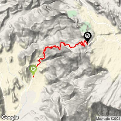
ROUTE MAP
MEMBER RATING

Not Yet Rated
-
Road
-
Traffic
-
Scenery

CURRENT WEATHER

PJAMM TRIPS ADVENTURE STARTER BUNDLES

Check out PJAMM Adventure's prepackaged (self-guided) cycling trips. They will help you plan, document and conquer your next adventure.
ALL TRIPS
Browse all of our prepackaged trips and find your next adventure!

NEARBY CLIMBS (0) RADIAL PROXIMITY

FROM
No Climbs Found

MEMBER REVIEWS & COMMENTS

Let us know what you thought of this climb. Signup for our FREE membership to write a review or post a comment.
Already have an account?
ROUTE MAP
PROFILE TOOL
Route Data
S.G. (%)
hide
Segment Data
hide
CLIMB SUMMARY

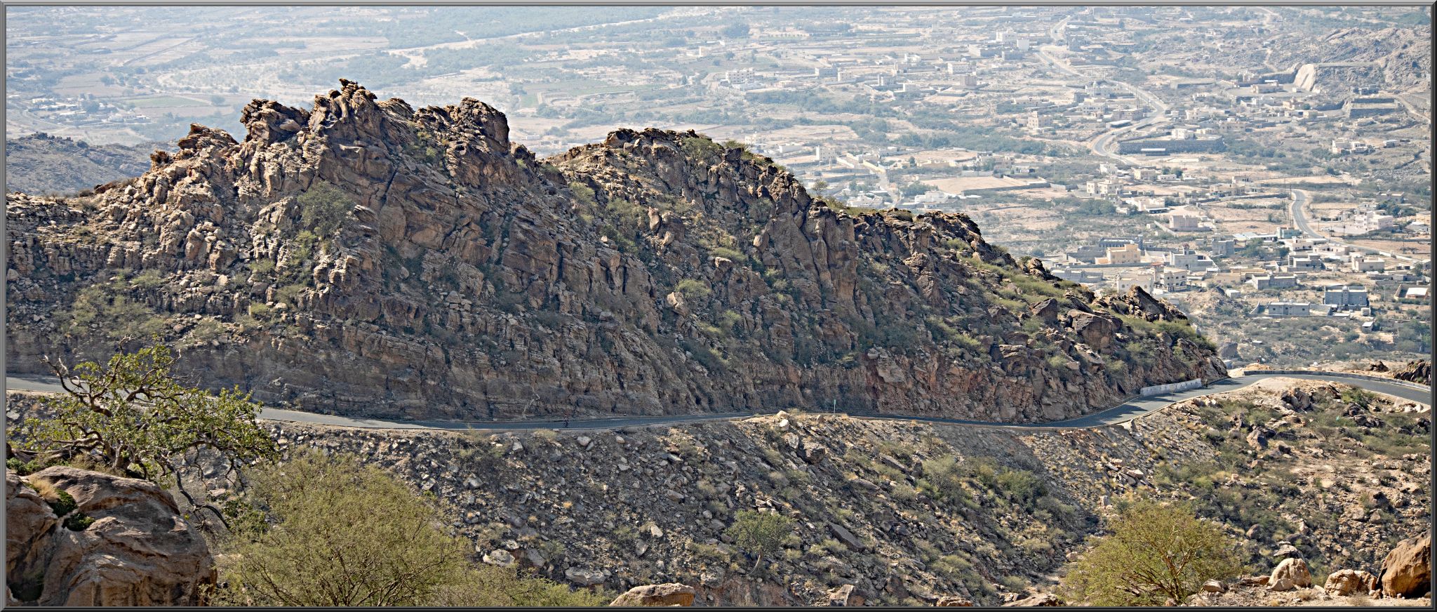
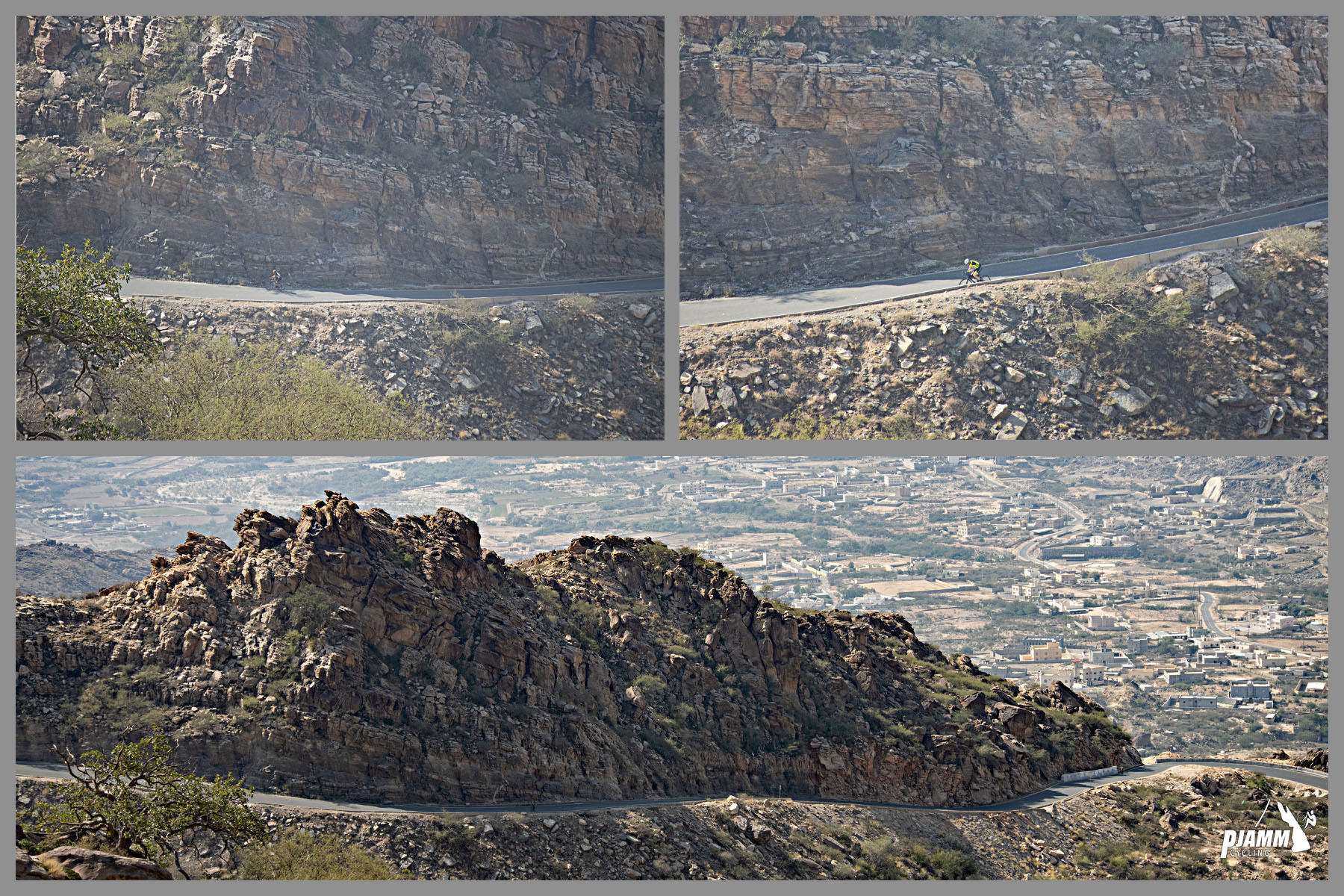
Cycling Parmah Pass, Saudi Arabia - panoramic view looking down at road carved into rocky mountainside below

Cycling Parmah Pass, Saudi Arabia

Ride 10.8 miles gaining 5,900’ at 10.5% average grade.

Summary by PJAMM’s John Johnson.

Parmah Pass is your typical run of the mill Asir Mountain climb - scenic, epic, steep, and ranked at the top of the world cycling climbing charts at #17.

START

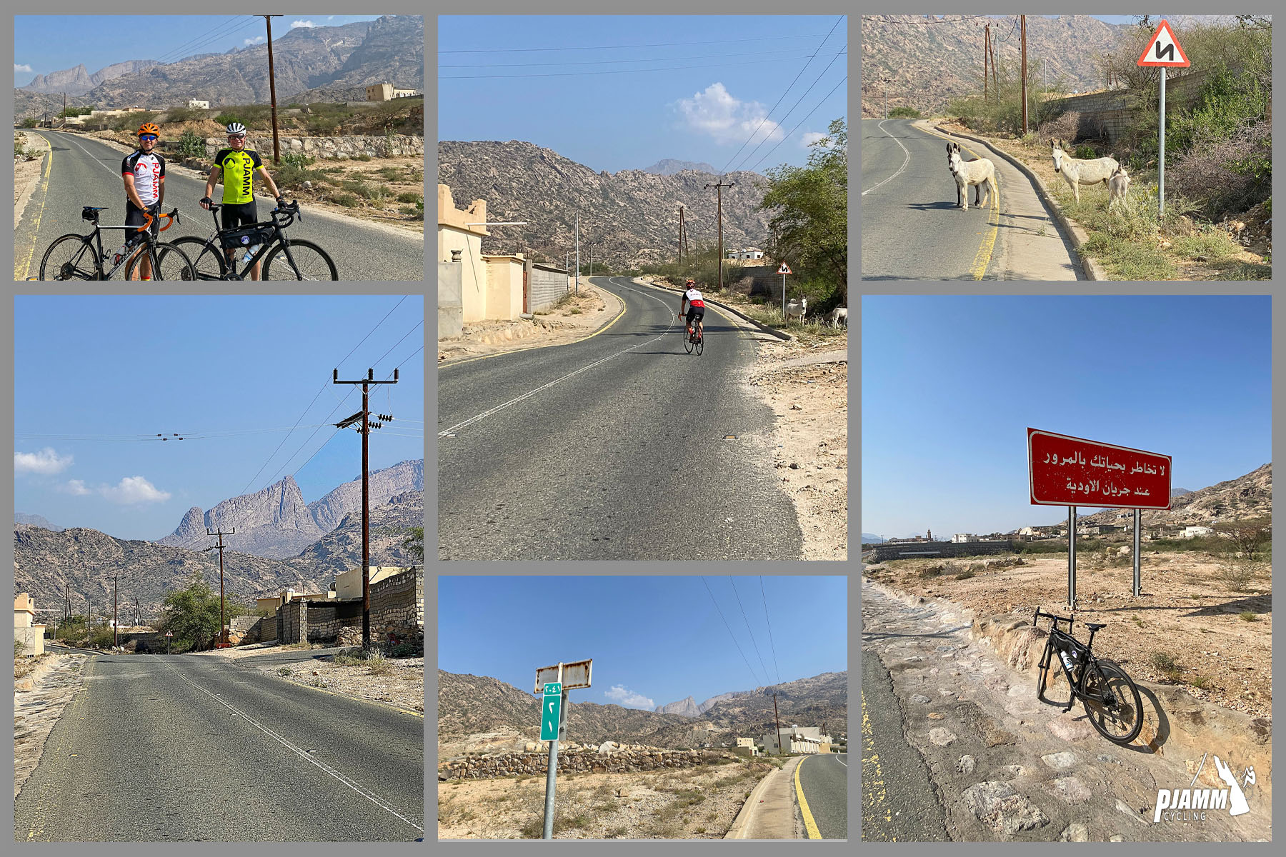
Cycling Parmah Pass, Saudi Arabia - photo collage shows views from the climb start, desert landscape, two-lane roadway, donkeys on roadway, two PJAMM Cyclists stand with their bikes

STEEP

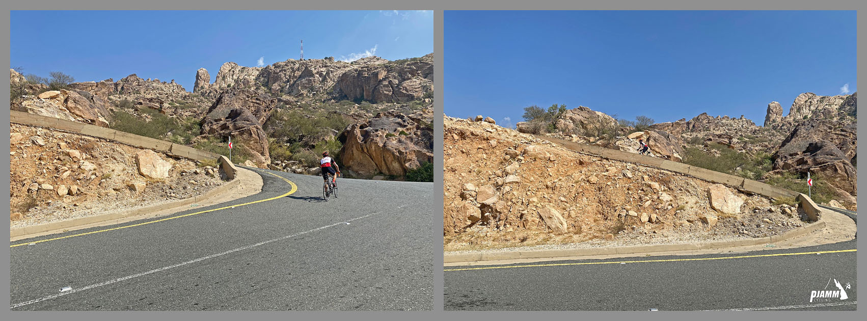
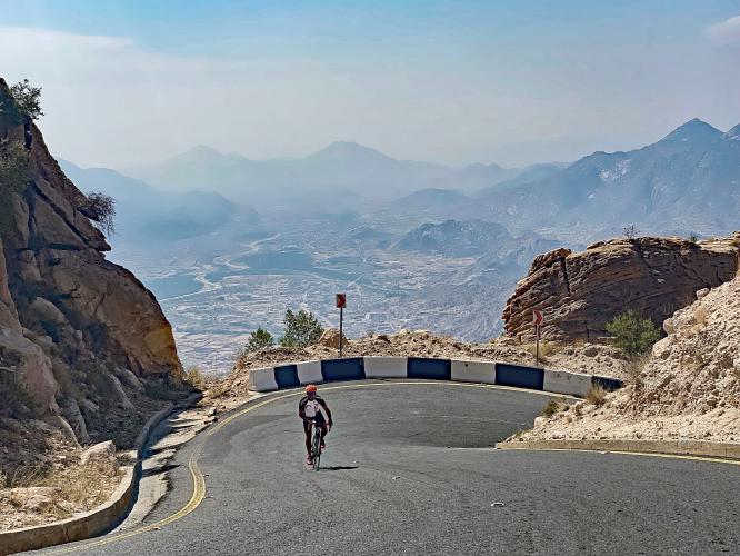
Cycling Parmah Pass, Saudi Arabia - PJAMM Cyclist rides along hairpin curve in roadway

As with all of the top Asir Mountain climbs (12 in the world top 100), there are some extremely steep segments on this climb: a quarter-mile at 20%, half-mile at 18%, and a full mile at 15.5% average grade.

HAIRPINS

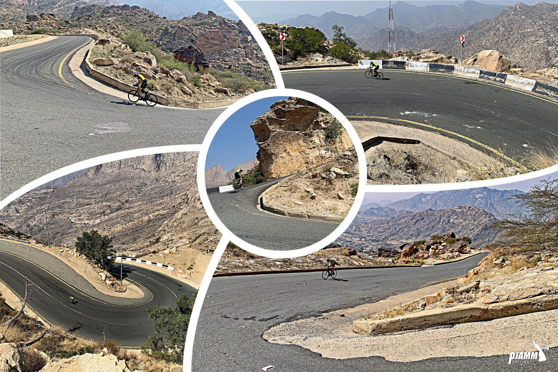
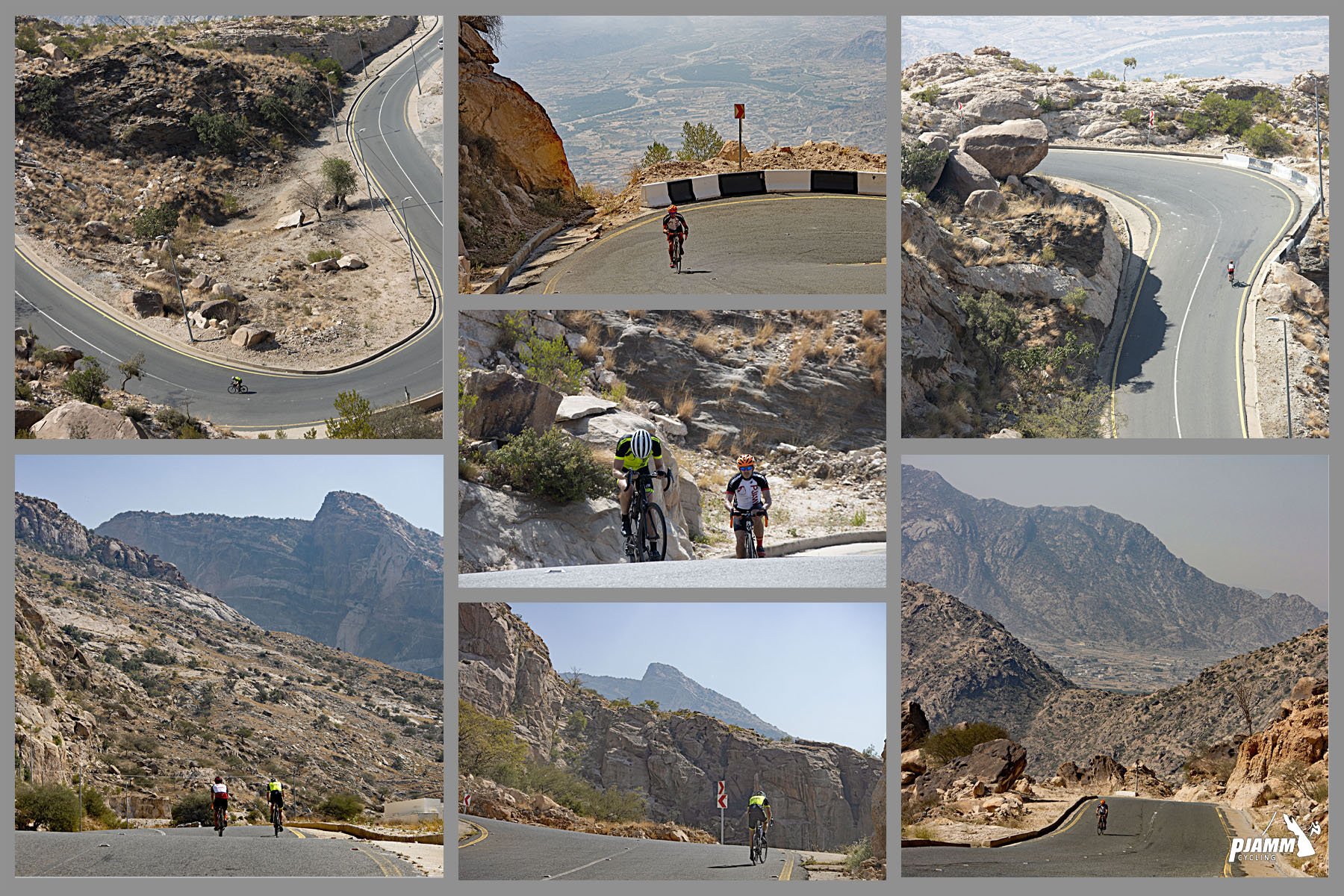
Cycling Parmah Pass, Saudi Arabia - photo collage highlights the hairpins along this ride, PJAMM Cycling logo in corner

There are roughly 50 hairpins on this climb - this is just a great serpentine road with a lot of pitch to it. I mean, really?  They put in 50 hairpins and the average grade is still in double figures??  😓

EPIC

Cycling Parmah Pass, Saudi Arabia - photo collage shows views of the roadway from above, PJAMM Cycling logo in corner

I know I’m beating the same drum over and over on these climbs, but this is an epic road bike climb.  It is ungodly challenging, scenic, through rugged terrain and completely unknown, unridden and undocumented (until now) in the cycling world.  There were no Strava segments for these climbs (until I added them after each of my climbs) and there is no literature online or off about cycling in this magnificent mountains.

Cycling Parmah Pass, Saudi Arabia - photo collage, views of two PJAMM Cyclists riding along the hairpin turns and steep grades of Parmah Pass, Asir Mountains, PJAMM Cycling logo in corner

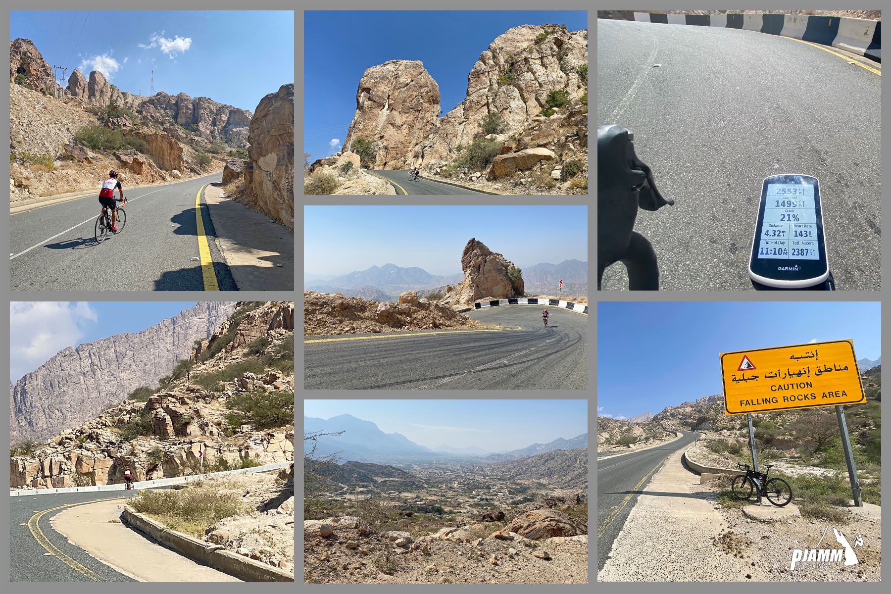
Cycling Parmah Pass, Saudi Arabia - photo collage, PJAMM Cycling logo in corner, views along the climb, PJAMM Cyclist tackles sharp hairpin turns, bike parked in front of yellow road sign reading, "Caution Falling Rocks Area," Garmin device reads 21%

It is not easy riding these steep segments and even harder to use one hand while photographing your Garmin . . . 😊

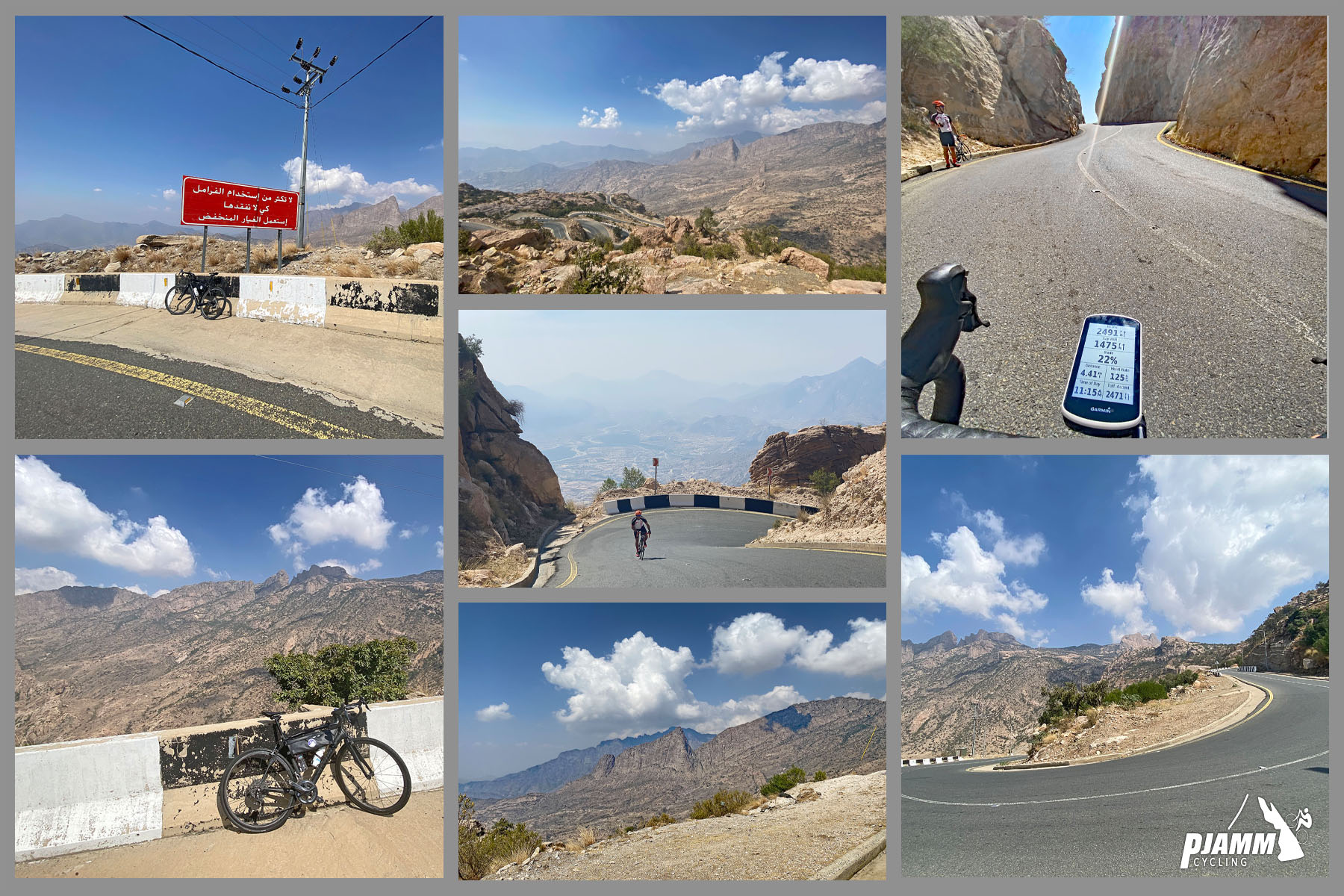
Cycling Parmah Pass, Saudi Arabia - photo collage, PJAMM Cycling logo in corner, views along the climb, PJAMM Cyclist tackles sharp hairpin turns, Garmin device reads 22%

22% was the highest I saw on my Garmin during the Parmah climb - and, believe me, my head was looking down (wheel, road, Garmin, whatever . . . ) during this climb.

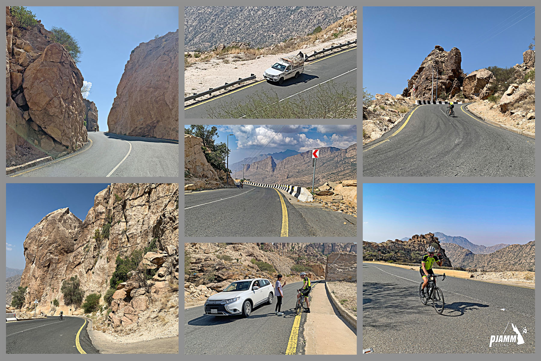
Cycling Parmah Pass, Saudi Arabia  - photo collage shows views along the climb, car stopped in roadway to talk to PJAMM Cyclist John Johnson while he was cycling this climb

The primary livestock in the Asir Mountains are goats - we saw no sheep and only one herd of cows, but many herds of goats. The bottom middle photo is one of my several interviews I was asked to give during my 11 climbs (in 11 days).  Motorists were amazed by and encouraging of someone cycling up these walls.

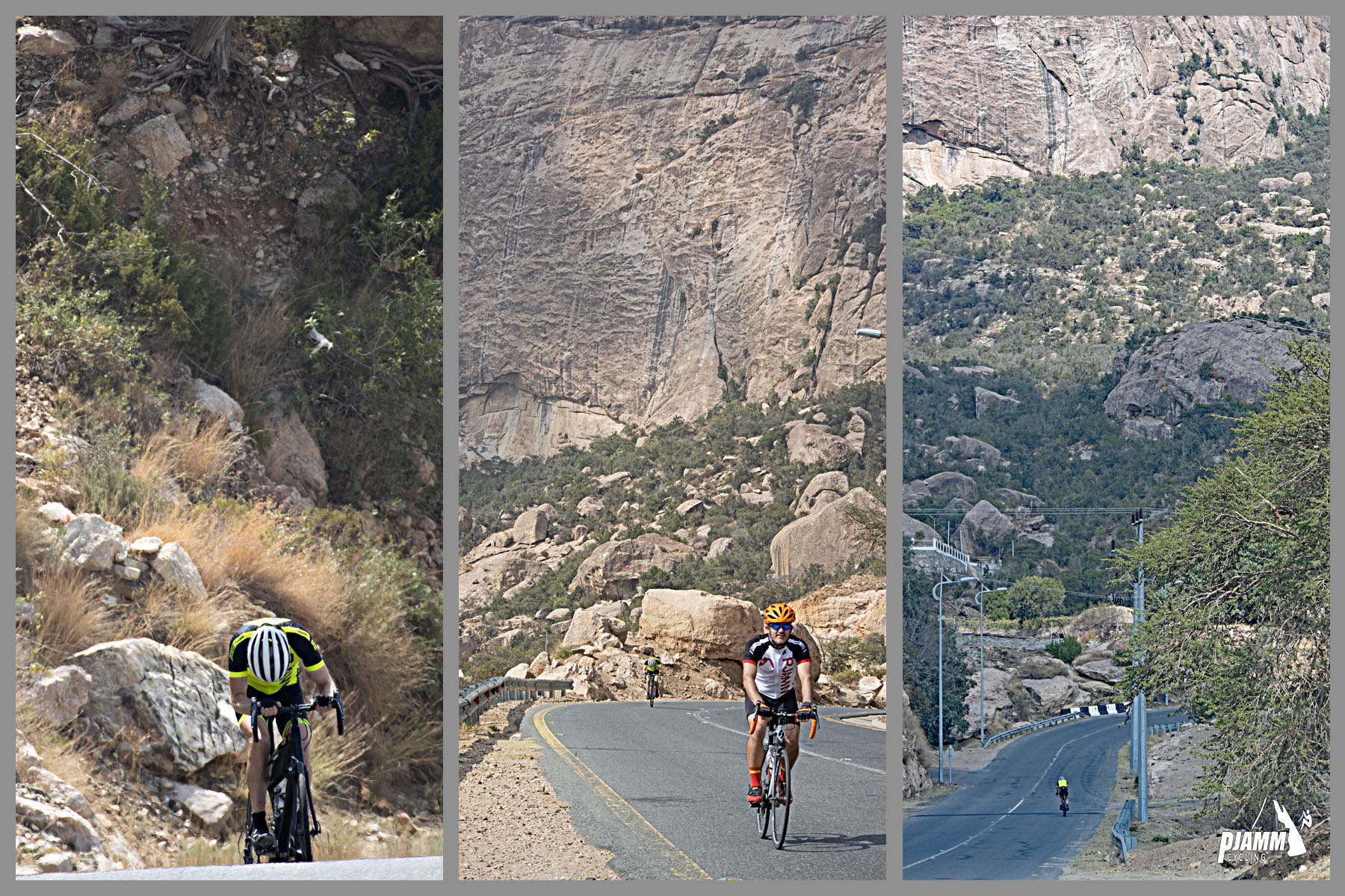
Cycling Parmah Pass, Saudi Arabia  - photo collage, PJAMM CYclists riding on two-lane roadway surrounded by high rock walls, PJAMM Cycling logo in corner

Left photo - here I demonstrate my standard climbing position in the Asir Mountains.

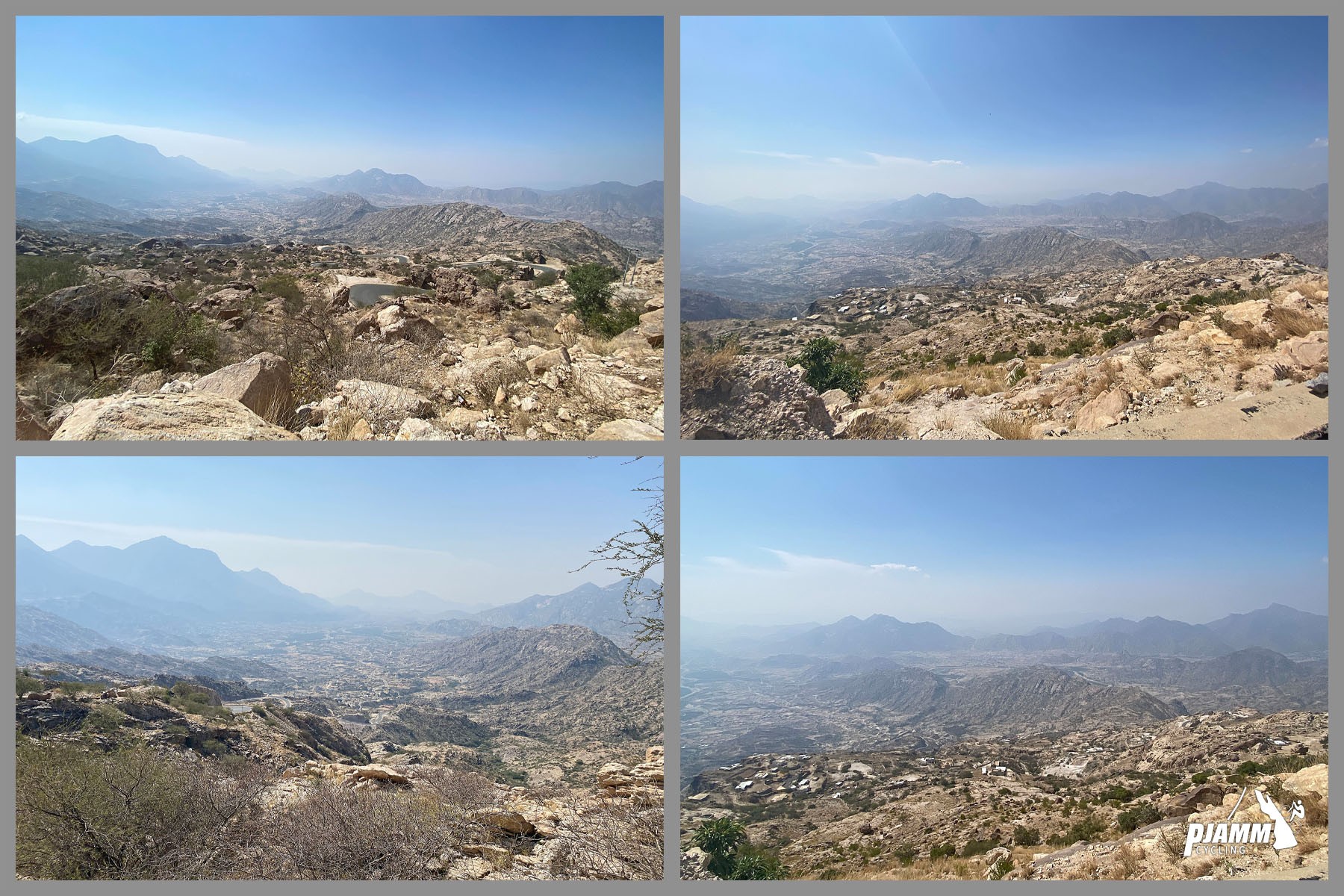
Cycling Parmah Pass, Saudi Arabia  - photo collage shows views down the mountain toward starting location, high desert landscape, town can be seen in the distance, low scrub plants and white rocks

Looking back along our climb we have unobstructed views far down the mountain towards our starting location.

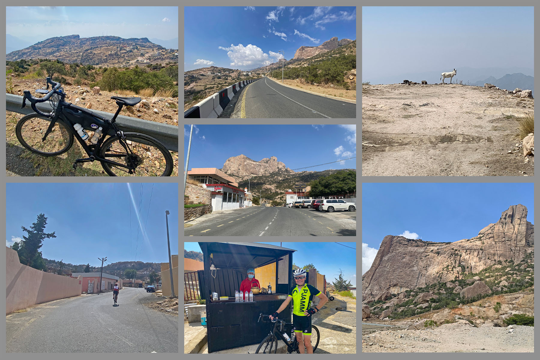
Cycling Parmah Pass, Saudi Arabia  - photo collage,  PJAMM Cyclist John Johnson stands next to vendor selling water, bike parked along guardrail looking down mountain, goats on side of road, large rock formations, PJAMM Cycling logo in corner

COOL ROCK CANYON

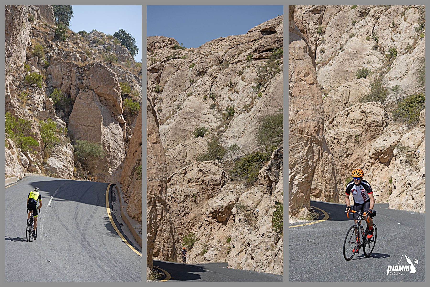
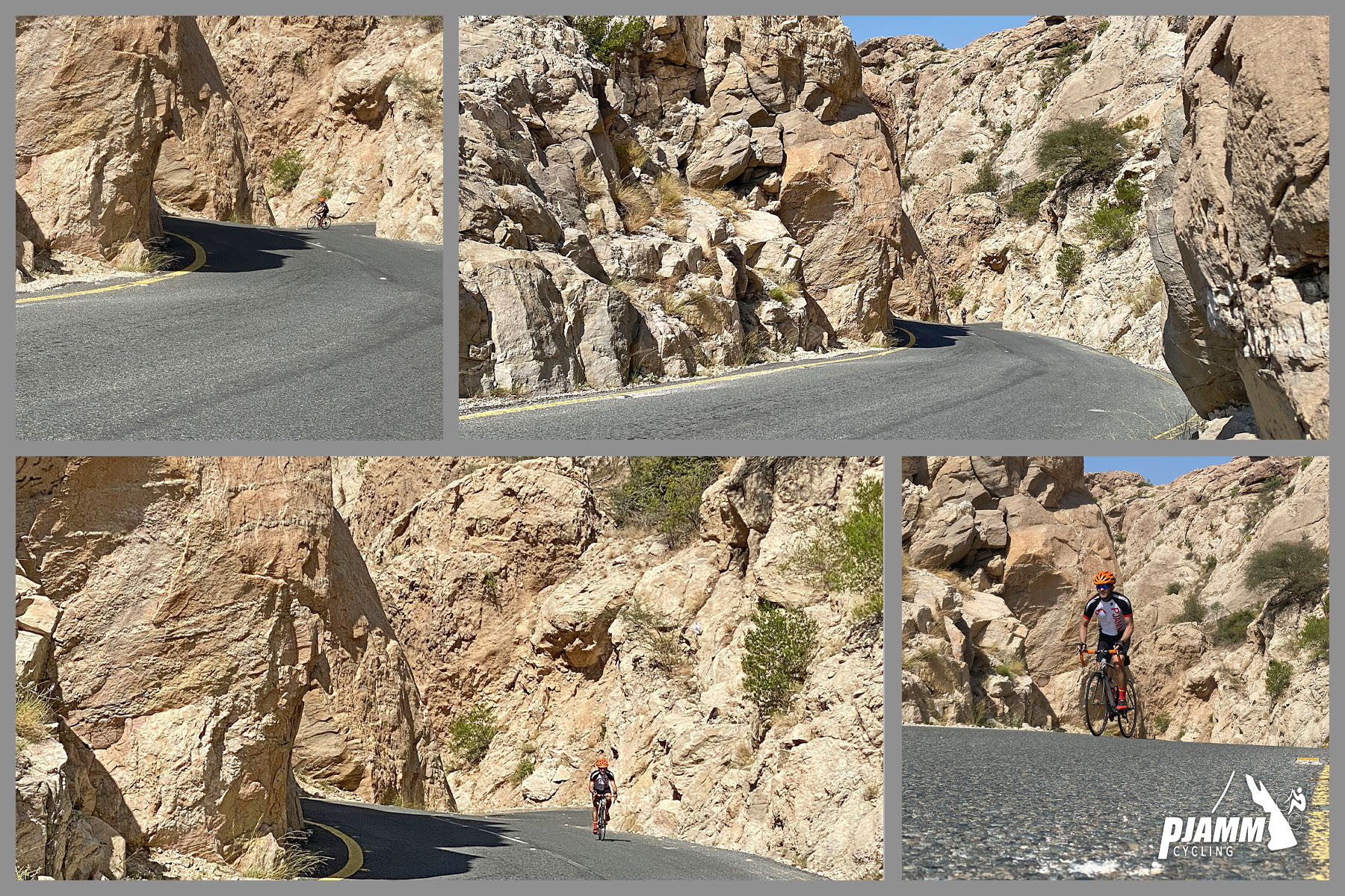
Cycling Parmah Pass, Saudi Arabia  - photo collage shows PJAMM Cyclists riding through rock canyon at mile 4.3

At mile 4.3 we enter a short and fun narrow segment bordered by rock walls.

Cycling Parmah Pass, Saudi Arabia  - rock canyon photo collage

BABOONS

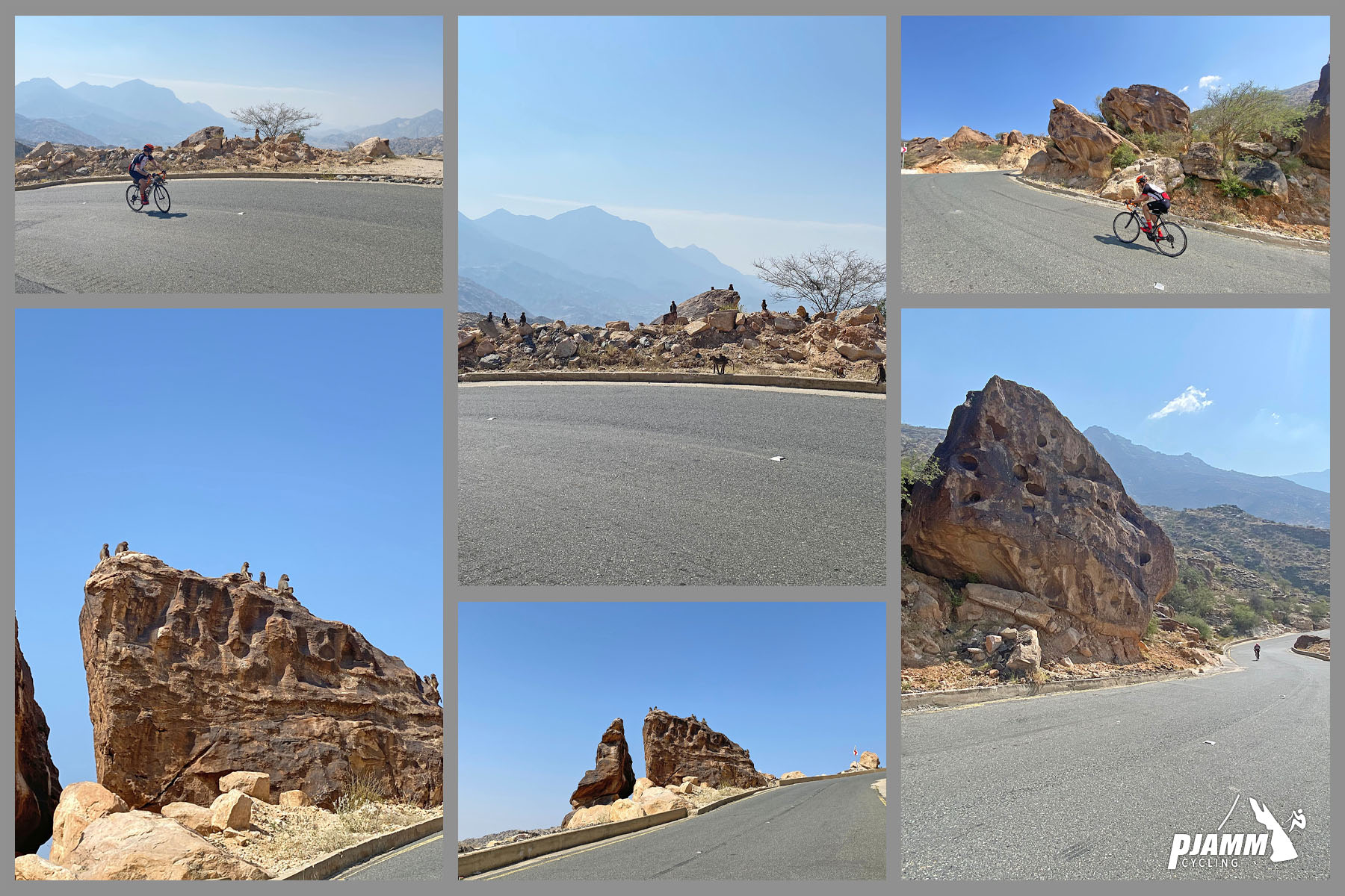
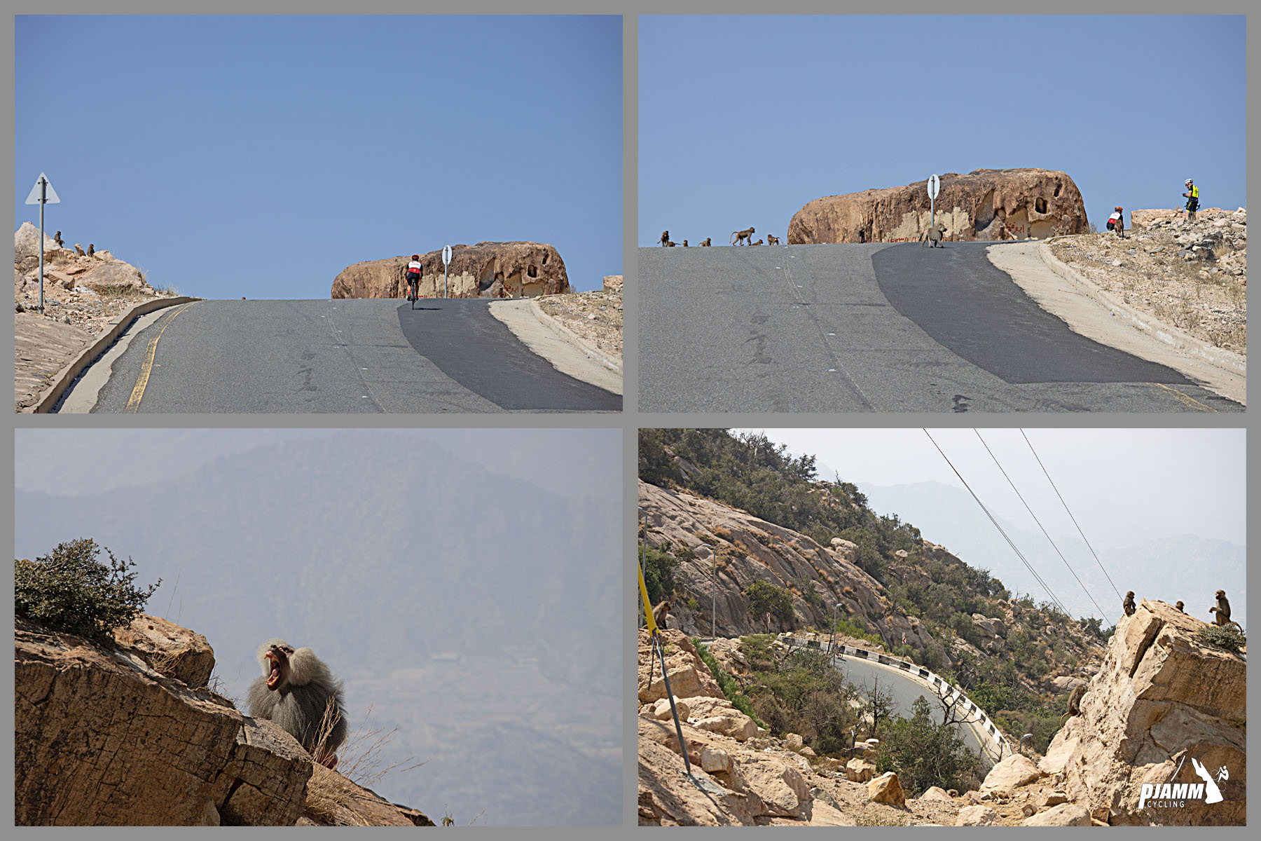
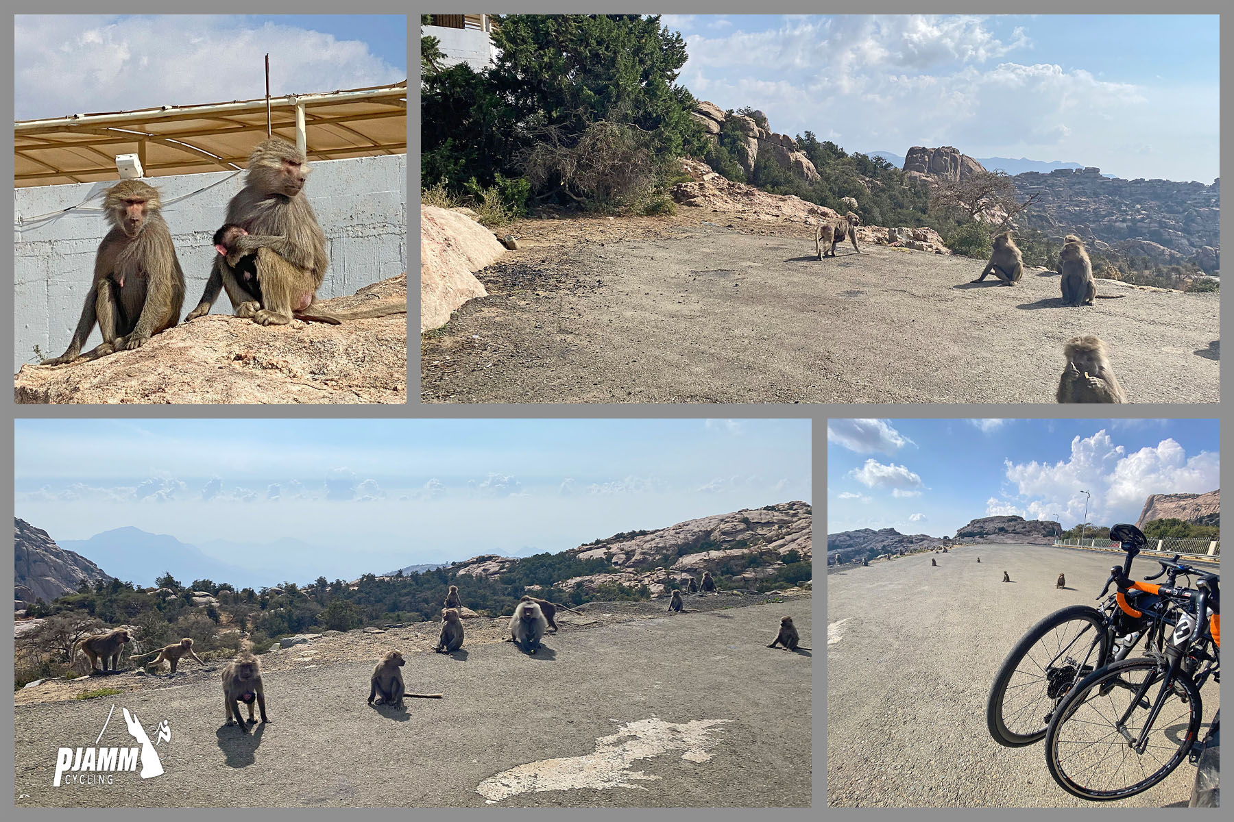
Cycling Parmah Pass, Saudi Arabia  - photo collages shows PJAMM Cyclists cycling past group of baboons, baboons sit high atop large rock on mountainside overlooking roadway

Baboons are native to the Sarawat region of southwestern Arabia.  

The Asir Mountains are part of the Sarawat Mountains, and we can attest there are a lot of baboons in these mountains.

Cycling Parmah Pass, Saudi Arabia  - baboons on roadside rocks

MOSQUE

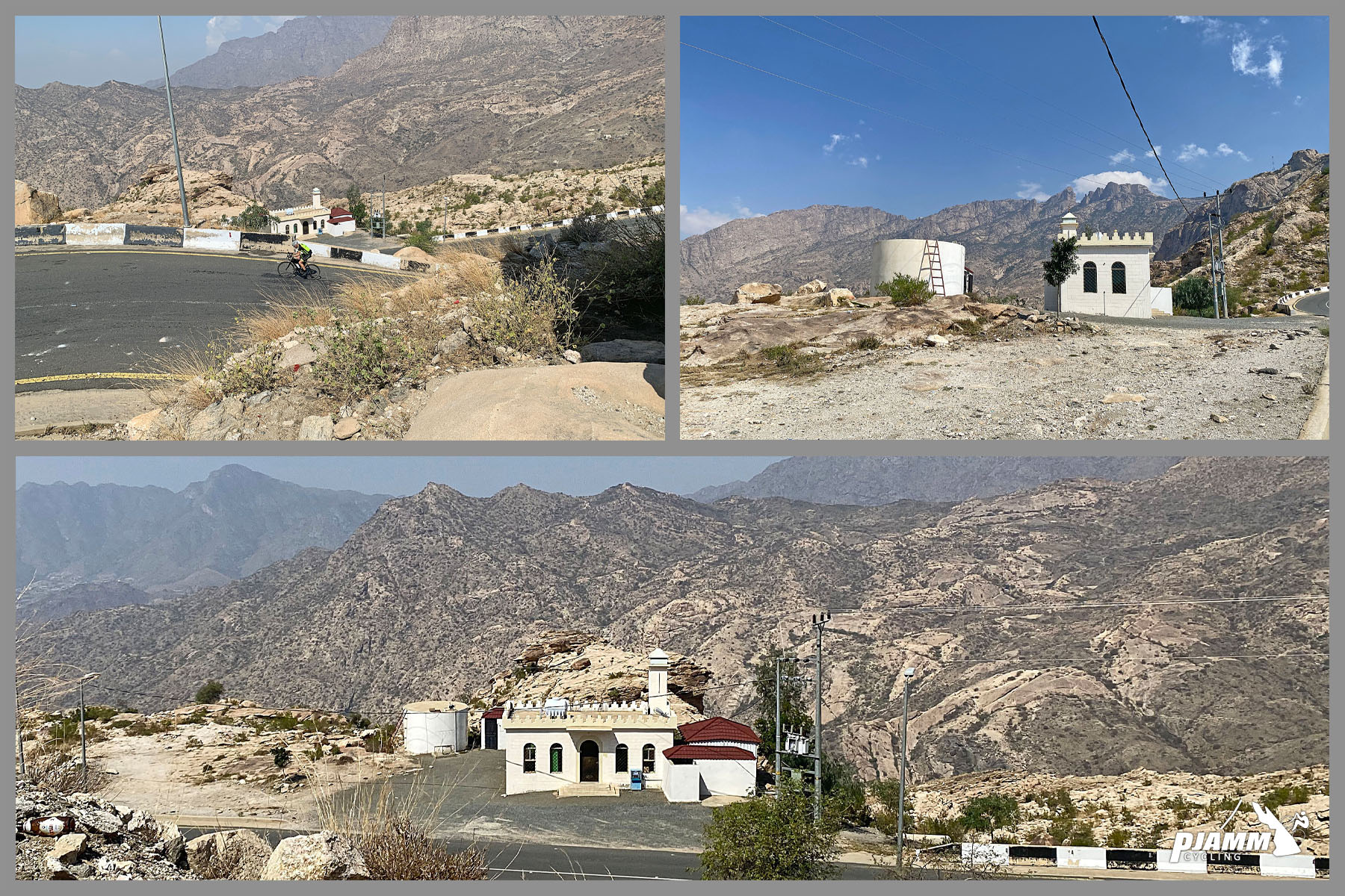
Cycling Parmah Pass, Saudi Arabia  - small white mosque next to roadside

We encountered many mosques along our climbs in the Asir Mountains.  Mosques are distinguishable by their towers, often with speakers at the top used for call to prayer five times per day beginning around 5 a.m. depending on the time of year, and ending around 6 p.m.

FINISH

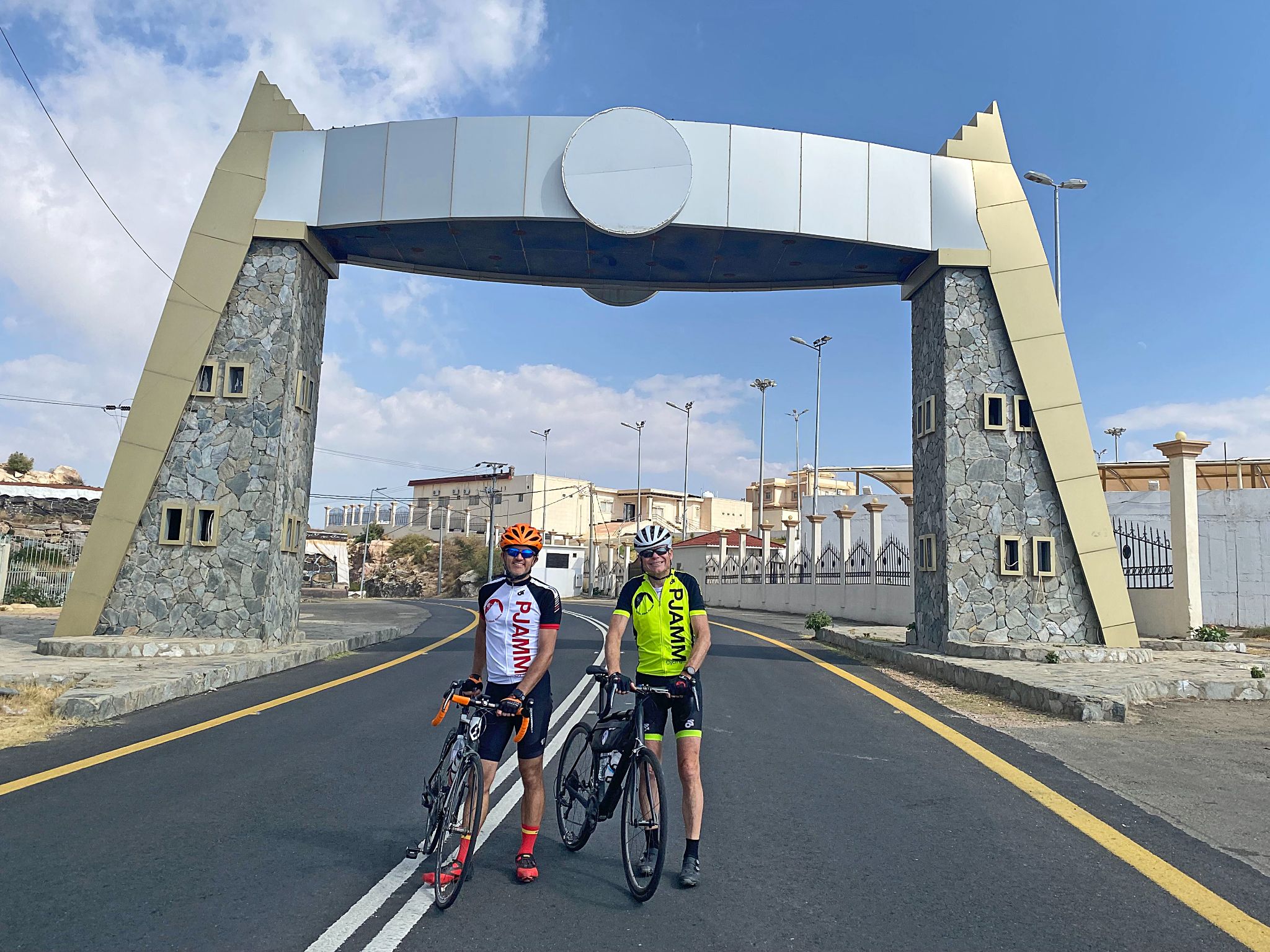
Cycling Parmah Pass, Saudi Arabia  - two PJAMM Cyclists stand with bikes under bridge structure crossing roadway at climb's finish

Matt left (ARAMCO, Dhahran, Saudi Arabia); John right.

Cycling Parmah Pass, Saudi Arabia  - bikes parked in parking lot at climb's finish, surrounded by many baboons

Plenty of company at the parking lot next to the finish.