![]()
Cycling Blue Ridge Road
Ride 13 miles gaining 3,976’ at 5.7% average grade.
This climb is in what could appear at first to be an arid and unattractive region. However, once you begin heading east towards the Sierra Nevada foothills, things change and the rides in this area are, in our opinion, very worthwhile and fun. This climb does not have the giant sequoias that its neighbors Balch Park and Bear Creek Road have, but its a great little climb nonetheless.
Climb summary by PJAMM ambassador Dan Razum, San Jose, California.
This climbs starts at the beginning of Balch Park Road and shares the first 5 miles with that climb before reaching Blue Ridge road.
![]()
The section of the climb on Balch Park Road is a narrow two lane road with no shoulder but in fairly good condition. Traffic is light, mostly local residents. We ride through the low foothills with oak trees and shrubs. To the left we can see the Blue Ridge, where we will eventually end up and in front we can see the Sierra Nevada Mountains.
![]()
After 5 miles we turn left onto Blue Ridge road.
![]()
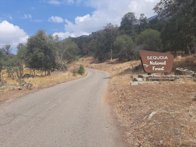
The road is more narrow and although the pavement is in good condition, it doesn't last long. About a mile later we cross a cattle guard and enter Sequoia National Forest.
![]()
![]()
From this point on the road is slightly wider than a single lane and the pavement is pretty rough in spots although overall it is still decent. Traffic is very minimal, so there is no problem riding around the occasional pothole.
![]()
As we climb up Blue Ridge there are scenic views of the valley below and surrounding mountains for a couple of miles at least. The vistas are a welcome distraction from the long climb. There are several houses, cattle guards and no trespassing signs as we climb up the ridge. Close to the top we pass through a pine forest, but there are no giant sequoias in this area. At the top there are several communication antennas and an exposed area of solid rock with sweeping views of the landscape below. The road does descend the other side of the mountain, past the antennas, but it is dirt so we did not check it out.
![]()
![]()
![]()

 We've partnered with Sherpa-Map.com to bring you the best route planning tool. With a PRO Membership you can use this climb as a reference when creating your route.

