![]()
Cycling Pig Trail Mountain Road
Ride 4.3 miles gaining 1,166’ at 4.9% average grade (5.9% climb only).
This north-south state highway is called Pig Trail Scenic Byway due to its steep hills and hairpin turns.
Climb summary by PJAMM ambassador Dan Razum.
This is a beautiful ride in the Ozarks. We ride on Highway 23, otherwise known as Pig Trail Scenic Byway. The entire Byway is 24 miles long, but we just ride a few miles near the middle, where most of the climbing is.
![]()
We start at the bridge over Fane Creek, near the junction of Pig Trail Scenic Byway and Rte 215. There is a parking area on Rte 215, at the junction, where we can park and ride a short way back to the bridge to start the climb.
![]()
![]()
There is a thick foilage throughout most of the climb, providing abundant shade but obscuring the views as we climb up.
![]()
The road is in good condition. There is a small shoulder in places but it has grooves for the most part. The grooves aren't too wide, so sometimes we can still ride on the shoulder, but not always. However, the Pig Trail is more of a tourist road, so there isn't a lot of traffic and the cars and motorcycles tend to be courteous so we weren't concerned
about the traffic.
![]()
The climbing is mostly in the first half, until about where we reach Mulberry Mountain Lodge and then it mellows out as we ride along the ridge.
![]()
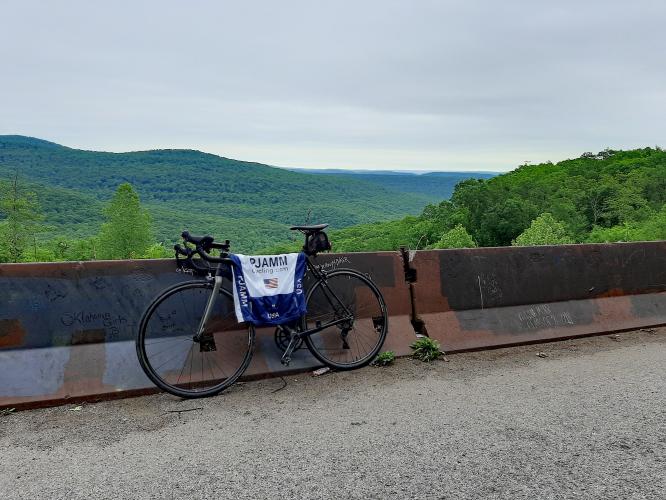
The climb ends at the Scenic Overlook. The road continues on as rolling terrain and is worth riding for fun, but there is no more substantial climbing after the Scenic Overlook. From the Overlook there is a nice view of the surrounding landscape.
![]()
![]()

 We've partnered with Sherpa-Map.com to bring you the best route planning tool. With a PRO Membership you can use this climb as a reference when creating your route.

