11.7
PDI
4.6 mi
DISTANCE
1,821 ft
GAINED
7.4 %
AVG. GRADE
FULL CLIMB STATS
Page Contributor(s): Dan Razum, San Jose, California
INTRO
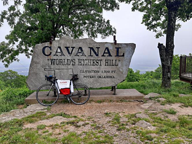
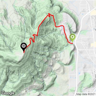
This 4.6 mile bike climb is located in OK, USA. The average gradient is 7.4% and there is a total elevation gain of 1,821 ft, finishing at 2,385 ft.
Use the profile tool, route map, and weather forecast to conquer this cycling climb.
Use the profile tool, route map, and weather forecast to conquer this cycling climb.
PLAN YOUR ROUTE
See more details and tools regarding this climb's grade via our interactive Profile Tool.
Information Not Available
If you have any information regarding this climb, we'd like to hear from you. Click the CONTRIBUTE button to share your thoughts with us.
Information Not Available
If you have any information regarding this climb, we'd like to hear from you. Click the CONTRIBUTE button to share your thoughts with us.
Before heading out on any cycling adventure check out our Things to Bring on a Cycling Trip and use our interactive check list to ensure you don't forget anything.
Information Not Available
If you have any information regarding this climb, we'd like to hear from you. Click the CONTRIBUTE button to share your thoughts with us.
ROUTE MAP
MEMBER RATING
CURRENT WEATHER
PJAMM TRIPS ADVENTURE STARTER BUNDLES
Check out PJAMM Adventure's prepackaged (self-guided) cycling trips. They will help you plan, document and conquer your next adventure.
NEARBY CLIMBS (0) RADIAL PROXIMITY
FROM No Climbs Found
MEMBER REVIEWS & COMMENTS
Let us know what you thought of this climb. Signup for our FREE membership to write a review or post a comment.
Already have an account?
LOG IN HERE
Skotscott
Oct 5, 2022
This is a short, sweet & sour climb - sweet, challenging climb - sour, rough decent. Mehhhh. I've descended much worse. The climbing is worth it. I did multiple laps so I opted to park at the top - cooler with a nice breeze. Nothing at the top but tech towers so not much traffic.
dpnstl


This was a great climb to do! It's not that long, under 5 miles but has 400 ft per mile elevation gain. In addition, the average grade is about 8.2% there are some long stretches of 10%+ as well as 13% - 15% sections...max grade is 15.8%. I wanted to do this as part of a longer ride but couldn't find a good route in the area so I just started a mile or so from the climb and did it. If you want to do that, I would suggest parking at the Poteau Primary Elementary School and roll from there. Here's the route for the climb https://www.strava.com/routes/2943256357916242862