
23.4
PDI
20 mi
DISTANCE
4,131 ft
GAINED
3.6 %
AVG. GRADE
FULL CLIMB STATS
INTRO
Punta Callan (Huaraz) is the Huaraz side of one of Peru's great paved mountain crossings. The climb covers 20.0 miles from the city at 9,954 ft to 13,790 ft, gaining 4,131 ft at an average of 3.6%. The pass itself, on the road to Pariacoto, sits at about 13,871 ft (4,228 m) in the Cordillera Negra, and this is the highest point of a paved route that then drops all the way to sea level near Casma.
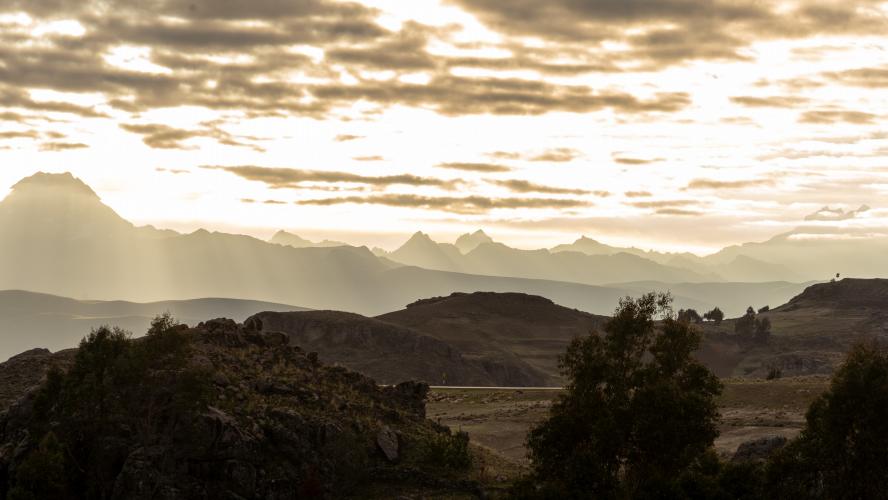
This is the "easier" side of Punta Callan, with the grade mostly under 6% and views of the snow-covered Cordillera Blanca across the valley all the way to the summit. The real difficulty is altitude. You start high already, finish well above 13,000 ft, and temperatures can fall from about 80F in Huaraz to less than 30F at the top. We also highly recommend starting a few miles up the road or carrying a stick, because there are some mean dogs that love to chase cyclists on the first part of the climb.
Traffic is very light and you will be passed by more auto rickshaws than cars. Check conditions before you go with our Weather tool, and for the longer, wilder route down the other side see our Punta Callan West page.
PLAN YOUR ROUTE
 We've partnered with Sherpa-Map.com to bring you the best route planning tool. With a PRO Membership you can use this climb as a reference when creating your route.
The climb averages 3.6% over 20.0 miles, but the grade is uneven. Mile 4 and mile 9 are nearly flat (0.1% and 0.6%), while miles 8 and 10 run 6.2% and 6.1%. The steepest quarter mile is 11.0%, the steepest half mile is 9.0%, the steepest mile is 6.4%, and the steepest 5 miles hold 4.8%.
Short descents add up to 295 ft along the way. The gentle numbers undersell the effort: the entire climb sits above 9,900 ft and finishes near 13,800 ft, so the thin air makes every mile harder than the grade suggests.
Roadway: The road is paved all the way on Carretera 14A, and the surface on the main roadway is very good. Higher up the road twists through an enormous number of turns as it crosses the Cordillera Negra.
Traffic: Traffic is very light. You'll be passed by more auto rickshaws than cars, and drivers will give you a friendly honk well before they pass to let you know they're approaching.
Parking: Parking or beginning your ride in the city of Huaraz is our recommendation. Street parking is available on most roads near the climb start.
Gear: This climb is paved, but in rural Peru you never know exactly what you're going to get until you're there. We recommend tires wider than 30mm, though 23s will work, and we also highly recommend bringing a spare tire.
Weather: The altitude change is drastic. It was 80F when we started and less than 30F at the summit, and rain can appear in an instant in the Andes, so bring gear for all conditions.
Dogs: For the first few miles, carry a stick. Most dogs in the region are friendly, but a few houses have very mean dogs that will chase and bite.
Before heading out on any cycling adventure check out our Things to Bring on a Cycling Trip and use our interactive check list to ensure you don't forget anything.
The best place to stay for this climb is Huaraz, and a few days there to acclimatize before riding is well worth it. We stayed at La Casa de Zarela (which we HIGHLY recommend!).
Click here to check out hotels in the Huaraz area.
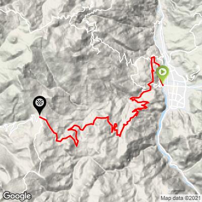
ROUTE MAP
MEMBER RATING
CURRENT WEATHER
PJAMM TRIPS ADVENTURE STARTER BUNDLES
Check out PJAMM Adventure's prepackaged (self-guided) cycling trips. They will help you plan, document and conquer your next adventure.
NEARBY CLIMBS (0) RADIAL PROXIMITY
FROM No Climbs Found
MEMBER REVIEWS & COMMENTS
Let us know what you thought of this climb. Signup for our FREE membership to write a review or post a comment.
Already have an account?
LOG IN HERE
cf70152


Road bike rentals are apparently hard to come by in the Andes, but got it done on a MTB. A stunning ride with constantly amazing views of the city and valley below. The dogs are everywhere on the bottom half of the climb, so take the warnings seriously.
