![]()
Cycling Paul da Serra from Miradous do Rabacal
Ride 18 kilometers gaining 1,600 meters at 8.7% average grade (10.1% climb only).
This is World #95 and has 500 meters at 24.6%, 1 km at 22.6% and 2 km at 20.8% average grade!!
Climb summary and photographs by Venancio Ferreira (Pomnta do Sol, Madeira, Portugal)
![]()
So, this is a Climb that begins in the small village of Calheta at around 300 metres from the sea level and climbs until Paul da Serra where it ends at 1226 m. The GPS data gives me an accumulate of 928 metres in a total distance of 17,9 with initial 7,6 very steep kilometers. I made this climb in July 2021 and the temperature was around 24ºC, it was sunny and the weather was very good for cycling, but nothing can prepare you for that grueling effort. At the time I used a Trek 1.5 Aluminium bike with a 32/11 cassette in the back and 50/34 crankset. I am a relatively heavy guy (around 81 kgs) so all the climb I used the 34/32 ratio and tried not to make any acceleration in order to maintain my power.
![]()
The climb begins already with quite a steep of around 12 to 13%, this is also the part where the tarmac is worse. In this regard we can say that for most of the course the tarmac is excellent. The second kilometer eases a bit so the steepness will be around 9 to 11%, in this section I did make a stop for some gel.
![]()
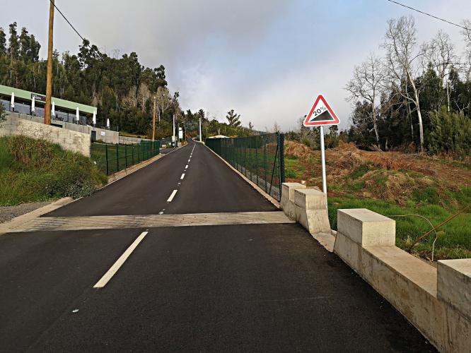
From the third kilometer things start to become really serious, From an intersection the road skyrockets in ramps that goes over 25% and the GPS data sometimes gave readings over 30% in some short parts. I must say that sometimes it was so steep that while pedalling the front wheel often lift off the ground and it was difficult to exceed 5 klm/h. Also it was so steep and slow that I was worried about not losing my balance on the bike. After this really awful part the road is just a little bit easier, but nevertheless around 18%. For this part, the road has good visibility and not much traffic so I used the ziguezague technique in order to maintain a speed around 6km/h.
![]()
At more or less 2.5 klm to the steep end in a right turn there is a small camping house, so I stopped there for some fresh water and a gel, it was a quick stop for about 2 or 3 minutes in order not to cool too much.Then the road goes more or less the same 10 to 15% steepness for about one kilometer more.
For the last 1.5 klm there is a special bonus, the road is on cobbles. So it is very uncomfortable and with a lot of vibration, for some parts we can ride in a small stripe of concrete by the road side but for the most part we have to ride over the pavee, until finally I reached the end of the climb that is situated in Paul da Serra.
![]()
In terms of view, for the first part we can see the small houses built in the hills of Calheta, but after 2 klms there are only trees and a view over the mountains above. It is not a view we can appreciate because the climb is so incredibly difficult.
This is a climb where we have to be equally physically and mentally strong. If you think for a second about giving up, you will give up.

 We've partnered with Sherpa-Map.com to bring you the best route planning tool. With a PRO Membership you can use this climb as a reference when creating your route.

