38
PDI
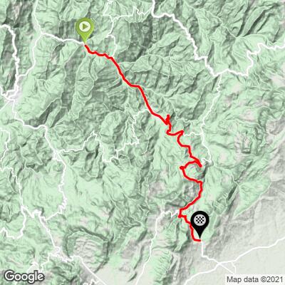
25.2 mi
DISTANCE
6,885 ft
GAINED
5 %
AVG. GRADE
FULL CLIMB STATS
Page Contributor(s): Hernando Bermudez, Seattle, WA, USA
INTRO
This 25.2 mile bike climb is located in Cundinamarca, Colombia. The average gradient is 5% and there is a total elevation gain of 6,885 ft, finishing at 9,280 ft.
Use the profile tool, route map, and weather forecast to conquer this cycling climb.
Use the profile tool, route map, and weather forecast to conquer this cycling climb.
PLAN YOUR ROUTE
See more details and tools regarding this climb's grade via our interactive Profile Tool.
Roadway & Traffic:
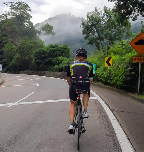
Road surface is quality, the shoulder is adequate. Traffic only intensifies as one returns closer to Bogota, we would advise against riding downhill and continuing South bound to down time Bogota.Parking:
This climb begins in the town of La Vega, parking options are not an issue
There is a Tea house called Le Petit Jardin at the 2/3 mark of the ascent that overlooks the valley. Stop here for provisions, otherwise, no other options until the summit.
Before heading out on any cycling adventure check out our Things to Bring on a Cycling Trip and use our interactive check list to ensure you don't forget anything.
Information Not Available
If you have any information regarding this climb, we'd like to hear from you. Click the CONTRIBUTE button to share your thoughts with us.
ROUTE MAP
MEMBER RATING
CURRENT WEATHER
PJAMM TRIPS ADVENTURE STARTER BUNDLES
Check out PJAMM Adventure's prepackaged (self-guided) cycling trips. They will help you plan, document and conquer your next adventure.
NEARBY CLIMBS (0) RADIAL PROXIMITY
FROM No Climbs Found
MEMBER REVIEWS & COMMENTS
Let us know what you thought of this climb. Signup for our FREE membership to write a review or post a comment.
Already have an account?
LOG IN HERE
xjezreel
This climb is part of one of two main roads that connect Bogota to the town of Villeta to the northwest on the way to Medellin. The road is a 4 lane divided highway with two lanes going in each direction. The climb proper starts around the town of Nocaima and passes through the town of La Vega which is a very popular start point for the climb. This is an example of a very typical climb in Colombia in that it is quite long but remains quite constant at a manageable grade. The road is a main highway so traffic is quite heavy including a significant amount of trucks, but the fact that there are 2 lanes in each direction means it's not a big issue. The climb from the other direction starting on the outskirts of Bogota and ending at el Vino is much shorter and very popular with the large population of cyclists in the city, specially on the weekends.