
42.1
PDI
26.3 mi
DISTANCE
6,721 ft
GAINED
4.8 %
AVG. GRADE
FULL CLIMB STATS
Page Contributor(s): Ties Arts, NL
INTRO
Sela Pass carries National Highway 13 - the Trans-Arunachal Highway - over a 13,754-foot Himalayan crest in India's Arunachal Pradesh, on the sole overland route linking the Buddhist enclave of Tawang to the rest of the country. From a start near 7,126 feet, the climb gains 6,721 feet over 26.25 miles at an average grade of 4.79%, currently ranked #87 among the world's toughest bike climbs.
What sets Sela apart is where it sits: this is one of the highest motorable roads on Earth, built and maintained largely by India's Border Roads Organisation because of the pass's strategic position near the disputed border with China.
Traffic thins dramatically above Dirang, the switchbacks tighten, and the air gets genuinely thin near the top - riders should expect to feel the altitude on the final miles regardless of fitness.
The pass takes its name from Sela, a young Monpa woman said to have aided an Indian soldier during the 1962 Sino-Indian War, and the sacred, often-frozen Sela Lake sits near the summit.
The Sela Tunnel, opened in 2024 about 1,300 feet below the pass, now gives motor traffic a lower, all-weather bypass - good news for cyclists on the original road, since it has pulled a meaningful share of heavy traffic off the high route.
PLAN YOUR ROUTE
 We've partnered with Sherpa-Map.com to bring you the best route planning tool. With a PRO Membership you can use this climb as a reference when creating your route.
 Sela Pass climbs 6,721 feet over 26.25 miles at an average grade of 4.79% - deceptively moderate on paper, but the hardest terrain is concentrated in short, sharp pitches near the bottom. The steepest 100 yards hits 12.73%, and the opening quarter-mile averages 11.12%, so the climb front-loads its toughest ramps before settling into a long, grinding gradient in the 5-6% range for most of the ascent.
The steepest half-mile averages 8.82%, and the steepest full mile 7.07%, meaning there's no single mile-long wall - instead it's a sustained, high-altitude slog where thinning air matters more than any individual pitch.
With a summit at 13,754 feet, the effective difficulty of any given gradient increases substantially over the final miles as oxygen availability drops.
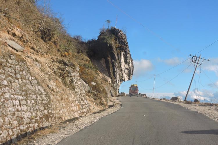
Roadway: The climb follows NH13, the Trans-Arunachal Highway, maintained by India's Border Roads Organisation (BRO) largely for military use given the pass's proximity to the disputed China border. The surface is mostly paved two-lane tarmac with tight switchbacks, though patches of broken pavement and loose gravel show up after monsoon season or winter freeze-thaw cycles. Snow and ice regularly affect the pass in winter, and heavy snowfall has stranded travelers near the summit as recently as February 2024 - check current conditions with BRO or local authorities before riding.
Traffic: Traffic is generally light but includes army convoys, trucks, and a steady stream of tourist vehicles heading to Tawang, especially in peak season (April-June and October). The 2024 opening of the Sela Tunnel, which bypasses the pass about 1,300 feet lower, has diverted a meaningful share of through-traffic away from the high route, making the original pass road quieter for cyclists than it was before 2024.
Parking: There's no formal trailhead or parking lot. Riders typically stage from Dirang or Bomdila the night before and ride up; near the summit, a scattering of tea stalls and a small monastery around Sela Lake offer informal pull-off space, but don't expect marked parking.
At over 13,700 feet, Sela Pass demands cold-weather cycling gear even outside winter - summit temperatures run well below what riders experience in the valley, and wind across the open pass adds a real chill factor. Pack thermal layers, wind-blocking gloves, and a shell jacket regardless of season; snow is possible even in shoulder months.
Water and food are scarce once you leave Dirang or Bomdila - carry more than you think you'll need, since services thin out fast above the treeline. A handful of small tea stalls near the summit sell hot chai and basic snacks when open, but don't count on them being staffed, especially outside peak tourist season.
Altitude is the real variable here: riders coming from lower elevations should budget extra acclimatization days in Dirang or Tawang before attempting the full climb, and know the symptoms of altitude sickness before setting out.
Before heading out on any cycling adventure check out our Things to Bring on a Cycling Trip and use our interactive check list to ensure you don't forget anything.
Sela Pass sits inside Arunachal Pradesh's restricted zone, so every Indian traveler from outside the state needs an Inner Line Permit (ILP), and foreign visitors need a Protected Area Permit (PAP) plus a minimum group size of two - apply online in advance at arunachalilp.com, since processing (typically within 24 hours) can still run tight against a tour timeline.
The best riding window is April through June, when snow has cleared and rhododendrons bloom around Sela Lake, or October, after the monsoon; winter brings serious cold and a real risk of snow closure. Base yourself in Dirang or Bomdila to the south, both of which have hotels and food and easier highway access than Tawang, which sits on the far side of the pass.
This is a remote, military-border region, so cell coverage is unreliable for long stretches - let someone know your planned route and expected return time. Riders piecing together a longer Arunachal itinerary can check our Routes in the Area tool to see other nearby climbs worth linking together.
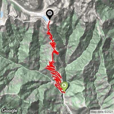
ROUTE MAP
MEMBER RATING
CURRENT WEATHER
PJAMM TRIPS ADVENTURE STARTER BUNDLES
Check out PJAMM Adventure's prepackaged (self-guided) cycling trips. They will help you plan, document and conquer your next adventure.
NEARBY CLIMBS (0) RADIAL PROXIMITY
FROM No Climbs Found
MEMBER REVIEWS & COMMENTS
Let us know what you thought of this climb. Signup for our FREE membership to write a review or post a comment.
Already have an account?
LOG IN HERE
