36.7
PDI
12.7 mi
DISTANCE
5,356 ft
GAINED
7.7 %
AVG. GRADE
FULL CLIMB STATS
Page Contributor(s): Ard Oostra, Switzerland; Helmuth Dekkers, Netherlands
INTRO
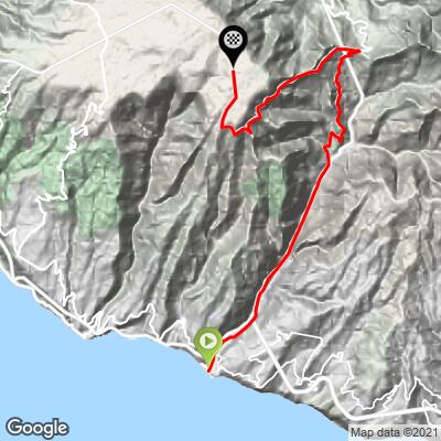
Paul da Serra is Madeira's largest highland plateau, a wide, wind-swept tableland in the center-west of the island at about 1,575 meters (5,167 feet). This route climbs the mountain's southern flank, starting just a few hundred meters from the Atlantic Ocean in Ribeira Brava and finishing on top of the plateau - 12.7 miles and 5,356 feet of gain at a 7.7% average grade.
It's one of the steepest sustained major climbs on Madeira.
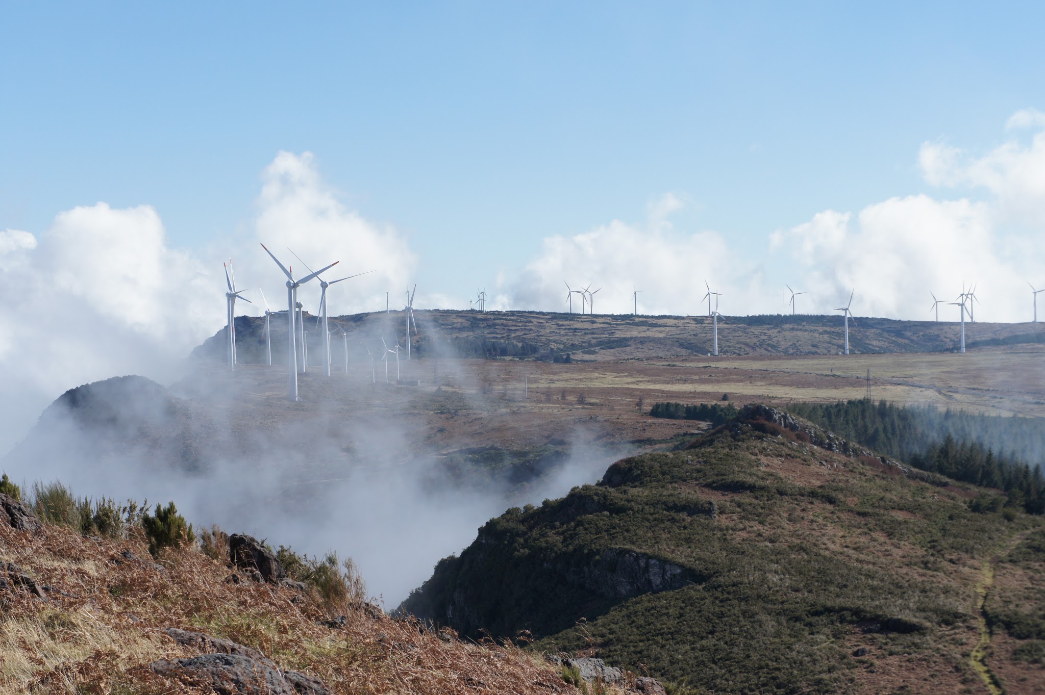
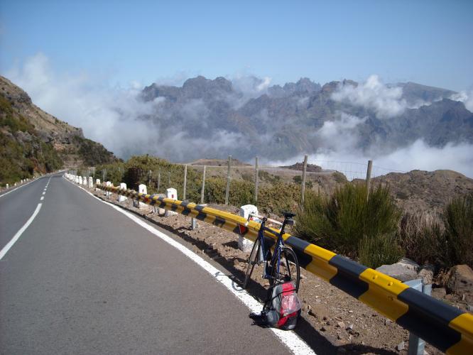
The road climbs quickly out of the coastal town through Serra de Água and up to Boca da Encumeada, switchbacking through laurel forest and at least one tunnel (bring a taillight) before breaking into the open on the plateau, where wind turbines line the ridge and semi-wild cattle graze right up against the roadway. Views stretch from the Atlantic far below to Madeira's central peaks.
It's currently ranked #139 in our database of the world's toughest climbs, and it's one of the highest-rated rides on the island for scenery as well as difficulty. Because the summit sits well above 5,000 feet and is regularly wrapped in cloud and wind even on clear coastal days, it's worth checking current conditions with our Weather tool before you go.
PLAN YOUR ROUTE
 We've partnered with Sherpa-Map.com to bring you the best route planning tool. With a PRO Membership you can use this climb as a reference when creating your route.
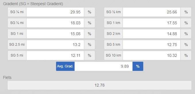
 This is a steep, front-loaded climb. The average grade over the full 12.7 miles is 7.7%, but it's far from steady: the single steepest 100-yard section spikes to 20.0%, and the steepest continuous mile averages 14.9%. Even measured over a full 5-mile window, the steepest stretch still holds an 11.4% average - a real test of sustained power, not just a hard pinch or two.
Roadway: Full pavement the entire way, well-maintained but narrow with tight switchbacks as it climbs out of Serra de Água toward Boca da Encumeada. There's at least one unlit tunnel along the route, so a taillight (and headlight) is essential. Above the pass, the road opens onto the exposed Paul da Serra plateau, where fog and crosswinds show up in any season. A related but separate stretch of the ER105 ridge road, between Boca da Encumeada and Miradouro das Molinas, has been closed for extended rockfall repairs as recently as early 2026 - if your plan continues further along that ridge, verify current status before you go.
Traffic: Light to moderate. The lower section through Ribeira Brava and Serra de Água carries local and some tourist car traffic, while the upper plateau road is quiet, used mostly by hikers, wind-farm maintenance vehicles, and free-roaming cattle - watch for animals standing in the road near the top.
Parking: There's no dedicated cyclist parking at the coastal start; riders typically begin from a pull-off near the ER101/VE3 roundabout in Ribeira Brava. If you're driving up to shuttle or provide sag support, small pullouts exist near Boca da Encumeada and at viewpoints along the plateau.
Bring a bike light and taillight for the tunnel section. Dress in layers - the plateau sits at 5,167 feet and is regularly wrapped in cloud, wind, and cool temperatures even when it's warm at sea level in Ribeira Brava. Top up water and food in town before you start; there are no shops or fountains along the climb once you leave Ribeira Brava, and nothing at the summit either.
Before heading out on any cycling adventure check out our Things to Bring on a Cycling Trip and use our interactive check list to ensure you don't forget anything.
Ribeira Brava is a proper small town with cafes, a market, and grocery stores, making it a good staging point before or after the ride. Weather on the plateau can shift fast, with fog and wind common even on clear coastal days, so pack accordingly and allow extra time if visibility drops.
ROUTE MAP
MEMBER RATING
CURRENT WEATHER
PJAMM TRIPS ADVENTURE STARTER BUNDLES
Check out PJAMM Adventure's prepackaged (self-guided) cycling trips. They will help you plan, document and conquer your next adventure.
NEARBY CLIMBS (0) RADIAL PROXIMITY
FROM No Climbs Found
MEMBER REVIEWS & COMMENTS
Let us know what you thought of this climb. Signup for our FREE membership to write a review or post a comment.
Already have an account?
LOG IN HERE