
17.2
PDI
4.7 mi
DISTANCE
2,189 ft
GAINED
8.9 %
AVG. GRADE
FULL CLIMB STATS
INTRO
On 25 May 2018 Chris Froome rode up this road alone, 80 km after attacking on the gravel of the Colle delle Finestre, and took the pink jersey he would carry to Rome. The Jafferau had seen big days before: Eddy Merckx won here in 1972, and in 2013 the Giro came up in sleet and fog, after snow had knocked the Sestriere off the route.
It's short and it doesn't let up. From the middle of Bardonecchia the road climbs 7.5 km (4.7 mi) and gains 667 m (2189 ft) at an 8.9% average, and only the first few hundred meters are anything like easy. After that it's 8-10% the whole way, with the steepest kilometer at 10.5% and the last few kilometers the hardest on average.
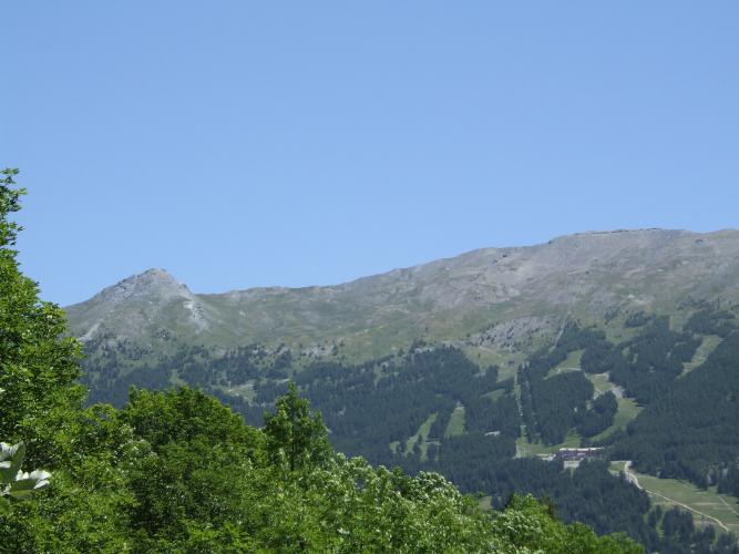
The lane is narrow and quiet, climbing through larch forest and past clusters of old stone chalets, with the valley and the peaks on the French border opening up behind you as you gain height. Where the asphalt stops, by the ski lifts, unpaved military roads carry on toward the old forts of the Jafferau at close to 2800 m - mountain-bike country.
PLAN YOUR ROUTE
 We've partnered with Sherpa-Map.com to bring you the best route planning tool. With a PRO Membership you can use this climb as a reference when creating your route.
There's no warm-up. After a gentler first few hundred meters out of Bardonecchia, the kilometers go 8.6%, 9.8%, 8.4% and 7.6%, then 9.5%, 8.9% and 10.1% before a final 8.1% to the top. The slightly easier fourth kilometer, near Gleise, is the closest thing to a rest.
Steepest sections on our profile: 0.5 km at 11.2%, 1 km at 10.5%, 2 km at 9.8% and 5 km at 9.0%. Overall: 7.5 km (4.7 mi) at 8.9%, from about 1264 m to 1932 m (6338 ft).
The Giro's version, measured to its finish line at 1908 m, was 7.2 km at about 9.1%.
Roadway: The SP238 has tarmac right up to where our route ends, but it's a narrow mountain lane rather than a pass road, with older, patched asphalt and cracks in places. It's fine on a road bike; take care on the descent, which is steep and narrow. Above the end of the tarmac, the old military roads toward Forte Föens and Forte Jafferau are rough gravel and stone, with limited motor access - for fat tires only. At these heights snow covers the upper road for much of the winter.
Traffic: Light. The road serves the hamlets above Bardonecchia, the ski area and the start of the military roads, so you'll see the odd resident, hikers' cars and some 4x4s in summer, and not much else.
Parking: Park in central Bardonecchia, which has public car parks around the town center, and start from there. Coming by train is easy: Bardonecchia station, on the line from Turin, is a short ride from the start.
Gear: Bring your lowest gears. Seven and a half kilometers near 9% with almost no relief is a serious effort, and you'll be glad of a 34x32 or similar. The descent back to town is steep and twisty, so check your brakes before you set off.
Provisions: Stock up in Bardonecchia, which has cafes, bakeries and supermarkets. Don't count on anything open on the climb or at the top outside the ski season.
Before heading out on any cycling adventure check out our Things to Bring on a Cycling Trip and use our interactive check list to ensure you don't forget anything.
Bardonecchia sits at the end of the line - the last Italian stop before the Fréjus rail tunnel to Modane - and makes a good base for a few days in the Alta Val di Susa. The town hosted the snowboard events of the 2006 Turin Winter Olympics, and Forte Bramafam, the restored 19th-century fort on the hill just above town, is now a museum.
For more riding, the road from Bardonecchia over the Colle della Scala drops into France's Vallée de la Clarée, our Sauze d'Oulx climb starts a short way down the valley in Oulx, and the Colle delle Finestre, where Froome began his 2018 attack, is a short drive further down toward Susa. On fat tires, the military roads above the end of our route climb on past Forte Föens to the ruins of Forte Jafferau.
ROUTE MAP

MEMBER RATING
CURRENT WEATHER
PJAMM TRIPS ADVENTURE STARTER BUNDLES
Check out PJAMM Adventure's prepackaged (self-guided) cycling trips. They will help you plan, document and conquer your next adventure.
NEARBY CLIMBS (0) RADIAL PROXIMITY
FROM No Climbs Found
MEMBER REVIEWS & COMMENTS
Let us know what you thought of this climb. Signup for our FREE membership to write a review or post a comment.
Already have an account?
LOG IN HERE
