
47.7
PDI
29.5 mi
DISTANCE
8,481 ft
GAINED
5.1 %
AVG. GRADE
FULL CLIMB STATS
Page Contributor(s): Hernando Bermudez, Bellevue, WA, USA
INTRO
Bocademonte is a long, remote climb in Boyaca, Colombia, rising out of the emerald-mining town of Pauna and finishing at the Alto de Bocademonte pass. From Pauna's start at roughly 1,371' (418m), the route climbs 8,481' over 29.5 miles at an average grade of 5.13% to the 9,353' (2,851m) summit - one of the longer, higher-altitude climbs in the PJAMM database, and currently ranked the 52nd hardest in the world.
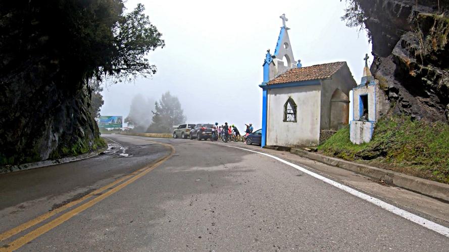
The climb opens with a sharp switchbacking section out of town before settling into long, steady mid-grade pitches through changing vegetation zones - the road climbs from warm, humid lowland terrain near Pauna up through cooler highland country as it gains more than 8,000 vertical feet. The final approach to the pass tackles a long, twisting stretch of hairpin turns cut into the mountainside, a hallmark of Boyaca's mountain roads.
Boyaca is one of the historic strongholds of Colombian cycling, and climbs like Bocademonte - remote, largely untouched by tourism, and physically demanding - are part of what makes the department a proving ground for the country's professional riders.
PLAN YOUR ROUTE
 We've partnered with Sherpa-Map.com to bring you the best route planning tool. With a PRO Membership you can use this climb as a reference when creating your route.
 Bocademonte averages 5.13% over its 29.5 miles, but the grade is far from steady. The steepest quarter mile hits 12.25% and the steepest full mile averages 7.87%, both concentrated in the switchbacking sections near the base and again in the hairpin-laden run to the summit. Long stretches in between ease to a more manageable 6-7%, giving the climb a rhythm of hard efforts followed by recovery rather than one continuous grind.
See more details and tools regarding this climb's grade via the "Profile Tool" button above.
Roadway: The road from Pauna to the Alto de Bocademonte summit is paved for most of its length, though the Pauna-San Pablo de Borbur corridor has been under ongoing repaving and improvement work, so expect some rougher, patchier pavement in spots rather than a uniformly smooth surface.
Traffic: Light outside of Pauna itself - this is a remote rural corridor through Boyaca's emerald-mining country, used mainly by local traffic, motorcycles, and trucks serving the mines rather than tourists.
Parking: Park in Pauna near the base of the climb; there is no formal cyclist parking area, so plan on street parking in town before starting.
Provisions: None along the route once you leave Pauna - stock up on food and water in town before starting.
Gear: This is a long, high-altitude climb finishing above 9,300', with a big swing in temperature and humidity between the warm lowland start and the cooler summit - bring layers along with plenty of water and electrolytes for the heat lower down.
Before heading out on any cycling adventure check out our Things to Bring on a Cycling Trip and use our interactive check list to ensure you don't forget anything.
Pauna has limited lodging options; nearby Chiquinquira is the larger regional hub, and Muzo - Colombia's famous emerald-mining town - is close by if you'd like to see more of the region's mining history alongside the ride.
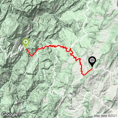
ROUTE MAP
MEMBER RATING
CURRENT WEATHER
PJAMM TRIPS ADVENTURE STARTER BUNDLES
Check out PJAMM Adventure's prepackaged (self-guided) cycling trips. They will help you plan, document and conquer your next adventure.
NEARBY CLIMBS (0) RADIAL PROXIMITY
FROM No Climbs Found
MEMBER REVIEWS & COMMENTS
Let us know what you thought of this climb. Signup for our FREE membership to write a review or post a comment.
Already have an account?
LOG IN HERE
