INTRO
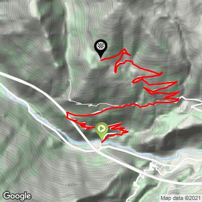
Col du Mont Joux climbs 17.1 km (10.6 mi) from Avise, on the floor of the Aosta Valley, to the end of the pavement beside a small lake just below the col, gaining 1141 m (3,745 ft) at a 6.6% average. The road winds up through the hamlets of Cérellaz and Charbonnière onto the sunny terraces of Saint-Nicolas, then up to Vens - a tiny, lovingly restored stone hamlet at 1735 m (5,692 ft) - before a narrow lane through the larches finishes by the lake. The col itself, at roughly 1930 m (6,332 ft), sits a short gravel stretch beyond.
Don't confuse it with the better-known Col de Joux between Saint-Vincent and the Val d'Ayas - this is a much quieter road. The Avise side is the hardest way up: the hairpins above Avise alternate steep kicks with easier stretches, then a long, almost flat balcony lets you recover before the final 10 km (6.2 mi) to Vens and the lake.
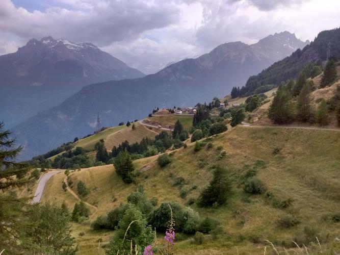
The views are the reward. Mont Blanc shows up early on, and from Vens the panorama runs from Mont Emilius across to the Rutor glacier. The whole climb faces south and is very exposed to the sun - great in spring and autumn, but brutal on a hot summer afternoon.
PLAN YOUR ROUTE
 We've partnered with Sherpa-Map.com to bring you the best route planning tool. With a PRO Membership you can use this climb as a reference when creating your route.
 Col du Mont Joux is 17.1 km (10.6 mi) long with 1141 m (3,745 ft) of elevation gain, an average grade of 6.6%.
The first 6 km (3.7 mi) out of Avise are the toughest part of the climb, averaging 8-9%, with individual hairpin ramps much steeper than that - the steepest 100 m (0.1 mi) pitch touches 15.6%. Then comes the break: roughly km 6.5 to km 8.5 is a nearly flat traverse (1-2%) along the mountainside toward Charbonnière.
After the turn up toward Vens the road climbs again at a steady 7-8.5%, with another short easing around km 11 and again near Vens at km 15. The final kilometer on the narrow lane above Vens is one of the steepest of the day at about 9%.
Steepest sections: 0.5 km (0.3 mi) at 10.5%, 1 km (0.6 mi) at 9.3%, 2 km (1.2 mi) at 8.8%, and 5 km (3.1 mi) at 8.7%.
Roadway: Paved from Avise all the way to the small lake just below the col, where the asphalt ends; the last 550 m (0.3 mi) or so to the col itself are on good gravel, fine to walk or ride carefully on a road bike. The lower regional road is in reasonable shape, but the narrow final section above Vens has rougher pavement and is not cleared of snow in winter, so it's typically a late-spring-to-autumn climb.
Traffic: Very light. Above Avise the road only serves a string of small hamlets and summer pastures - Vens itself has only a couple dozen residents - so you'll mostly share it with locals and the occasional hiker heading for the lake.
Parking: Avise sits right on the main SS26 through the Aosta Valley, so you can park considerately in the village and start from the bottom. If you'd rather ride only the upper section or bring a non-riding companion, Vens has a small parking area at the entrance to the hamlet, the usual starting point for walks to the lake and the col.
Provisions: Stock up in the main valley before you turn off at Avise - above it the route passes only small farming hamlets, so don't count on shops or cafés along the way. Carry plenty of water: this is a south-facing, largely shadeless climb.
Gear: Bring a compact or similar low gear for the steep hairpin ramps above Avise. Wider tires (28 mm or more) make the gravel stretch from the lake to the col more comfortable, and with the top near 1900 m, pack a light layer for the long descent.
Saint-Nicolas, whose terraces you cross on the way up, is the home village of Abbé Jean-Baptiste Cerlogne, the 19th-century poet who wrote the first dictionary of the Valdôtain patois. The small Musée Cerlogne near the parish church and the Centre d'études francoprovençales René Willien in Fossaz-Dessus keep that heritage alive - worth a detour if you're interested in the Aosta Valley's Franco-Provençal culture. The parish church also sits on a wonderfully panoramic promontory.
Up top, Vens is a maze of narrow lanes and restored stone houses. From there, an old irrigation channel (ru) leads walkers along exposed, cable-protected paths toward the wild Vertosan valley - a spectacular short hike if you've brought shoes.
Aosta, about 20 km (12.4 mi) down the valley, is the natural base for a few days here, with nearby climbs including Pila and the Cogne valley. See other climbs nearby, or build a custom route from here, with our Routes in the Area tool.
ROUTE MAP