90.7
PDI
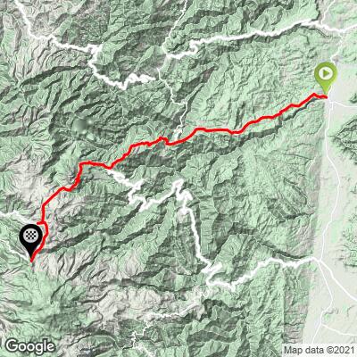
59 mi
DISTANCE
16,484 ft
GAINED
3.7 %
AVG. GRADE
FULL CLIMB STATS
Page Contributor(s): Hernando Bermudez, Bellevue, WA, USA
INTRO
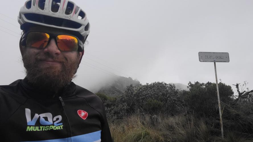
This ride is an extension in both directions of the traditional route up to Alto de Letras. The beginning part is to go from the town of Honda to Mariquita and it's not very steep at all but it's still almost all constant climbing. The part at the end consists of descending from Letras for about 4km and then entering into the Nevados National Park to climb about 12km up to the highest point called the Cerro Guali the road is fully paved although the last part in the national park is in rough shape in some places.
PLAN YOUR ROUTE
See more details and tools regarding this climb's grade via our interactive Profile Tool.
Information Not Available
If you have any information regarding this climb, we'd like to hear from you. Click the CONTRIBUTE button to share your thoughts with us.
Information Not Available
If you have any information regarding this climb, we'd like to hear from you. Click the CONTRIBUTE button to share your thoughts with us.
Before heading out on any cycling adventure check out our Things to Bring on a Cycling Trip and use our interactive check list to ensure you don't forget anything.
Information Not Available
If you have any information regarding this climb, we'd like to hear from you. Click the CONTRIBUTE button to share your thoughts with us.
ROUTE MAP
MEMBER RATING
CURRENT WEATHER
PJAMM TRIPS ADVENTURE STARTER BUNDLES
Check out PJAMM Adventure's prepackaged (self-guided) cycling trips. They will help you plan, document and conquer your next adventure.
NEARBY CLIMBS (0) RADIAL PROXIMITY
FROM No Climbs Found
MEMBER REVIEWS & COMMENTS
Let us know what you thought of this climb. Signup for our FREE membership to write a review or post a comment.
Already have an account?
LOG IN HERE