35.4
PDI
5.6 mi
DISTANCE
3,587 ft
GAINED
12.2 %
AVG. GRADE
FULL CLIMB STATS
Page Contributor(s): Ties Arts, Netherlands
INTRO
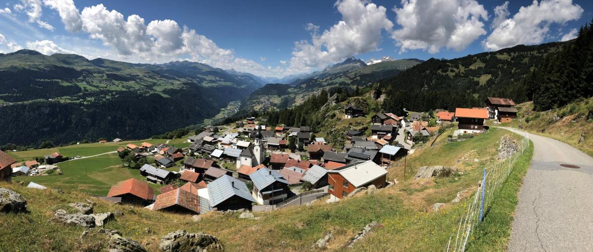
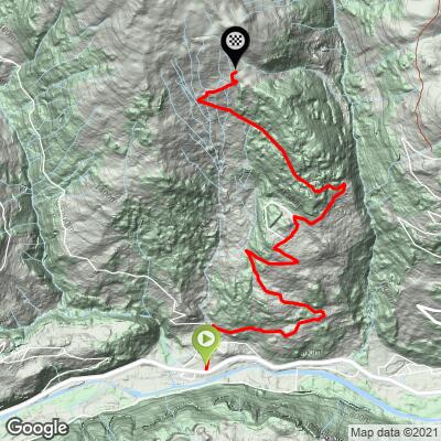
Alpe de Siat climbs 5.6 miles and 3,587 feet at a 12.2% average grade out of Rueun, in Switzerland's Graubünden region (Bezirk Surselva), topping out near 1,835 meters (6,026 feet) on the flank of the Fil da Rueun ridge above the Vorderrhein valley.
This one comes with a real asterisk: the road is paved for roughly the first 3.2 miles (5.1 km) out of Rueun, and turns to a rougher, unpaved surface above about 1,550 meters for the push to the true summit. It's steep the entire way, with no flat sections to recover on, and the grade only gets harder once the pavement ends.
We hesitated to add this climb at all after getting mixed reports on whether it's really achievable on a standard road bike - the consensus from local riders is that the paved lower two-thirds is a great, hard climb on its own, while the unpaved final stretch is better suited to a gravel bike or wider tires. Treat the point where the pavement ends as a natural, worthwhile turnaround if you're on skinny road tires.
PLAN YOUR ROUTE
 We've partnered with Sherpa-Map.com to bring you the best route planning tool. With a PRO Membership you can use this climb as a reference when creating your route.
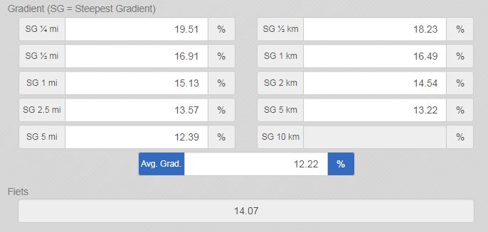
 This climb averages 12.2% over 5.6 miles, climbing from 2,457 feet to a summit at 6,026 feet. It's steep from the start and stays that way: the steepest full mile still averages 15.3%, the steepest half-mile 16.9%, and the steepest 100 yards hits 22.5%. There's no meaningful flat section anywhere along the route to recover on.
Roadway: Paved from Rueun to about mile 3.2 (km 5.1), after which the surface turns to a rougher, unpaved track above roughly 1,550 meters elevation for the final push to the summit. Local col-cataloguers who know the road well describe that upper section as steep and not well suited to a standard road bike - wider tires or a gravel bike are the safer choice if you want to reach the true top rather than turning around where the pavement ends.
Traffic: Minimal. This is a narrow local road serving farms and alpine huts above Rueun rather than a through route, so you're unlikely to encounter more than the occasional local vehicle near the bottom and nothing at all higher up.
Parking: Start in Rueun at the "T" intersection of Fersal Road and S. Clau, just off Hwy 19 (Oberalpstrasse) - park along the road near the village center before heading north onto Fersal Road.
Gear low - a 12.2% average with pitches over 20% leaves little room for a tall cadence, and that's before you hit the unpaved upper section, where extra torque and traction matter even more. Riders planning to push past the pavement's end around mile 3.2 should consider a gravel bike or at least wider tires with some tread; a standard road setup is better suited to treating the paved lower section as the full ride. There are no shops or water sources on the climb itself, so carry what you need from Rueun.
Before heading out on any cycling adventure check out our Things to Bring on a Cycling Trip and use our interactive check list to ensure you don't forget anything.
Rueun is a small Surselva village between Ilanz and Waltensburg, an easy base for tackling several of the region's steep, quiet climbs. Alpe de Siat is one of the harder options in the immediate area - if you want more, our Routes in the Area tool can show you what else is within reach from this climb's start point before you plan your day.
Because of the surface change partway up, decide before you leave whether you're riding this on a road bike (turn around near mile 3.2, where the pavement ends) or a gravel setup (continue to the true summit). Either way, this is a quiet, lightly-trafficked valley with no services above the village, so fuel up in Rueun first.
ROUTE MAP
MEMBER RATING
CURRENT WEATHER
PJAMM TRIPS ADVENTURE STARTER BUNDLES
Check out PJAMM Adventure's prepackaged (self-guided) cycling trips. They will help you plan, document and conquer your next adventure.
NEARBY CLIMBS (0) RADIAL PROXIMITY
FROM No Climbs Found
MEMBER REVIEWS & COMMENTS
Let us know what you thought of this climb. Signup for our FREE membership to write a review or post a comment.
Already have an account?
LOG IN HERE