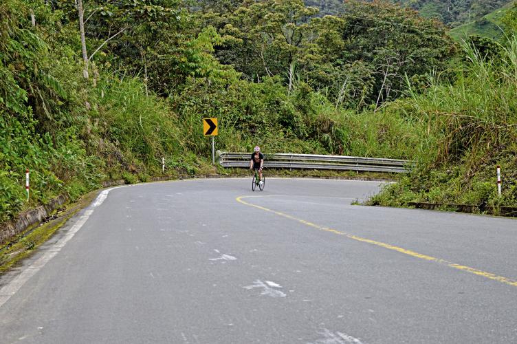
![Cycling El Torneado, Ecuador panoramic view of slick, wet, one-lane mountain roadway curving along hillside, surrounded by lush green landscape]()
Cycling El Torneado, Ecuador - World #9
Ride 32 kilometers gaining 2,716 meters at 8.4% average grade.
![Cycling El Torneado, Ecuador photo collage; PJAMM Cyclist rides on one-lane roadway past lush green tropical foliage, old stone castle-like building]()
Some of the world’s hardest climbs are in the Andes Mountains of South America, and this is surely one of them. As with the other top 10 World Bike Climbs in Ecuador, this climb is through extremely lush surroundings and finishing in foul weather - nice at the bottom, bad at the top!
![Cycling El Torneado, Ecuador photo collage; PJAMM cyclist riding on smooth paved two-lane roadway through lush tropical setting; riding past road sign for San Cristobal; riding past large double decker bus]()
This is a very difficult bike climb with some extremely long and steep segments: 500 meters at 14.7% and there is a 10 km segment that averages just over 12%.
Climb Summary by PJAMM Ambassador Hernando Bermudez, of Bellevue, Washington:
This was the third ride of my Ecuadorian trip. After suffering mightily on Apagua on New Year’s Eve, I had three days remaining with the daunting task of riding El Torneado and its crazily steep ramps and El Chimborazo and its extreme finishing altitude. These two make up the bulk of the climbing on what locals call simply the 0-5000m route: riding from sea level at the town of Babahoyo to the Carrel Hut at the end of the road where mountaineering routes to the peak of Chimborazo start. I had reserved an AirBnB for two nights in the town of Guaranda in between the two climbs.
![Cycling El Torneado, Ecuador road sign reads "Bienvenidos a Guaranda"]()
![Cycling El Torneado, Ecuador view looking down over town of Guaranda]()
New Year’s Day was spent resting, traveling, and calling around until we managed to find a charger for the electronic shifting on my bike. With the bike back in working order and a good night’s sleep, we set out early for Montalvo where El Torneado begins. However, only after having breakfast there I decided to ask Esteban to drive the extra 20 miles to Babahoyo so we could start at sea level. This ended up having the extra benefit of giving me a chance to warm up before hitting the climb. With the experience of Apagua behind me the goal throughout the day was to control my effort and avoid blowing up, something I wasn’t sure I’d be able to do considering the very steep ramps that awaited us. The lower slopes of the climb from Montalvo to Balzapamba are about seven miles on the main highway and average a quite manageable 5-6% but once we detour onto the Torneado road itself we are faced with 12 miles at 10%.
![Cycling El Torneado, Ecuador Aerial drone view as PJAMM Cyclist rides along sharp U turn in roadway surrounded by lush green tropical vegetation]()
To control the effort, I remained seated for as long as I could at the beginning, but soon began alternating riding out of the saddle for several minutes and sitting down when possible, stopping when I wanted to eat some panela and change out my drink bottles. The day was overcast from the start, and it eventually turned into a thick fog with some rain. With every turn that went by I gained more and more confidence that my legs would hold up and I would manage to conquer this monster. The thick tropical forest and rural farmhouses that lined the road provided a consistently scenic and interesting experience throughout. As I approached the end of the climb it begun to rain in earnest, and I decided that I would stop at the top and drive to Guaranda rather than brave the cold and wet roads to complete the 0-5000m route. I ended up setting personal bests for average power over two and three hours on this ride, which shows how important pacing was to survive.
![Cycling El Torneado, Ecuador PJAMM Cyclist Hernando smiles and gives a thumbs up on his bike while cycling on two-lane mountain roadway on El Torneado climb]()
Thank you Hernando!

 We've partnered with Sherpa-Map.com to bring you the best route planning tool. With a PRO Membership you can use this climb as a reference when creating your route.

