
17.1
PDI
7.6 mi
DISTANCE
2,748 ft
GAINED
6.8 %
AVG. GRADE
FULL CLIMB STATS
INTRO
Mezzenile was a town of nail-makers. More than 70 forges worked iron here until after the Second World War, and eight nails still sit on the town's coat of arms. The road to the Colle della Dieta starts at the bottom of the village, passes right by the Francesetti counts' 17th-century castle in the first kilometer, and then climbs out of the Stura valley through a string of hamlets to a quiet pass above the Val di Viù.
It's 12.2 km (7.6 mi) and 838 m (2748 ft) of climbing at 6.8%, and for the first 8 km that average feels generous - a gentle start with a short dip around 2 km, then a steady 6-8% past Bogliano and Villa. Above Monti the road narrows to a lane and the grade goes up sharply: from 8.5 km to 11 km it averages about 10%, with ramps near 15%. One rider called it a wonderful climb with a murderous end, and the other reviews say much the same.
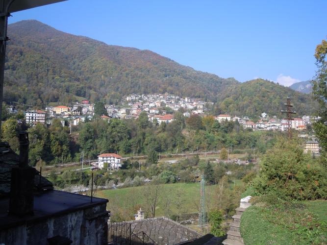
There's almost no traffic - riders consistently describe it as light - and the views open up as you climb toward the ridge between the two valleys. The col itself is just a saddle in the woods with nothing to stop for, so most riders roll straight over and down to Viù, a descent they rate highly.
PLAN YOUR ROUTE
 We've partnered with Sherpa-Map.com to bring you the best route planning tool. With a PRO Membership you can use this climb as a reference when creating your route.
We measure 12.2 km (7.6 mi) and 838 m (2748 ft) of gain from 609 m (1998 ft) at Vernetto to 1436 m (4712 ft) at the col, for a 6.8% average.
The first 3 km are gentle, averaging around 3.5%, including a short descent near 2 km (1.2 mi). From 3 km to 8.5 km (1.9-5.3 mi) the road settles at 6-8%, with one steeper half-kilometer near 9.7% around Bogliano. The hard part is 8.5-11 km (5.3-6.8 mi): about 10% for 2.5 km, with the steepest kilometer at 11.0% and short ramps around 15%. The grade eases over the last half-kilometer and flattens onto the col.
The hardest 2 km (1.2 mi) average 10.4% and the hardest 5 km (3.1 mi) 9.0%.
Roadway: Tarmac throughout - the SP219 through Mezzenile, then Via Bogliano and a narrow lane above Monti. Riders rate the surface as fair rather than smooth, and the top section is tight enough that the hairpins deserve care if you come back down this way. Over the col, long stretches of the descent to Viù have been resurfaced recently, but riders have found loose gravel in its first kilometers. At around 1450 m the top can hold snow late into spring.
Traffic: Light from bottom to top. You'll meet the odd local car between Mezzenile's hamlets; above Monti there's next to nothing.
Parking: Park in Mezzenile around the village center and the castle at Murasse, less than a kilometer up the route, or near the start on the valley road at Vernetto (Street View). Either way, the first kilometer makes a decent warm-up.
Gear: Gear for the top, not the bottom. After 8 km of easy-to-moderate climbing, the last 3 km at 10% with ramps near 15% will find out anyone who started too fast, so a low gear in reserve is worth having.
Provisions: Fill up in Mezzenile. The restored castle complex in the village center now has a restaurant and a chocolate shop; above the village there's nothing until you're down in Viù on the other side.
Before heading out on any cycling adventure check out our Things to Bring on a Cycling Trip and use our interactive check list to ensure you don't forget anything.
Mezzenile is in the Valli di Lanzo, under an hour's drive from Turin, and makes a quiet base for riding the Stura valleys. The Francesetti castle at Murasse, built in the 17th century on an older residence and recently restored, is worth a look once you're off the bike.
Over the col, the road drops into the Val di Viù (our Colle della Dieta (Viù) page covers that side as a climb). From Viù the Colle del Lys is the other big climb of the valley, and for a loop back to Mezzenile you can follow the Val di Viù down toward Lanzo and ride back up the Stura valley road.
Riders who have done both sides of the Dieta tend to call the Mezzenile side the longer and harder one and the Viù side the prettier - riding it as a crossing gets you both.
ROUTE MAP

MEMBER RATING
CURRENT WEATHER
PJAMM TRIPS ADVENTURE STARTER BUNDLES
Check out PJAMM Adventure's prepackaged (self-guided) cycling trips. They will help you plan, document and conquer your next adventure.
NEARBY CLIMBS (0) RADIAL PROXIMITY
FROM No Climbs Found
MEMBER REVIEWS & COMMENTS
Let us know what you thought of this climb. Signup for our FREE membership to write a review or post a comment.
Already have an account?
LOG IN HERE
