
29.5
PDI
7.4 mi
DISTANCE
3,776 ft
GAINED
9.2 %
AVG. GRADE
FULL CLIMB STATS
INTRO
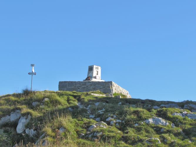
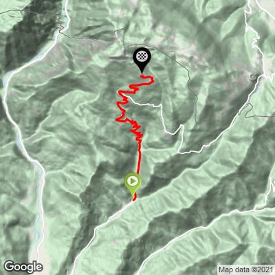
Monte Matajur via Ieronizza is a 12.0 km (7.4 mi) climb out of the village of Savogna, in the Natisone Valleys of eastern Friuli-Venezia Giulia, that gains 1,151 m (3,776 ft) at a 9.2% average grade. The road - known locally as the strada vecchia, or old road - climbs past the hamlets of Ieronizza and Stermizza before finishing at Rifugio Pelizzo (1,314 m), a mountain hut just a few hundred meters below the true summit of Monte Matajur. At 1,641 m, Matajur is the highest point of the Julian Prealps on the Italian side of the border with Slovenia, and the peak that dominates the skyline above Cividale del Friuli.
This is one of the more demanding, least-trafficked climbs in Friuli. The road is narrow and fully paved, threading through dense forest with the sound of streams running alongside for much of the way - there's little exposure and even less traffic, since this isn't a through-road to anywhere. The grade is remorseless rather than explosive: the steepest kilometer averages 12.6% and the steepest quarter-mile 16.2%, but there's no single pitch that defines the climb so much as the steady, sustained grind of it.
Monte Matajur has real racing pedigree: this exact ascent from Savogna via Ieronizza was climbed as a categorized first-category KOM in Stage 13 of the 2016 Giro d'Italia, on the way to the stage finish in Cividale del Friuli.
PLAN YOUR ROUTE
 We've partnered with Sherpa-Map.com to bring you the best route planning tool. With a PRO Membership you can use this climb as a reference when creating your route.
 Matajur via Ieronizza averages 9.2% over 12.0 km (7.4 mi) - one of the steeper sustained climbs in the region. The steepest quarter-mile is 16.2%, the steepest half-mile 12.9%, and the steepest kilometer 12.6%; even the steepest 5 km still averages 10.4%, which shows how little relief this climb offers over its full length.
Roadway: Paved the entire way from Savogna to Rifugio Pelizzo. The road is narrow - barely more than one lane in places - but well-maintained, winding through forest past the hamlets of Ieronizza and Stermizza. The final few hundred meters to the true summit of Monte Matajur beyond the refuge are hiking trail only and not rideable.
Traffic: Very light. This is a dead-end mountain road serving a handful of small hamlets rather than a through-route, so cars are rare outside a few summer weekends.
Parking: Start from the center of Savogna, where the old road toward Ieronizza splits off (46.1598, 13.53392); free roadside parking is available in the village.
Provisions: None along the route - stock up in Savogna, or in Cividale del Friuli beforehand, since there's nothing open at Rifugio Pelizzo year-round.
Gear: A compact or triple crankset earns its keep here - the climb holds 9%+ for long stretches with no flat sections to recover on. The road is paved throughout, so a standard road bike is fine.
Before heading out on any cycling adventure check out our Things to Bring on a Cycling Trip and use our interactive check list to ensure you don't forget anything.
Cividale del Friuli, about a 30-minute drive down the valley from Savogna, is well worth the detour - its Lombard-era center (the Tempietto Longobardo and the Ponte del Diavolo over the Natisone river) is a UNESCO World Heritage Site, and it's the easiest place nearby to find restaurants and a place to stay.
There's nothing open along the climb itself, so fill bottles before you start. Conditions can change quickly this high up, especially outside summer, so check our Weather tool before heading up.
ROUTE MAP
MEMBER RATING
CURRENT WEATHER
PJAMM TRIPS ADVENTURE STARTER BUNDLES
Check out PJAMM Adventure's prepackaged (self-guided) cycling trips. They will help you plan, document and conquer your next adventure.
NEARBY CLIMBS (0) RADIAL PROXIMITY
FROM No Climbs Found
MEMBER REVIEWS & COMMENTS
Let us know what you thought of this climb. Signup for our FREE membership to write a review or post a comment.
Already have an account?
LOG IN HERE
