
23.7
PDI
7.9 mi
DISTANCE
3,345 ft
GAINED
8.1 %
AVG. GRADE
FULL CLIMB STATS
INTRO
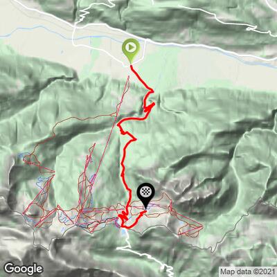
The Nassfeldpass climbs out of Carinthia's Gailtal to the Italian border in the Carnic Alps. Our route runs 12.6 km (7.9 mi) from Tröpolach, gaining 1020 m (3,345 ft) at an 8.1% average. It crosses the 1530 m (5,020 ft) pass - Passo di Pramollo on the Italian side - at about 11 km, then continues roughly 1.5 km on the resort road above it to finish at 1625 m (5,333 ft).
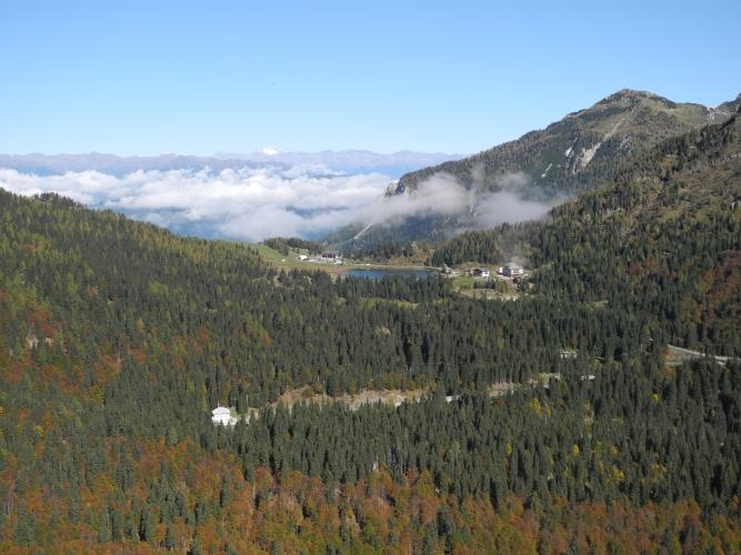
This is a wide, well-built road, but the gradient is anything but steady: steeper and easier pitches alternate all the way up, with the hardest kilometers near 11%. From around 1300 m the views open north to the snowy peaks of the Hohe Tauern, and after a short gallery and the turn for the Schlanitzer Alm the hotels and lifts of Nassfeld, Carinthia's largest ski area, come into view. Four hairpins carry you through the resort to the pass, where a small lake sits just over the border.
Construction on the Italian side closed the crossing to through traffic from April 7 to June 15, 2026, with further restrictions into late July - the Austrian climb stayed open up to the border throughout, and the pass has since reopened fully.
PLAN YOUR ROUTE
 We've partnered with Sherpa-Map.com to bring you the best route planning tool. With a PRO Membership you can use this climb as a reference when creating your route.
 Nassfeldpass from Tröpolach is 12.6 km (7.9 mi) long, gaining 1020 m (3,345 ft) at an 8.1% average, from 606 m (1,988 ft) to 1625 m (5,333 ft). The pass itself (1530 m / 5,020 ft) comes at about 11 km.
Km 0-4: an easy first kilometer (4.4%), then three steady kilometers at 7.2-7.5%.
Km 4-10: the heart of the climb and the most irregular part - kilometer 5 is the steepest at 11.1%, followed by 9.5%, 8.1%, 10.7%, 9.2% and 8.6%.
Km 10-12.6: through the resort hairpins and over the pass at about 7.6%, easing to 5.2% at the finish.
Steepest sections: 100 yd (91 m) at 14.0%, 0.5 km at 12.5%, 1 km at 11.2%, 2 km at 10.5%, 5 km at 9.9% and 10 km at 8.7%.
Roadway: The B90 is a wide, well-engineered two-lane road, paved throughout and kept open year-round to serve the ski area. There's one short gallery on the upper half. The Italian side (SP 110 down to Pontebba) was closed for major works from April 7 to June 15, 2026, with a further one-day full closure on July 27 and heavy-vehicle restrictions through July 31 - the Austrian side was never affected up to the border, and the crossing is open again. The southern ramp is narrower and was partly repaved in 2026, so take extra care if you descend into Italy.
Traffic: Moderate. The Nassfeld is one of only two road crossings into Italy from the Hermagor district, so summer brings steady tourist and cross-border shopping traffic, and ski season is busy. Expect more cars on weekends and around the resort in the final few kilometers.
Parking: Tröpolach is the valley base for the Nassfeld ski area - the Millennium-Express gondola station area on the village edge is the obvious place to leave a car. At the top, the ski area's large lots near the pass offer plenty of space outside the winter season.
Gear: The irregular gradient keeps you shifting, and kilometers near 11% arrive in the middle of the climb - a compact with a 30-34 cog is a sensible setup. You'll finish more than 1000 m above the start, and the pass can be cool and breezy even in midsummer, so pack a vest or light jacket for the descent.
Provisions: Tröpolach has hotels and restaurants, and Hermagor, just down the valley to the east, is the district town for a full supermarket stop. The road climbs through open country with no services until the resort, where there are restaurants on both the Austrian and Italian sides of the pass.
Before heading out on any cycling adventure check out our Things to Bring on a Cycling Trip and use our interactive check list to ensure you don't forget anything.
As you leave Tröpolach, a small military cemetery (Heldenfriedhof) sits on the left at the edge of the village - a reminder that the Carnic ridges above were front line in the First World War.
At the top, roll a few meters past the Austrian sign to see the Italian pass sign and the small Lago di Pramollo right on the border. Tröpolach is also the valley station of the Millennium-Express, a roughly 6 km, three-section gondola that was the longest cable car in the Alps when it opened in 1999 - an easy way up for non-riding companions, who can then meet you at the top.
If you want a bigger day, the Nassfeld pairs well with the Plöckenpass to the west for a loop through Friuli, and our Passo di Pramollo page covers the same pass from Pontebba on the Italian side. See other climbs nearby, or build a custom route from here, with our Routes in the Area tool.
ROUTE MAP
MEMBER RATING
CURRENT WEATHER
PJAMM TRIPS ADVENTURE STARTER BUNDLES
Check out PJAMM Adventure's prepackaged (self-guided) cycling trips. They will help you plan, document and conquer your next adventure.
NEARBY CLIMBS (0) RADIAL PROXIMITY
FROM No Climbs Found
MEMBER REVIEWS & COMMENTS
Let us know what you thought of this climb. Signup for our FREE membership to write a review or post a comment.
Already have an account?
LOG IN HERE
