
16.5
PDI
8.2 mi
DISTANCE
2,795 ft
GAINED
6.4 %
AVG. GRADE
FULL CLIMB STATS
INTRO
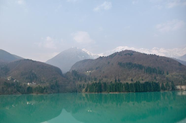
Most people know Piancavallo from Aviano, the side Pantani made famous in 1998. This is the other way up: a narrow, patched road that leaves the green water of Lago di Barcis and spends most of its 13.3 km (8.2 mi) under beech trees, gaining 852 m (2795 ft) at 6.4% to the resort at 1270 m (4166 ft).
It isn't steep for long, but it rarely lets up. The first two kilometers off the lake run at 7-8%, with a few hairpins and your first look back down over the water, then it settles to 5-6% for a while. The hardest stretch is km 4 to 7, where the steepest kilometer hits 9.1%. Around 1000 m a nearly flat kilometer gives your legs a break, and from there it's a steady 5-7.5% through the forest to the resort.
In May 2026 the Giro d'Italia came down this road. Stage 20 went over Piancavallo from Aviano, dropped all the way to Lago di Barcis and rolled back toward Aviano to climb the main side again, where Jonas Vingegaard won the stage and sealed the overall. The rest of the year it's a quiet road. Take the descent easy - the surface is patched and the hairpins above the lake come up quickly.
PLAN YOUR ROUTE
 We've partnered with Sherpa-Map.com to bring you the best route planning tool. With a PRO Membership you can use this climb as a reference when creating your route.
Piancavallo from Lago di Barcis climbs 13.3 km (8.2 mi) from 427 m (1400 ft) to 1270 m (4166 ft), gaining 852 m (2795 ft) at an average of 6.4%.
The first two kilometers are 8.2% and 7.2%, then km 3 and 4 ease to 5.5% and 6.4%. Km 5 to 7 are the hard part at 9.1%, 8.0% and 7.2%. Km 8 is 5.7%, km 9 is nearly flat at 1.8%, and the climb finishes with 7.5%, 5.8%, 4.8% and 5.7% kilometers into Piancavallo.
The steepest 500 m averages 9.7%, the steepest kilometer 9.1%, the steepest 2 km 8.6%, the steepest 5 km 7.4% and the steepest 10 km 6.7%.
Roadway: Asphalt from the lake to the resort, but this is a back road: narrow, patched and a little rough in places, especially low down above the lake, and shaded by beech forest for most of the climb. It was good enough for the Giro to descend in May 2026. Piancavallo is a ski resort, so expect snow and ice on the upper half from late autumn into spring.
Traffic: Light. Most cars bound for the resort use the SR 466 from Aviano, so on this side you'll mostly meet locals and hikers, a few more on summer weekends. Keep right on the blind hairpins above the lake.
Parking: Park in Barcis, by the lake - the village has public parking and a paid motorhome area. From there it's a few minutes' ride over the bridge to the start. If you're staying up in Piancavallo, ride down to the lake first and climb back up.
Gear: Something like 34x32 makes the 8-9% kilometers in the middle comfortable. Tires of 28 mm or wider make the rough sections and the descent more comfortable. Bring a layer: you finish more than 800 m higher than you start, and the forest keeps the upper road cool.
Provisions: Barcis has bars and restaurants on the lake, and the local frico or petuccia (smoked sheep sausage) is a good post-ride reason to stay. There's nothing on the climb itself. At the top, Piancavallo's bars and restaurants are open in summer.
Before heading out on any cycling adventure check out our Things to Bring on a Cycling Trip and use our interactive check list to ensure you don't forget anything.
Barcis is a better base than it looks on the map. The lake is a reservoir, formed when the Ponte Antoi dam was finished in 1954, and its green water is what brings most visitors. Below the dam, the old Valcellina road through the Cellina gorge has been closed to traffic since 1992 and is now a ticketed route for walkers and cyclists run by the Dolomiti Friulane park - check the park's site for opening before you go. In the village, the 16th-century Palazzo Centi with its double loggia houses the library and a tourist information point.
For the full Piancavallo, ride over the top and down to Aviano, then back up the main side - our Piancavallo page covers that climb and its Giro history. Pian de Cea, up the valley toward Claut, is a short climb nearby. Routes in the Area will help you piece together a day around the lake.
ROUTE MAP

MEMBER RATING
CURRENT WEATHER
PJAMM TRIPS ADVENTURE STARTER BUNDLES
Check out PJAMM Adventure's prepackaged (self-guided) cycling trips. They will help you plan, document and conquer your next adventure.
NEARBY CLIMBS (0) RADIAL PROXIMITY
FROM No Climbs Found
MEMBER REVIEWS & COMMENTS
Let us know what you thought of this climb. Signup for our FREE membership to write a review or post a comment.
Already have an account?
LOG IN HERE
