
30.1
PDI
9.4 mi
DISTANCE
4,129 ft
GAINED
8.4 %
AVG. GRADE
FULL CLIMB STATS
INTRO
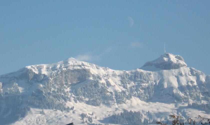
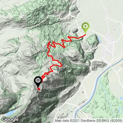
Oberriet - Hoher Kasten climbs 9.4 miles and 4,129 feet from the Rhine Valley town of Oberriet to Oberkamor, on the ridge just below the Kamor and Hoher Kasten summits, at 5,587 feet (1,703 m). The average grade is 8.4%, with the steepest mile averaging 12.2% and the steepest kilometer touching 12.7%.
This is the longer, gentler of two Sankt Gallen roads that reach the exact same spot on the ridge: Oberriet's route covers about 1.3 more miles than the climb from neighboring Rüthi to reach the identical Oberkamor endpoint, trading some of that route's brutal, unrelenting steepness for a more spread-out effort.
The road climbs out of the valley through Kobelwies and Hard before working its way up toward the Kamor ridge, where a listening post - built by the Swiss Army after World War II to monitor radio traffic - still marks the top of the road.
From the ridge, the reward is the same as it is from Rüthi's side: sweeping views across the Rheintal, the Appenzell foothills, and Lake Constance in the distance. Hoher Kasten's summit itself, with its well-known revolving restaurant, is more commonly reached by cable car from Brülisau on the far side of the mountain - both of these Rheintal approaches are the harder, quieter way up by road bike.
PLAN YOUR ROUTE
 We've partnered with Sherpa-Map.com to bring you the best route planning tool. With a PRO Membership you can use this climb as a reference when creating your route.
 Oberriet - Hoher Kasten averages 8.4% over 9.4 miles, gaining 4,129 feet from Oberriet (1,458 ft) to Oberkamor (5,587 ft) on the ridge below Hoher Kasten. The steepest mile averages 12.2%, the steepest 2.5 miles hold 10.4%, and the steepest kilometer touches 12.7% - a more gradual ride overall than the steeper, shorter Rüthi approach to the same summit, though it still finishes with real bite in the upper kilometers.
Roadway: The route is paved out of Oberriet through Kobelwies and Hard; higher on the mountain, expect the same kind of natural-surface stretches found on the neighboring Rüthi approach, since both roads reach the identical Oberkamor site on the ridge below Hoher Kasten. Check conditions before an early- or late-season attempt - snow can linger into late spring at this elevation.
Traffic: Traffic is light on the valley roads out of Oberriet and drops close to nothing once the route leaves the village for the hillside, since this is a working farm and forestry road rather than a through route for cars.
Parking: Oberriet is a small Rhine Valley town - look for informal parking near the town center before starting the climb. Riders wanting to compare the two approaches to Hoher Kasten can also base from Rüthi, a few kilometers south, where a small lot exists at Brunnenberg partway up that neighboring route.
This is a long, steady climb with real elevation to cover - bring gearing suited to sustained 8-9% pitches with a few sharper ramps near the top. There's little in the way of services above Oberriet, so carry all the food and water you'll need for the full 9.4 miles; a warmer layer for the descent is worth having too, since Oberkamor sits well above the Rheintal's valley-floor temperatures.
Before heading out on any cycling adventure check out our Things to Bring on a Cycling Trip and use our interactive check list to ensure you don't forget anything.
Oberriet has its own selection of restaurants and shops in the town center for a pre- or post-ride stop, distinct from Rüthi's options a few kilometers south. Like its neighboring approach, the best window for this climb is late spring through early autumn - snow can linger on the upper mountain into May most years.
Riders looking to string together both Sankt Gallen approaches to Hoher Kasten, or scout other climbs nearby, can use our Routes in the Area tool to see what else is close by.
ROUTE MAP
MEMBER RATING
CURRENT WEATHER
PJAMM TRIPS ADVENTURE STARTER BUNDLES
Check out PJAMM Adventure's prepackaged (self-guided) cycling trips. They will help you plan, document and conquer your next adventure.
NEARBY CLIMBS (0) RADIAL PROXIMITY
FROM No Climbs Found
MEMBER REVIEWS & COMMENTS
Let us know what you thought of this climb. Signup for our FREE membership to write a review or post a comment.
Already have an account?
LOG IN HERE
