
22.9
PDI
12.6 mi
DISTANCE
3,997 ft
GAINED
5.9 %
AVG. GRADE
FULL CLIMB STATS
INTRO
The Furkajoch is a 20.3 km (12.6 mi) climb in Vorarlberg, Austria, gaining 1,218 m (3,997 ft) at a 5.9% average grade from the hamlet of Muntlix to the pass at just over 1,730 m (5,685 ft), where the Rhine Valley gives way to the Bregenzerwald. The road, the L51, is one of the few paved routes across this stretch of the Vorarlberg Alps, linking the Frutz valley near Laterns with Damüls on the far side.
The gradient is anything but steady. After a moderate opening, the road flattens through a long, rolling middle section before kicking hard for the final push to the pass - the steepest kilometer averages 12.7%, and short ramps near the top touch nearly 18%. Three tunnels punctuate the upper mountainside on this approach, cut into the rock as the road works its way toward the col.
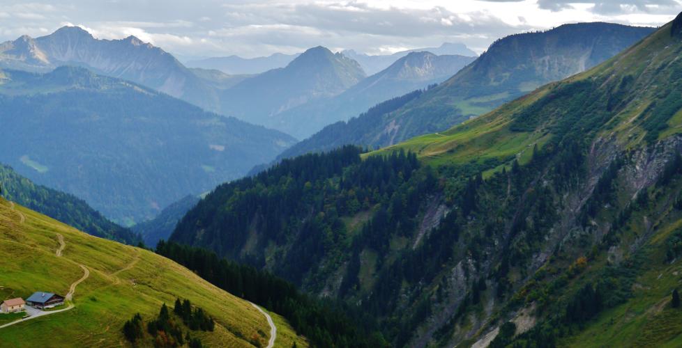
Views open up across the Frutz valley and the surrounding peaks - Hohenfreschen, Löffelspitze, and Türtschhorn all rise around the pass - and the road narrows in its final kilometers to a single comfortable lane. RVs and motorhomes are prohibited on the climb, which keeps it to cars, motorcycles, and cyclists.
Like most passes in this part of the Alps, the Furkajoch closes for winter, typically from November into May, so plan a summer or early-fall visit. A small mountain hut, Zum Charly, sits right at the summit and is a welcome stop after the long, uneven climb.
PLAN YOUR ROUTE
 We've partnered with Sherpa-Map.com to bring you the best route planning tool. With a PRO Membership you can use this climb as a reference when creating your route.
 5.9% average grade over 20.3 km (12.6 mi). The profile is uneven rather than steady - a moderate start gives way to a long, flatter middle section before the road kicks hard for the finish. The steepest kilometer, in the closing stretch, averages 12.7%, and short ramps near the pass reach nearly 18%.
Roadway: The L51 is paved the entire way and in good, well-maintained condition, though it narrows to a single comfortable lane in several stretches, particularly near the top. RVs and motorhomes are prohibited on the climb, which helps keep the road manageable for cyclists. Like most high passes in this part of Vorarlberg, it's closed each winter, typically from November into May - confirm it's open before a shoulder-season ride.
Traffic: Generally light. This is a quieter connector road between the Rhine Valley and the Bregenzerwald rather than a major through-route, with local and recreational traffic rather than heavy commercial use.
Parking: Roadside parking is available near the start in Muntlix. At the summit, Zum Charly's mountain hut has its own parking area if you'd like to start or finish a ride there instead.
Provisions: Zum Charly, the mountain hut at the Furkajoch summit, is open in season and is the only reliable food and drink stop directly on the climb - there's little else along the way, so carry what you need for the lower two-thirds of the route.
Before heading out on any cycling adventure check out our Things to Bring on a Cycling Trip and use our interactive check list to ensure you don't forget anything.
Muntlix sits in Vorarlberg's Feldkirch district, a short drive from the larger towns of Feldkirch and Rankweil in the Rhine Valley, both of which offer a fuller range of hotels and restaurants if you're staying in the area. The Furkajoch is also a natural link into the Bregenzerwald on the far side of the pass, a region known for its own network of quieter cycling roads - worth exploring if you have extra days built into your trip.
See our Routes in the Area tool for other nearby Vorarlberg climbs.
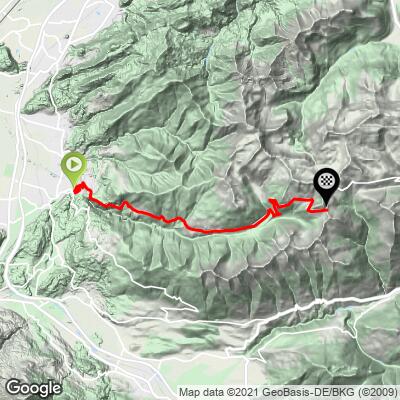
ROUTE MAP
MEMBER RATING
CURRENT WEATHER
PJAMM TRIPS ADVENTURE STARTER BUNDLES
Check out PJAMM Adventure's prepackaged (self-guided) cycling trips. They will help you plan, document and conquer your next adventure.
NEARBY CLIMBS (0) RADIAL PROXIMITY
FROM No Climbs Found
MEMBER REVIEWS & COMMENTS
Let us know what you thought of this climb. Signup for our FREE membership to write a review or post a comment.
Already have an account?
LOG IN HERE
