
17.8
PDI
10.2 mi
DISTANCE
3,159 ft
GAINED
5.9 %
AVG. GRADE
FULL CLIMB STATS
INTRO
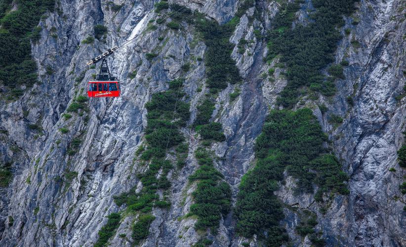
Lunersee climbs 16.4 km (10.2 mi) from Bürs, on the edge of Bludenz, to the end of the road at the Lünerseebahn valley station, gaining 963 m (3159 ft) from 598 m (1963 ft) to 1553 m (5095 ft) at a 5.9% average. From the top, a six-minute cable car ride lifts you to the Lünersee itself at 1970 m (6463 ft), one of the largest high-mountain lakes in Vorarlberg, set in the Rätikon below the Swiss border.
This is a climb with a sting in the tail. The opening 3.2 km (2.0 mi) climb 242 m (794 ft) at 7.6% through the forest to Bürserberg, then the road eases to 3.1% for 7.9 km (4.9 mi) up the valley through Tschapina and Brand, the Brandnertal's main resort village. Above Brand everything changes: the final 5.2 km (3.2 mi) on the Schattenlagantstraße gain 472 m (1549 ft) at 9.0%, including 2 km at 11.7% and pitches up to 15%, squeezed between steep rock walls at the head of the valley.
That last road is privately owned by the power company illwerke vkw but open to the public and toll-free. It serves the Lünersee reservoir, once the largest natural mountain lake in the Eastern Alps and dammed in the late 1950s for what was then considered the most powerful pumped-storage plant in the world.
This is a climb with a sting in the tail. The opening 3.2 km (2.0 mi) climb 242 m (794 ft) at 7.6% through the forest to Bürserberg, then the road eases to 3.1% for 7.9 km (4.9 mi) up the valley through Tschapina and Brand, the Brandnertal's main resort village. Above Brand everything changes: the final 5.2 km (3.2 mi) on the Schattenlagantstraße gain 472 m (1549 ft) at 9.0%, including 2 km at 11.7% and pitches up to 15%, squeezed between steep rock walls at the head of the valley.
That last road is privately owned by the power company illwerke vkw but open to the public and toll-free. It serves the Lünersee reservoir, once the largest natural mountain lake in the Eastern Alps and dammed in the late 1950s for what was then considered the most powerful pumped-storage plant in the world.
PLAN YOUR ROUTE
 We've partnered with Sherpa-Map.com to bring you the best route planning tool. With a PRO Membership you can use this climb as a reference when creating your route.
Lunersee is 16.4 km (10.2 mi) long and gains 963 m (3159 ft) at a 5.9% average, but nearly half the climbing is packed into the last third.
Bürs to Bürserberg: The first 3.2 km (2.0 mi) gain 242 m (794 ft) at 7.6%, with two kilometers at 8.3-8.8%.
Bürserberg to Brand: The next 7.9 km (4.9 mi) gain another 242 m (794 ft) at just 3.1%, with a couple of nearly flat kilometers - the place to eat, drink and save your legs.
Schattenlagantstraße: The final 5.2 km (3.2 mi) gain 472 m (1549 ft) at 9.0%. The first 2 km above Brand average 11.7%, and the last full kilometer to the valley station is close to 10%. Overall, the steepest 500 m averages 14.3%, the steepest kilometer 11.9%, the steepest 2 km 11.5% and the steepest 5 km 9.3%.
Bürs to Bürserberg: The first 3.2 km (2.0 mi) gain 242 m (794 ft) at 7.6%, with two kilometers at 8.3-8.8%.
Bürserberg to Brand: The next 7.9 km (4.9 mi) gain another 242 m (794 ft) at just 3.1%, with a couple of nearly flat kilometers - the place to eat, drink and save your legs.
Schattenlagantstraße: The final 5.2 km (3.2 mi) gain 472 m (1549 ft) at 9.0%. The first 2 km above Brand average 11.7%, and the last full kilometer to the valley station is close to 10%. Overall, the steepest 500 m averages 14.3%, the steepest kilometer 11.9%, the steepest 2 km 11.5% and the steepest 5 km 9.3%.
Roadway: Paved throughout and in very good condition. The Brandnertal road up to Bürserberg and Brand is a well-built valley road with a lit tunnel and a short avalanche gallery. Above Brand, the Schattenlagantstraße is narrower and much steeper - it's a private road owned by illwerke vkw but open to the public with no toll. Rockfall is a real hazard below the cliffs: in July 2023 a rockfall from the Seekopf area hit a passing car and closed the road between Brand and the Lünersee for blasting and securing work. Check for current closures with Brandnertal tourism or illwerke vkw before you ride. If you'd rather avoid the busy lower road, a paved forest road from Bürs that is closed to general traffic rejoins the main route near Brand.
Traffic: The lower road is the main way into the Brandnertal and is popular with motorcyclists, so expect steady traffic as far as Brand. On the Schattenlagantstraße, cable car visitors bring waves of cars in the morning, around midday and in the early evening, while an early ride can be nearly car-free. Postbus line 580 also runs up to the valley station.
Parking: Bludenz has a main-line rail station and Bus 580 runs from there through Bürs, so it's easy to arrive without a car. Drivers can park in Bürs or Bludenz and ride from there. To ride only the steep top section, start in Brand, or use the lots at the Lünerseebahn valley station and Schattenlagant, which cost €4 per day (coins or card at the machine, no change given).
Traffic: The lower road is the main way into the Brandnertal and is popular with motorcyclists, so expect steady traffic as far as Brand. On the Schattenlagantstraße, cable car visitors bring waves of cars in the morning, around midday and in the early evening, while an early ride can be nearly car-free. Postbus line 580 also runs up to the valley station.
Parking: Bludenz has a main-line rail station and Bus 580 runs from there through Bürs, so it's easy to arrive without a car. Drivers can park in Bürs or Bludenz and ride from there. To ride only the steep top section, start in Brand, or use the lots at the Lünerseebahn valley station and Schattenlagant, which cost €4 per day (coins or card at the machine, no change given).
Provisions: Brand has several restaurants and is the last proper village on the route, so refuel there before the steep finish. Just below the top, the Schattenlagant-Hütte (1483 m) is the last stop on the road, and if you take the cable car up, the Douglass-Hütte at the dam is the classic lunch spot by the lake.
Gear: Bring your lowest gears - 2 km at 11.7% with ramps to 15% calls for a compact crankset and a 32-34 tooth rear cog. If you plan to visit the lake, note that the Lünerseebahn's luggage tickets don't include bicycle transport, so bring a lock and leave the bike at the valley station. Pack a layer for the long descent.
Gear: Bring your lowest gears - 2 km at 11.7% with ramps to 15% calls for a compact crankset and a 32-34 tooth rear cog. If you plan to visit the lake, note that the Lünerseebahn's luggage tickets don't include bicycle transport, so bring a lock and leave the bike at the valley station. Pack a layer for the long descent.
Before heading out on any cycling adventure check out our Things to Bring on a Cycling Trip and use our interactive check list to ensure you don't forget anything.
The Lünersee is the payoff for this climb. In 2026 the Lünerseebahn runs from May 23 to October 26, every 15 minutes from 8:00 to 17:00, and the top station sits right at the dam. From there an easy 6.1 km (3.8 mi) loop around the lake takes about two hours, and a longer walk from the Douglass-Hütte to the Gafalljoch on the Swiss border looks back over the whole lake. The reservoir covers about 112 hectares (277 acres) and holds up to 78.3 million cubic meters of water.
Back in the valley, Bludenz is the base with the most services. Its old town has the 16th-century church of St. Laurentius and Schloss Gayenhofen, and the Fohrenburger brewery, with its unicorn logo, is a local institution. The Muttersberg cable car on the edge of town is an easy rest-day outing.
The lake sits much higher than Bürs and the weather up there can turn quickly, so check current conditions before you go with our Weather tool.
Back in the valley, Bludenz is the base with the most services. Its old town has the 16th-century church of St. Laurentius and Schloss Gayenhofen, and the Fohrenburger brewery, with its unicorn logo, is a local institution. The Muttersberg cable car on the edge of town is an easy rest-day outing.
The lake sits much higher than Bürs and the weather up there can turn quickly, so check current conditions before you go with our Weather tool.
ROUTE MAP

MEMBER RATING
CURRENT WEATHER
PJAMM TRIPS ADVENTURE STARTER BUNDLES
Check out PJAMM Adventure's prepackaged (self-guided) cycling trips. They will help you plan, document and conquer your next adventure.
NEARBY CLIMBS (0) RADIAL PROXIMITY
FROM No Climbs Found
MEMBER REVIEWS & COMMENTS
Let us know what you thought of this climb. Signup for our FREE membership to write a review or post a comment.
Already have an account?
LOG IN HERE
