26
PDI
10.4 mi
DISTANCE
3,938 ft
GAINED
7.1 %
AVG. GRADE
FULL CLIMB STATS
INTRO
Col de Pailhères East climbs 16.8 km (10.4 mi) from the small hamlet of Rouze, near Usson-les-Bains in the remote Donezan region, to the 1,996 m (6,549 ft) summit, gaining 1,200 m (3,938 ft) at an average grade of 7.1%. Also known as Port de Pailhères, the col has featured in the Tour de France five times between 2003 and 2013, four of those as the launching pad for a summit finish a few kilometers beyond at Ax 3 Domaines - though it hasn't returned to the race since 2013.
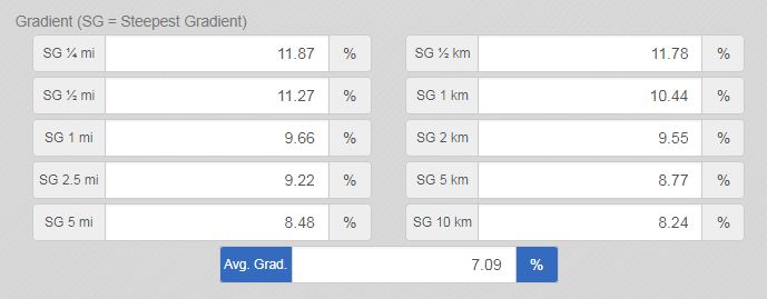
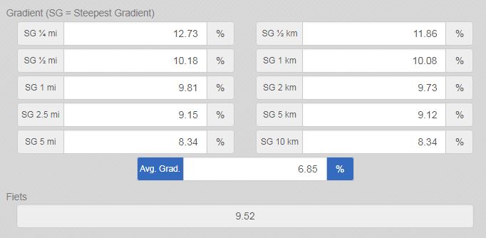
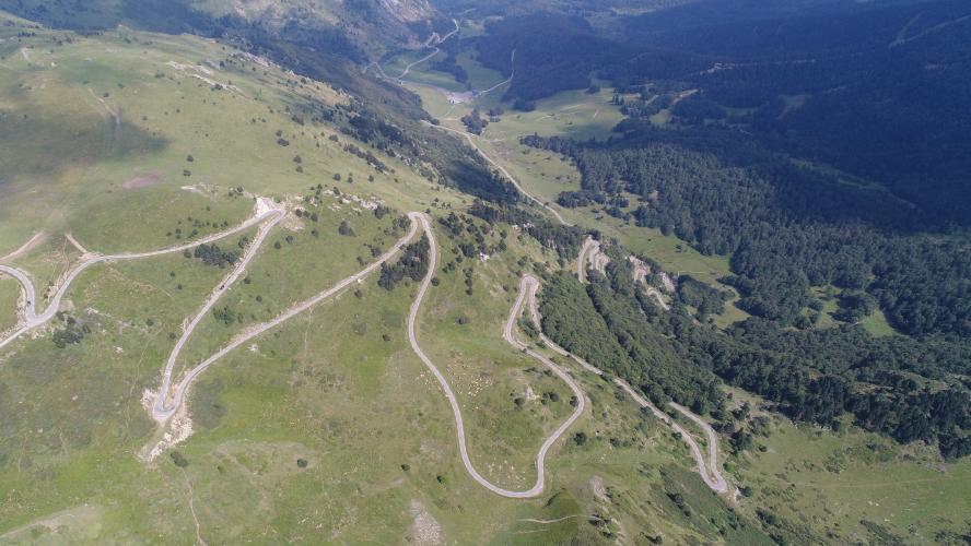
This eastern approach is the quieter, less-visited side of the col. From Usson-les-Bains the road opens with a run of hairpins in the 5-6% range before a harder, more exposed straight section leads into Rouze, where the real climbing begins. Above Rouze the road narrows to little more than a ribbon of asphalt across open pastureland, with almost no tree cover for the final third - a long series of hairpins starts around 1,645 m and carries the road the rest of the way to the summit, with the steepest kilometer, around km 10, averaging 10.5%.
The Donezan is one of the most sparsely populated corners of the Pyrenees, and this side of Pailhères reflects that: wide-open, wind-exposed high pasture with sweeping views rather than the tourist infrastructure of the Ax-les-Thermes side. Like all the high Pyrenean passes, it closes with the first serious snowfall and doesn't reopen until late spring.
PLAN YOUR ROUTE
 We've partnered with Sherpa-Map.com to bring you the best route planning tool. With a PRO Membership you can use this climb as a reference when creating your route.
 Col de Pailhères East gains 1,200 m (3,938 ft) over 16.8 km (10.4 mi) at an average grade of 7.1%, starting at 806 m (2,643 ft) near Rouze and topping out at 1,996 m (6,549 ft).
The lower kilometers out of Usson-les-Bains are the easiest part of the climb, a run of hairpins around 5-6% followed by a harder straight section into Rouze. The difficulty builds steadily above the village: the steepest full kilometer, beginning around km 10, averages 10.5%, and the steepest 100 meters on the route touches 17.1%. The final third, above roughly 1,645 m, is a long, fairly consistent series of hairpins across open pasture with no flat sections to recover on before the summit.
Roadway: The D16/D118 route from Usson-les-Bains and Rouze is paved the entire way, a narrow ribbon of asphalt that gets progressively tighter above Rouze as it climbs into open pastureland. Road quality is generally good by Pyrenean standards, though as with any high mountain pass, expect the usual scattering of frost heave and patched sections after winter. Pailhères closes with the first heavy snow and stays shut until late spring - check Ariège's road status pages before planning a ride outside summer.
Traffic: Light. This side sees far less traffic than the Ax-les-Thermes approach, since it serves only the handful of hamlets of the Donezan rather than a spa town. Expect a quiet, exposed ride once you're above Rouze, with sweeping views compensating for the near-total lack of tree cover.
Parking: There is no formal parking area on this side. Most riders leave a car in Rouze itself, a hamlet of well under 50 residents, or a few kilometers back in Usson-les-Bains at the D118/D16 junction where the climb effectively begins.
There are no services anywhere on this side of the climb - Rouze and Usson-les-Bains are both tiny hamlets without shops, so stock up before you arrive, either in Ax-les-Thermes or Quérigut. The upper two-thirds of the climb has essentially no shade, so carry more water than the distance alone would suggest, especially in summer, and pack a windproof layer for the exposed, often breezy summit.
Before heading out on any cycling adventure check out our Things to Bring on a Cycling Trip and use our interactive check list to ensure you don't forget anything.
The Donezan, the small historic region around Rouze and Usson-les-Bains, is one of the quietest corners of the Pyrenees - a scattering of hamlets and high pasture well off the main tourist routes, in contrast to the busier spa town of Ax-les-Thermes on the west side of the col. It's a good base for riders who want to string together several of the Ariège's Pyrenean climbs while avoiding the crowds; see our Routes in the Area tool for other nearby climbs to combine with Pailhères, including Plateau de Beille and Ax 3 Domaines. For hotels, restaurants, and the region's thermal baths, Ax-les-Thermes on the opposite side of the col is the closest full-service town, about a 30-minute drive from Rouze via the col or around the valley.
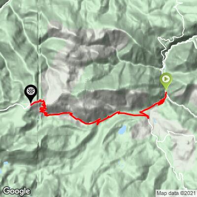
ROUTE MAP
MEMBER RATING
CURRENT WEATHER
PJAMM TRIPS ADVENTURE STARTER BUNDLES
Check out PJAMM Adventure's prepackaged (self-guided) cycling trips. They will help you plan, document and conquer your next adventure.
NEARBY CLIMBS (0) RADIAL PROXIMITY
FROM No Climbs Found
MEMBER REVIEWS & COMMENTS
Let us know what you thought of this climb. Signup for our FREE membership to write a review or post a comment.
Already have an account?
LOG IN HERE
MethowBiker
You get a nice warm up from Axat, several km of 1-2% along a river. Take a right turn and up you go. I found the first couple km the most difficult, though the little village, with some double digit ramps. Once you exit the village, you can settle in. Lots of hairpins. And if you’re travelling through, rather than an out and back, there’s a screaming decent to Ax Les thermes, with great hôtels and hot springs.