28.3
PDI
11.6 mi
DISTANCE
4,369 ft
GAINED
7.1 %
AVG. GRADE
FULL CLIMB STATS
Page Contributor(s): Carl Hansen, Guernsey, UK
INTRO
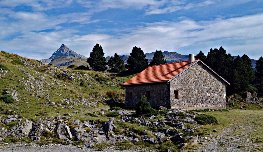
This part of the Pyrenees has been featured on the Tour de France route several times in recent years, with a stage finish at the Pierre Saint Martin ski station in 2015. When you visit this part of France, you will understand why - the climbs are challenging and the scenery is lovely!
Depending on where you are based for this climb, you can also try some of the other climbs in the area such as the Port de Larrau and the Col de Marie Blanque. You can also do some international loop rides by continuing on through Spain and returning over another climb.
PLAN YOUR ROUTE
See more details and tools regarding this climb's grade via our interactive Profile Tool.
Roadway: The roadway is in good shape up to the Pierre Saint Martin ski station. If you continue on to the col and the border with Spain, watch for free range farm animals and evidence on the road that they have recently been in the area.
Traffic: There is almost no traffic in the non-ski season.
Parking: You can park in Arette, or in some places along the side of the road as you get closer to where the climbing really starts.
Summer in the Pyrenees is normally warm and sunny, even at higher elevations. However, there are some periods of low clouds that can make the climbs quite damp. Bring warm clothes just in case. There is a bike shop in Arette.
Before heading out on any cycling adventure check out our Things to Bring on a Cycling Trip and use our interactive check list to ensure you don't forget anything.
For those looking to stay in the area we would recommend the Pyrenees Cycling Lodge. Located in the beautiful medieval village of Saint Savin and hosted by Mark & Niamh, the Lodge is run by cyclists for cyclists. It is a great location for any cycling adventure in the Pyrenees with several renowned climbs within 100km of the property and 6 Tour de France climbs within 15km. Visit their website or contact them directly at pyreneescyclinglodge@gmail.com .
There are places to stay in Arette, Aramits, and some of the smaller villages in the area. Arette and Aramits also have restaurants and shops for food. Be sure to sample the sheep’s cheese and other local delicacies.
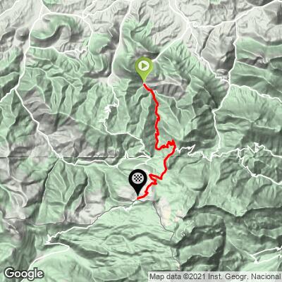
ROUTE MAP
MEMBER RATING
CURRENT WEATHER
PJAMM TRIPS ADVENTURE STARTER BUNDLES
Check out PJAMM Adventure's prepackaged (self-guided) cycling trips. They will help you plan, document and conquer your next adventure.
NEARBY CLIMBS (0) RADIAL PROXIMITY
FROM No Climbs Found
MEMBER REVIEWS & COMMENTS
Let us know what you thought of this climb. Signup for our FREE membership to write a review or post a comment.
Already have an account?
LOG IN HERE
carlinguernsey
This is a good remote climb in a lesser known part of the Pyrenees. It includes some tough gradients to keep you interested. Keep going past the ski station to get to the actual col and the border with Spain. The last part of the road is not as well maintained.

