![Cycling Machynlleth Mountain, Wales one lane country road surrounded by lush green pastureland]()
Cycling the epic and scenic Machynlleth Mountain, Wales
Ride 6.6 miles gaining 1,626’ at 4.5% average grade.
Simon Warren says of this beauty “From now on - whatever you are doing, werever you are - keep an eye on the weather in west Wales. As soon as there are clear blue skies, call in sick, pack the family off to the grandparents, throw the bike in the car and head for this climb.” Simon Warren, Cycling Climbs of Wales, A Road Cyclist’s Guide, p. 97.
![Cycling Machynlleth Mountain, Wales photo collage, PJAMM cyclist rides one-lane country roadway surrounded by green hillsides]()
Simon Warren (of 100 Climbs UK) gave us a list of the most epic bike climbs in England, Wales, Scotland, and the UK overall. Simon lists Machynlleth Mountain as Wales #9 Most Epic and we completely agree with his assessment of this wonderful bike climb.
![Cycling Machynlleth Mountain, Wales climb start, Forge Road, bride over Afon Dulas]()
Climb begins on Forge Road as we cross the bridge over Afon Dulas.
Just outside the town of Machynlleth begins the climb of Machynlleth Mountain. This road is large and frequently traveled - by Welsh standards that is. The starting point is at an old stone bridge near a number of old houses.
The town of Machynlleth (colloquially referred to as “Mach”), is a small market town (population 2,235 as of 2011) in Powys, Wales. The town claims to be the “ancient capital of Wales,” due to it being the seat of the Welsh Parliament in the year 1404, but it has never been officially recognized as a capital. The primary income and employment stream in Machynlleth is tourism, largely due to the mountain biking trails in the area.
![Cycling Machynlleth Mountain, Wales photo collage shows views along first part of climb, one-land roadway, lush green pastureland, aerial drone view shows ton of Machynlleth]()
There are some very steep segments on this climb - 13.5% for a quarter-mile and 9.2% for a mile - both during the final third of the climb.
![Cycling Machynlleth Mountain, Wales typical views along the climb, one-lane roadway, lush green pastureland, white sheep grazing]()
Sweeping views of pastureland the entire climb.
For the opening miles grades are quite comfortable. Nearing the top the winds pick up and so do the gradients.
![Cycling Machynlleth Mountain, Wales street signs read: Dylife, Penffordd-las Staylittle, Y Bontfaen Forge, Machynlleth]()
Stay left at the fork at mile 2.8.
![Cycling Machynlleth Mountain, Wales lush green pasturelands with road sign warning of a cattle guard]()
This climb is entirely within the Glaslyn Nature Reserve, home to ospreys that migrate to and from West Africa each year.
The road stair-steps up the summit point which is marked by signs for the nature preserve. On the day I rode in early June 2022, imposing clouds rolled in and out and threatened rain but it never came. For brief moments the sun would shine through and light up the canyon and valley below, creating an absolutely stunning landscape.
![Cycling Machynlleth Mountain, Wales aerial drone view shows PJAMM Cyclist as the only passerby on a long stretch of country road]()
![Cycling Machynlleth Mountain, Wales aerial drone view shows roadway stretching along green pastureland hills]()
![Cycling Machynlleth Mountain, Wales photo collage, Cadair Viewpoint, mile 6.2]()
This climb rolls its way up to amazing views, not the least of which is from Cadair Viewpoint at mile 6.2. From here, on a very clear day, you can see Yr Wyddfa - Snowdon, Wales’ highest peak at 3,560. This is a perfect place to read about the history of the town and take in the view.
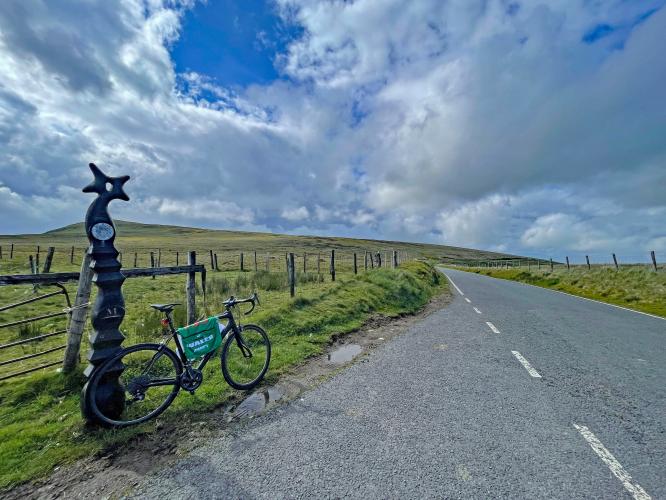
![Cycling Machynlleth Mountain, Wales bike parked at climb finish, sign for nature reserve]()
Climb Finish.
![]()
That’s a wrap!!

 We've partnered with Sherpa-Map.com to bring you the best route planning tool. With a PRO Membership you can use this climb as a reference when creating your route.

