
22.8
PDI
9.4 mi
DISTANCE
3,543 ft
GAINED
7.2 %
AVG. GRADE
FULL CLIMB STATS
INTRO
Col de Soudet climbs 15.0 km (9.3 mi) from the Sainte-Engrâce dam, gaining 1080 m (3,543 ft) at an average grade of 7.2% to the 1540 m (5,052 ft) pass on the ridge between the Basque Soule and the Béarn's Barétous valley. This is the exact approach the Tour de France used in 2023, when Col de Soudet was the race's first hors catégorie climb of the year, 72 km into stage 5 from Pau to Laruns - Felix Gall led over the top, and Jai Hindley went on to win the stage and take the yellow jersey.
It's a climb of two very different halves. The first 4 km (2.5 mi) roll gently up the valley toward the upper village of Sainte-Engrâce; after that the D113 kicks up into a sequence of hard ramps separated by brief easings, with the steepest kilometer at 12.1%. The last few kilometers climb out of the forest onto open limestone terrain, part of the vast karst system that lies beneath the whole massif.
The Tour has crossed Col de Soudet nine times since its debut in 1987, though it's often ridden uncategorized as part of the longer climb to Col de la Pierre St. Martin, just above. It's one of our Legendary Climbs of the Tour de France.
PLAN YOUR ROUTE
 We've partnered with Sherpa-Map.com to bring you the best route planning tool. With a PRO Membership you can use this climb as a reference when creating your route.
 From the Sainte-Engrâce dam, Col de Soudet climbs 15.0 km (9.3 mi) at a 7.2% average, gaining 1080 m (3,543 ft) from a start at 458 m (1,503 ft). The opening 4 km (2.5 mi) average only about 4.5%, which means the rest of the climb is noticeably harder than the headline average suggests.
From there the grade comes in waves rather than a steady ramp. Kilometers 5 and 6 average over 9%, then the road eases to around 4-5% for 2 km (1.2 mi) before the hardest part of the climb begins: from about km 9 to km 13, three of the four kilometers are between 9.6% and 12.1%, and the steepest half-kilometer reaches 13.4%. The final 2 km (1.2 mi) to the col settle back to around 7%.
The steepest mile averages 11.0%, the steepest 5 km (3.1 mi) average 9.5%, and the steepest 10 km (6.2 mi) still average 8.4%.
Roadway: The D113 is paved the entire way. It narrows above Sainte-Engrâce and climbs through forest before opening onto exposed pasture and limestone near the col; loose stones and gravel can wash onto the road after storms, and livestock graze the open upper slopes, so watch for animals on the road near the col.
Traffic: Light. This side of the col sees far less traffic than the D132 from Arette, with most cars heading to or from the Arette-La Pierre-Saint-Martin ski station just above the col. Expect a little more traffic on winter weekends and around summer holiday periods.
Parking: The Kakouetta gorges car park along the D113 at the foot of the climb is the most practical place to leave a car; Sainte-Engrâce itself is small and spread out, so park considerately if you start there. At the top, there's space to pull off at the col, and larger car parks at the La Pierre-Saint-Martin ski station a short way above.
The steepest kilometer tops 12% and the hardest 4 km (2.5 mi) average close to 10%, so a compact crankset with a 30-32t low gear is the right call - the gentle opening will lull you into pushing too big a gear.
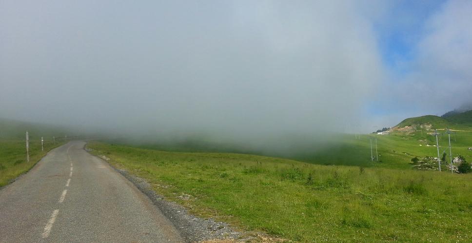
There are no shops on the climb itself. Stock up down the valley in Tardets-Sorholus before you start, and carry enough to reach the top - the ski station just above the col has seasonal services, but don't count on them outside winter and peak summer. The col sits right on the crest of the range and often catches cloud and wind even when the valley is warm, so bring a layer for the descent.
Before heading out on any cycling adventure check out our Things to Bring on a Cycling Trip and use our interactive check list to ensure you don't forget anything.
Sainte-Engrâce, which you ride through in the first few kilometers, is one of the most remote villages in the French Basque Country - see our Col de la Pierre St. Martin (D113) page for its Romanesque church and the Kakouetta gorges, both just off this route.
For something different, the Grotte de La Verna is reached by a side road from Sainte-Engrâce. It's one of the largest underground chambers in the world, part of the Pierre Saint-Martin cave system that runs beneath the whole massif, and it's open to visitors through a 660 m (2,165 ft) access tunnel - bookings are online only, and at 5°C (41°F) year-round you'll want warm clothes. Over the col, the road drops into the Barétous valley toward Arette, and Col Issarbe climbs from the Barétous back over toward Sainte-Engrâce - an obvious loop for a big day. The col is exposed and often in cloud, so check current conditions with our Weather tool before you head up.
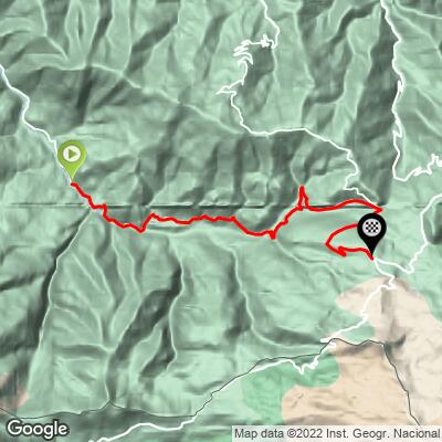
ROUTE MAP
MEMBER RATING
CURRENT WEATHER
PJAMM TRIPS ADVENTURE STARTER BUNDLES
Check out PJAMM Adventure's prepackaged (self-guided) cycling trips. They will help you plan, document and conquer your next adventure.
NEARBY CLIMBS (0) RADIAL PROXIMITY
FROM No Climbs Found
MEMBER REVIEWS & COMMENTS
Let us know what you thought of this climb. Signup for our FREE membership to write a review or post a comment.
Already have an account?
LOG IN HERE
