
18.1
PDI
9.7 mi
DISTANCE
3,150 ft
GAINED
6.1 %
AVG. GRADE
FULL CLIMB STATS
INTRO
The Grand Ballon is the highest summit in the Vosges at 1424 m (4672 ft), and the climb from Willer-sur-Thur is its classic Thur valley approach: 15.7 km (9.7 mi) with 960 m (3150 ft) of climbing at a 6.1% average, from 374 m (1226 ft) in the valley to 1332 m (4369 ft) on the Route des Crêtes just below the top. It ranks #1209 in the world in our database.
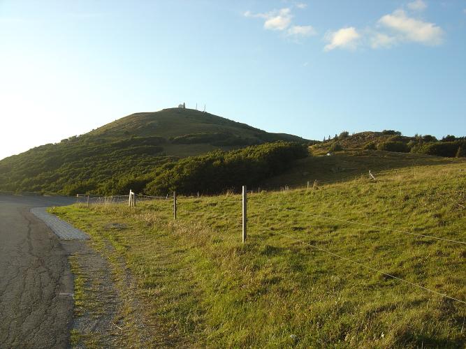
Like most roads up the Grand Ballon, this is a climb in two acts. The first 9 km (5.6 mi) are the gentler half - a winding road through farmland and forest at 2-8%, with a run of hairpins after about 4 km and the small village of Goldbach at roughly the 6 km mark. At the Col Amic the road meets the climbs from Soultz and Cernay, and everything gets harder: the last 6.6 km (4.1 mi) average about 7.7%, with kilometers 13 and 14 both above 8%. You can see the summit radar dome from early on, which is either motivating or cruel depending on the day. The trees finally give way to open high-Vosges pasture over the last few kilometers, with views across the Alsace plain and, on clear days, to the Black Forest and the Alps.
The Grand Ballon has real Tour de France history. Lucien Van Impe led the race over it for the first time in 1969, and the race has crossed it nine times in all, most recently in 2026. It also featured in the 2022 Tour de France Femmes, and amateur riders tackle it every June on the Trois Ballons sportive alongside the Ballon d'Alsace and Ballon de Servance.
PLAN YOUR ROUTE
 We've partnered with Sherpa-Map.com to bring you the best route planning tool. With a PRO Membership you can use this climb as a reference when creating your route.
The climb gains 960 m (3150 ft) over 15.7 km (9.7 mi) at an average of 6.1%, but the number hides two very different halves.
The first 9 km (5.6 mi) to the Col Amic average about 5%. The opening 2 km (1.2 mi) out of Willer-sur-Thur are gentle at 3-4%, then the road steepens to around 6% through the hairpins between km 3 and km 5 before settling back to 4-5% toward Goldbach. Kilometer 8 kicks up to 7.5%, and kilometer 9 eases to under 4% as you arrive at the col.
From the Col Amic at about 828 m (2717 ft) the final 6.6 km (4.1 mi) average about 7.7% with no real break. Kilometers 13 and 14 are the hardest of the climb at 8.4% and 8.5%, and the last kilometer still holds 7.2% to the finish.
The steepest 1 km (0.6 mi) averages 8.7%, the steepest 2 km (1.2 mi) 8.4%, and the steepest 5 km (3.1 mi) 7.9%. The steepest mile averages 8.4%.
Roadway: The road is paved the entire way. The lower road from Willer-sur-Thur through Goldbach to the Col Amic is broad and well graded, and from the col you join the D431, the southern section of the Route des Crêtes, for the final push to the summit. Riders have reported a few short cobbled patches on the upper hairpins between the Col Amic and the Grand Ballon - take care on them in the wet and on the descent. The upper Route des Crêtes is subject to winter closures and snow at this altitude often lingers into spring, so check the Collectivité européenne d'Alsace's road information before riding outside summer.
Traffic: Traffic is light on the lower road, especially on weekdays, and is mostly local traffic heading to Goldbach. Above the Col Amic you share the road with Route des Crêtes sightseeing traffic, and on sunny weekends that means plenty of motorcycles and sports cars - go early or midweek for the quietest ride.
Parking: Willer-sur-Thur is a small Thur valley town of about 1800 people rather than a trailhead, so park considerately in the village near the start of the Goldbach road. The easier option may be to leave the car behind entirely: TER trains on the Mulhouse - Kruth line stop at Willer-sur-Thur, about 35 minutes from Mulhouse.
Provisions: Fill your bottles in Willer-sur-Thur before you leave. Riders report water in some of the small villages on the way up, and there are bars and restaurants near the summit on the Route des Crêtes. The Ferme-auberge du Grand Ballon, just off the Route des Crêtes on this side of the mountain, serves a traditional farm meal but keeps reduced winter hours - see our Grand Ballon (Soultz) page for details.
Gear: The lower half rewards steady pacing; the final 6.6 km (4.1 mi) from the Col Amic at close to 8% is where you will want a compact chainring and a 28- or 30-tooth cog. The finish is nearly 1000 m (3281 ft) above the Thur valley and fully exposed, so carry a wind jacket and something warm for the long descent, even on a warm day in the valley.
Before heading out on any cycling adventure check out our Things to Bring on a Cycling Trip and use our interactive check list to ensure you don't forget anything.
Willer-sur-Thur makes an easy base for the southern Vosges: it sits on the Mulhouse - Kruth railway, so you can ride or train up and down the Thur valley without a car. The best rest-day outing is a few stops up the same line at Husseren-Wesserling, where the Parc de Wesserling occupies a former royal textile works - five gardens labeled "Jardin Remarquable," a museum in the restored manufacturers' château, and live demonstrations of spinning, weaving and block printing. It is open daily from May to early November.
On the climb itself, take the short detour from Goldbach to the hamlet of Altenbach for a view south over the Rhine valley and the Rossberg (1191 m / 3907 ft). Goldbach-Altenbach is a commune of fewer than 300 people, yet its territory reaches almost to the top of the Grand Ballon. Above the Col Amic the Hartmannswillerkopf First World War memorial is a short ride away - our Grand Ballon (Soultz) page covers its history and visiting hours, and our Grand Ballon (Moosch) page covers the Saint-Amarin valley next door.
The summit can be cold, windy and in cloud when the valley is warm, so check our Weather tool before you set out.
ROUTE MAP

MEMBER RATING
CURRENT WEATHER
PJAMM TRIPS ADVENTURE STARTER BUNDLES
Check out PJAMM Adventure's prepackaged (self-guided) cycling trips. They will help you plan, document and conquer your next adventure.
NEARBY CLIMBS (0) RADIAL PROXIMITY
FROM No Climbs Found
MEMBER REVIEWS & COMMENTS
Let us know what you thought of this climb. Signup for our FREE membership to write a review or post a comment.
Already have an account?
LOG IN HERE
carlinguernsey

This is one of those climbs where you can see your destination from early on, which might make you question your sanity. The first part of the climb up to the Col Amic is not as difficult or as interesting as the upper part. Once you reach the D431, the gradients get much harder and the views get much better. There is water in some of the small villages on the way up and bars/restaurants at the top.
