Coach House Drive & Woodland Way Bike Climb - PJAMM Cycling

2.8
FIETS
2 mi
DISTANCE
987 ft
GAINED
9.4 %
AVG. GRADE

FULL CLIMB STATS

INTRO

This 2 mile bike climb is located in South Australia, Australia. The average gradient is 9.4% and there is a total elevation gain of 987 ft, finishing at 1,486 ft.

Use the profile tool, route map, and weather forecast to conquer this cycling climb.

See more details and tools regarding this climb's grade via our interactive Profile Tool.
Information Not Available

If you have any information regarding this climb, we'd like to hear from you. Click the CONTRIBUTE button to share your thoughts with us.

Information Not Available

If you have any information regarding this climb, we'd like to hear from you. Click the CONTRIBUTE button to share your thoughts with us.

Before heading out on any cycling adventure check out our Things to Bring on a Cycling Trip and use our interactive check list to ensure you don't forget anything.
Information Not Available

If you have any information regarding this climb, we'd like to hear from you. Click the CONTRIBUTE button to share your thoughts with us.

ROUTE MAP

MEMBER RATING

Not Yet Rated
-
Road
-
Traffic
-
Scenery

CURRENT WEATHER

PJAMM TRIPS ADVENTURE STARTER BUNDLES

Check out PJAMM Adventure's prepackaged (self-guided) cycling trips. They will help you plan, document and conquer your next adventure.
ALL TRIPS
Browse all of our prepackaged trips and find your next adventure!
Australia
Australia
24 ROUTES
41 POIs
ROUTE STATS (TOTAL)
443.9
mi
DISTANCE
64,453
ft
ELEV. GAIN
Australia: Adelaide
Australia
21 ROUTES
34 POIs
ROUTE STATS (TOTAL)
130.4
mi
DISTANCE
22,651
ft
ELEV. GAIN

NEARBY CLIMBS (0) RADIAL PROXIMITY

FROM
No Climbs Found

MEMBER REVIEWS & COMMENTS

Let us know what you thought of this climb. Signup for our FREE membership to write a review or post a comment.
Already have an account?
ROUTE MAP
PROFILE TOOL
Route Data
S.G. (%)
hide
Segment Data
hide

Climb Profile Not Found
CLIMB SUMMARY

bike parked along road side, two-lane roadway shrouded in a tunnel of eucalyptus trees

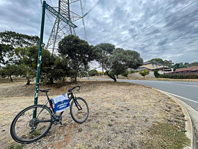
Cycling Coach House Drive and Woodland Way, South Australia

Ride 3.2 kilometers gaining 300 meters at 9.4% average grade.

This climb is rated the third hardest in Southern Australia, primarily due to its severe grade.  There is a 500 meter segment beginning at 1.9 kilometers that averages nearly 14% and 40% of the climb is in double digits.

bike parked against large green piece of machinery

Climb summary by PJAMM Cycling’s Brad Butterfield.

Sandwiched between the two routes up to Norton Summit, Coach House drive punishes riders with some wicked steep gradients towards the top. It’s a nice counterpart to the two Norton Summit climbs; good way to mix up the flavor of your ride when in the area. Once at the top, you’ll have the option to connect over to Norton Summit road for a more mellow (gradient wise) descent, or blast down Coach House drive in a minute or two.

PJAMM Cycling's Brad Butterfield takes a selfie in roadside mirror while riding his bike; sign below mirror reads "Distorted Image"

two-lane roadway overlooking town below, gorgeous cloud cover in sky

photo collage; eucalyptus trees, speed limit 50; sign reading "Crest"

bike parked against sign at intersection of Teringie Drive and Woodland Way; climb finish

Finish at the intersection of Woodland Way and Teringie Drive, just short of Norton Summit Road.