Page Contributor(s): Photos: A.S.O. / Unipublic / Cxcling / Antonio Baixauli
INTRO
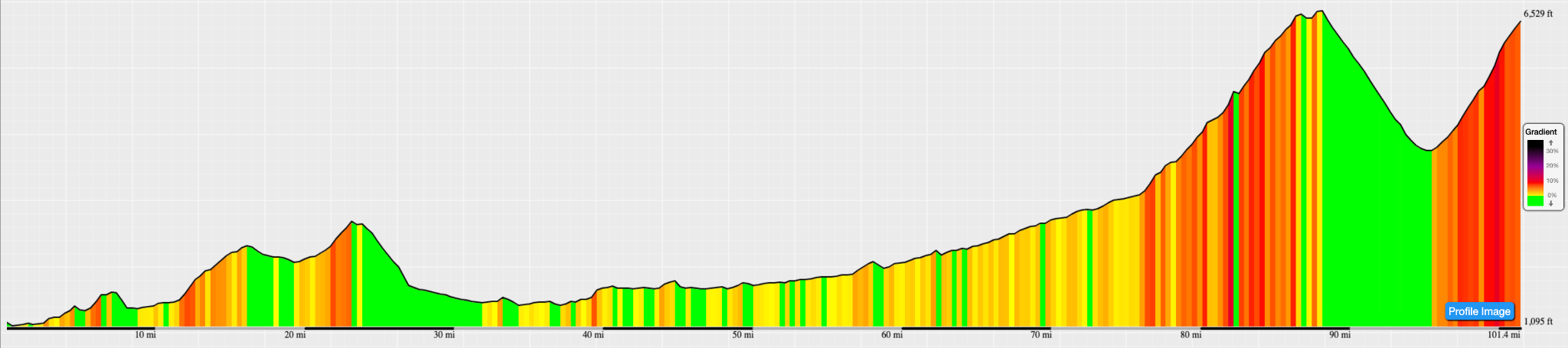
Stage 3 marks the Vuelta's first real mountain test: 174 km from the Mediterranean coast at Gruissan to a summit finish at Font-Romeu-Odeillo-Via on Monday, August 24. After a long transition west through the Corbières and Roussillon plains, the road turns uphill for good near Olette and doesn't let up — the Category 1 Col de Mont-Louis (19.4 km at 4.8%, cresting at 1,571 m) leads into a short descent and straight into the Category 2 finishing climb to Font Romeu (9.8 km at 5%, summit 1,936 m).
It's a day built for climbers and GC contenders rather than sprinters, and it should produce the race's first real time gaps.
PLAN YOUR ROUTE
 We've partnered with Sherpa-Map.com to bring you the best route planning tool. With a PRO Membership you can use this climb as a reference when creating your route.
 The two categorized climbs bookend the finale of an otherwise rolling, transitional stage. Col de Mont-Louis, the Category 1 test, gains 934 m over 19.4 km (4.8% average) with no brutally steep sections but a long, grinding rhythm that starts near Olette.
After a short descent through Font-Romeu-Odeillo-Via, the finishing Category 2 climb adds another 490 m over 9.8 km at 5% — a demanding one-two punch to close out 174 km of racing, and the first stage of the race where climbing legs will matter more than raw power.
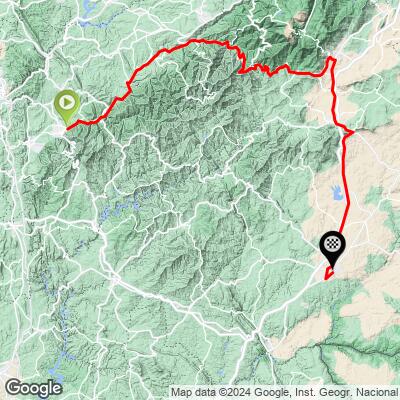
Outside race day, this route runs along quiet D-roads through Corbières wine country (Sigean, Rivesaltes) and up the Têt valley through Ille-sur-Têt, Prades, and the fortified town of Villefranche-de-Conflent before climbing to Mont-Louis and Font-Romeu.
Expect well-paved but narrow mountain roads on the two climbs, with more traffic near Prades and the Conflent valley towns. Parking is easiest in Olette or Mont-Louis if you'd rather ride just the categorized climbs than the full 174 km stage.
A compact or triple crankset is worth having for the sustained Col de Mont-Louis climb, especially if you're tackling it after 140 km already in your legs. Carry enough water for both climbs — services thin out above Olette, and with Font Romeu summiting near 6,350 ft, temperatures drop noticeably compared to the coast.
Neither climb is technical, so standard road tires and setup are fine; this is an endurance and pacing challenge more than a handling one.
If you have any information regarding this climb, we'd like to hear from you. Click the CONTRIBUTE button to share your thoughts with us.
ROUTE MAP