
15.5
PDI
14.8 mi
DISTANCE
3,486 ft
GAINED
4 %
AVG. GRADE
FULL CLIMB STATS
INTRO
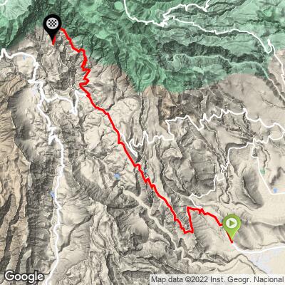
This climb rises from the dry coastal plain of southeast Gran Canaria into the vast Caldera de Tirajana - 23.8 km (14.8 mi) with 1,063 m (3,486 ft) of gain at a 4.0% average grade, from 187 m (614 ft) at Era del Cardón to 1,134 m (3,719 ft) at Agua Latente.
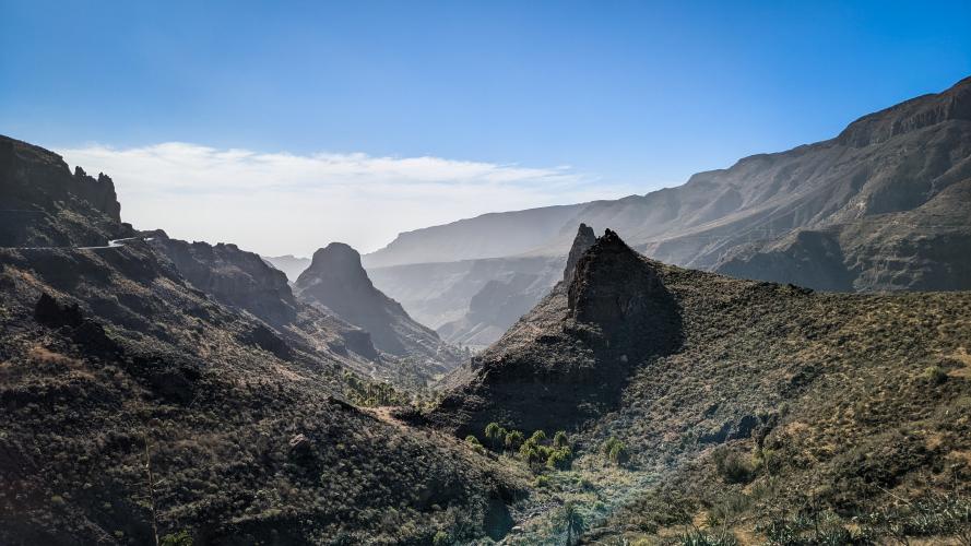
The low average hides two very different climbs. The first 14 km (8.7 mi) are gentle: the GC-65, the Carretera de Los Cuchillos, climbs a cliffside road with views down to the ocean, then crosses a flat plateau past the El Guriete viewpoint to the village of Santa Lucía, with its domed church and palm-filled ravines. After a short dip beyond the village, the GC-654 turns serious - the steepest kilometer (10.7%) comes on the climb through Rosiana and Lomo Taidía, where the road snakes up the caldera wall past towering volcanic cliffs.
This is a stage-worthy road: the opening day of the Gran Canaria Bike Week sportive has taken this route from the coast up through Santa Lucía toward Tunte.
Storm Therese closed the GC-654 for months in 2026; it reopened to traffic on 7 August 2026 - see Roadway & Parking.
PLAN YOUR ROUTE
 We've partnered with Sherpa-Map.com to bring you the best route planning tool. With a PRO Membership you can use this climb as a reference when creating your route.
 The climb covers 23.8 km (14.8 mi) at an average of 4.0%, gaining 1,063 m (3,486 ft) from 187 m (614 ft) to 1,134 m (3,719 ft). The steepest kilometer averages 10.7%, the steepest 2 km 9.4%, and the steepest 5 km 7.1%.
The first 7 km (4.3 mi) up the GC-65 average about 5%, reaching roughly 555 m (1,821 ft). Kilometers 7 to 11 are essentially flat across the plateau at El Guriete, followed by a moderate 3 km rise to Santa Lucía at about km 14 (8.7 mi) and 685 m (2,247 ft).
Just past the village the road drops about 35 m (115 ft), and then the real climb begins: from about km 15.5 to km 20 the GC-654 averages 8.2% for 4.5 km (2.8 mi), with several kilometers above 8.5%. After a short dip near km 20.5, the final 3 km (1.9 mi) average about 5% to the finish.
Roadway: Paved the entire way. The GC-65 is a two-lane road in good condition; the GC-654 above Santa Lucía is narrower and more rural, with tight bends, steep drops and low barriers in places. Storm Therese (19-26 March 2026) left the GC-654 between Rosiana and Tunte at risk of collapse, and it stayed closed until emergency repairs finished - it reopened to traffic on 7 August 2026, with minor slope and barrier work still being completed into September. The Cabildo also scheduled slope and rockfall-mesh work on the GC-65 (Carretera de Los Cuchillos) without long closures planned. Check the Cabildo de Gran Canaria's road notices before you go.
Traffic: Moderate at the bottom near Vecindario and on the GC-65 into Santa Lucía, which carries local traffic up from the coast. Above the village the GC-654 is quiet, used mostly by residents of Rosiana and Taidía.
Parking: Vecindario and El Doctoral, a few minutes below the start, are busy commercial towns with plenty of street parking. To skip the lower half, the El Guriete viewpoint on the GC-65 has a parking area, and Santa Lucía village has limited street parking.
Provisions: Stock up in Vecindario or El Doctoral before the start - there's nothing on the GC-65 until Santa Lucía, about 14 km (8.7 mi) in, where the village has bars and small shops for a refill before the steep part. Past the village, options are very limited until San Bartolomé de Tirajana (Tunte), just below the finish.
Gear: The lower half is hot, dry and exposed, so carry two full bottles and sun protection even in winter. The GC-654 above Santa Lucía holds grades above 8% for several kilometers, so a compact crankset with a 30- or 32-tooth cog is a sensible choice, and good brakes matter on the narrow, twisting descent.
Before heading out on any cycling adventure check out our Things to Bring on a Cycling Trip and use our interactive check list to ensure you don't forget anything.
Santa Lucía, the old village that gives this large municipality its name, sits at about 680 m (2,230 ft) inside the Caldera de Tirajana. Its church, which stands on the site of a 17th-century chapel, has a dome that looks almost like a mosque from a distance, and the Museo Castillo de la Fortaleza displays pre-Hispanic finds from the valley. Nearby, the Fortaleza de Ansite rock formations are considered the last stronghold of Gran Canaria's aboriginal people, where the Castilian conquest of the island ended in 1483.
The road above the village climbs through ground that has literally moved: the Rosiana landslide, reactivated several times since the 19th century, shifted about 3 million cubic meters of earth after exceptional rains in February 1956 and forced the evacuation of around 250 people. Higher up, the white volcanic wall of Risco Blanco, more than 400 m tall, dominates the caldera.
Stop at the El Guriete viewpoint on the way up for views across the Tirajana basin to the Ansite massif. Tunte, Fataga and the high roads to Pico de las Nieves are all close by - see what's nearby and build a longer day with our Routes in the Area tool.
ROUTE MAP
MEMBER RATING
CURRENT WEATHER
PJAMM TRIPS ADVENTURE STARTER BUNDLES
Check out PJAMM Adventure's prepackaged (self-guided) cycling trips. They will help you plan, document and conquer your next adventure.
NEARBY CLIMBS (0) RADIAL PROXIMITY
FROM No Climbs Found
MEMBER REVIEWS & COMMENTS
Let us know what you thought of this climb. Signup for our FREE membership to write a review or post a comment.
Already have an account?
LOG IN HERE
