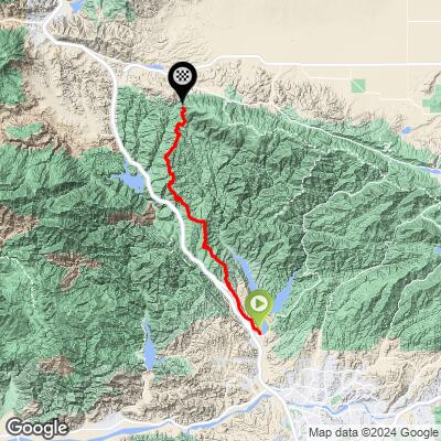
15.3
PDI
24.4 mi
DISTANCE
4,221 ft
GAINED
2.4 %
AVG. GRADE
FULL CLIMB STATS
INTRO
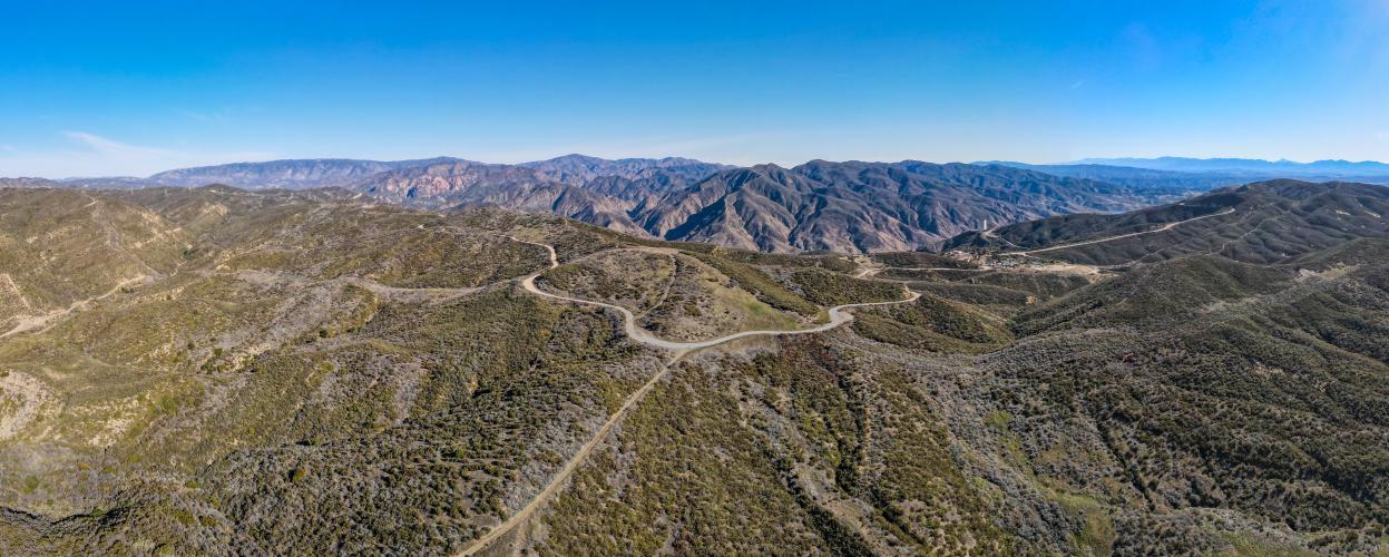
The Old Ridge Route is a road with a long and storied history. Built in 1915 and Known as "The Grapevine", the road is the original way to get from Los Angeles area into the Central Valley. The road was closed for being too dangerous, having caused many crashes due to its high speeds, tight curves, and steep dropoffs, and in 1933 was replaced by the US 99 interstate, which was replaced by the faster I-5 interstate in the 60s.
Now the majority of the road is closed to cars, leaving a peaceful and scenic ride for cyclists.
PLAN YOUR ROUTE
See more details and tools regarding this climb's grade via our interactive Profile Tool.
Road surface:
Buttery smooth to ok to bad to borderline gravel ride, then back to smooth. Since the road is closed to cars, they don't clear loose gravel/landslide residue very often.
Traffic:
You'll encounter some cars until the intersection of Templin Hwy (mile 7), but very few after that. Both times we did it, the road was closed to cars at mile 8.7
Parking:
They'll charge you a fee to park at the Castaic Lake park, so we just park in one of these neighborhoods for free.
One of the problems with this climb is it doesn't really go anywhere. It starts in Castaic, which is already a small exit off the 5, the kind with a couple gas stations and a McDonalds. And it goes to... Gorman? (keep riding another 10 miles) The Tumble Inn? (literal ruins) The Sandberg Inn? (also ruins) Three Points? (is this even a real place?)
We stopped for a soda and water refill at the Lucky Days dive bar in Lake Hughes halfway around our 68 mile loop which we recommend.
It's also closed to cars for a section, so there's hardly any traffic and no one to help if you get in trouble. Definitely a bring all your own water and food kind of ride.
Before heading out on any cycling adventure check out our Things to Bring on a Cycling Trip and use our interactive check list to ensure you don't forget anything.
The main attraction in the area is Castaic Lake State Park, one of the most popular non-ocean spots in LA area to go boating.
Fun fact: the dam is under constant monitoring due to seismic activity from the San Andreas Fault.
ROUTE MAP
MEMBER RATING
CURRENT WEATHER
PJAMM TRIPS ADVENTURE STARTER BUNDLES
Check out PJAMM Adventure's prepackaged (self-guided) cycling trips. They will help you plan, document and conquer your next adventure.
NEARBY CLIMBS (0) RADIAL PROXIMITY
FROM No Climbs Found
MEMBER REVIEWS & COMMENTS
Let us know what you thought of this climb. Signup for our FREE membership to write a review or post a comment.
Already have an account?
LOG IN HERE