
28.7
PDI
12.8 mi
DISTANCE
4,655 ft
GAINED
6.8 %
AVG. GRADE
FULL CLIMB STATS
INTRO
Alto de Garajonay is La Gomera's highest point at 1,487 m, sitting inside Garajonay National Park, a UNESCO World Heritage laurisilva (laurel) cloud forest. This route climbs to it from Hermigua, a village on the island's north coast, following the GM-1 for 20.6 km (12.8 mi) and gaining 1,419 m (4,655 ft) at a 6.8% average grade, from 95 m (312 ft) near the coast to roughly 1,475 m (4,837 ft) high on the mountain.
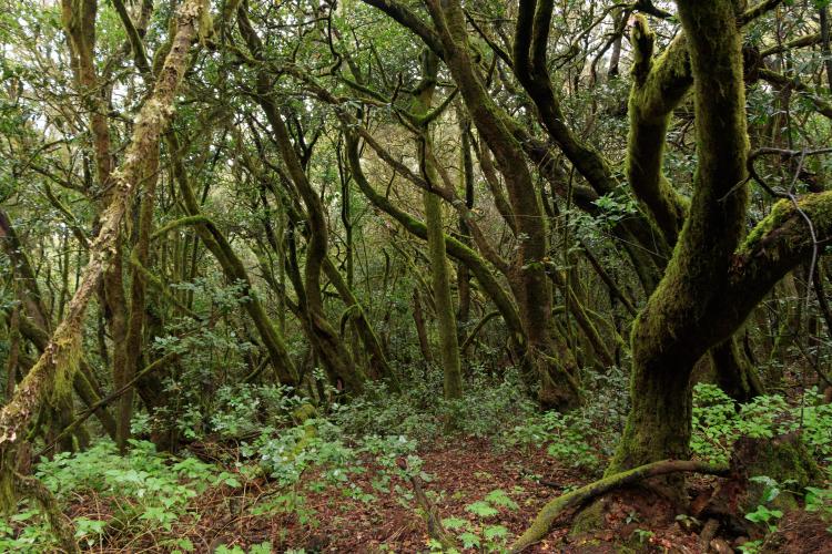
Hermigua itself sits in a steep-sided ravine terraced with banana plantations, and the climb starts by working straight up out of that ravine - expect a short, sharp pitch near the base before the grade settles into a long, steady grind. As the road gains altitude, the landscape changes dramatically, from the ravine's cultivated terraces to the dense, often mist-shrouded laurel forest of Garajonay National Park, one of the last surviving remnants of the subtropical forest that once covered much of southern Europe.
The road itself tops out near Pajarito, a short walk from the actual summit trig point - the true peak isn't rideable, since the final stretch to the highest ground is a signed walking trail through the forest, not part of the road. On a clear day the viewpoints along the way and near the top look out over the rest of La Gomera and, across open water, to Tenerife's Mount Teide, La Palma, and El Hierro.
PLAN YOUR ROUTE
 We've partnered with Sherpa-Map.com to bring you the best route planning tool. With a PRO Membership you can use this climb as a reference when creating your route.
 From Hermigua (95 m / 312 ft), the climb to Alto de Garajonay covers 20.6 km (12.8 mi) and gains 1,419 m (4,655 ft) at a 6.8% average grade, finishing around 1,475 m (4,837 ft). The road starts with its hardest work: a short, steep pitch climbing straight out of the Hermigua ravine, with the steepest kilometer on the whole route averaging around 15.7%. Above the ravine, the grade settles into a long, consistent grind through the national park's forest, without significant flat sections to recover on.
Roadway: The GM-1 is paved the entire way from Hermigua to the Garajonay National Park high point, and the Cabildo (island council) has carried out active repaving and tunnel maintenance work on this exact stretch between San Sebastian and Hermigua through 2025 and into 2026, so surface quality is generally good and improving. Because work is ongoing in places, check the Cabildo de La Gomera's road-status announcements before you go in case of intermittent closures.
Traffic: Light to moderate. The GM-1 is the main road linking Hermigua to the rest of the island, so it carries a steady trickle of local and tourist traffic, but volumes are low by mainland standards. Traffic thins out further as the road climbs into the national park itself.
Parking: Hermigua's village center has roadside parking near the GM-1, making it a natural base for the climb. Near the top, the Pajarito car park - at the junction where the short walking trail to the actual summit begins - has formal parking if you want to combine the ride with the walk to the true high point.
Gear: A compact or triple crankset is worth having for the steep pitch straight out of Hermigua, and since the finish sits near 1,475 m (4,837 ft) in cloud forest that's often shrouded in mist, pack a light jacket even on an otherwise warm day - conditions at the top can be noticeably cooler and damper than at the coast.
Provisions: Hermigua has shops, bakeries and cafes at the base for stocking up before you start. There's little to nothing along the climb itself once you're into the national park, so carry enough water and food for the full 20.6 km (12.8 mi).
Before heading out on any cycling adventure check out our Things to Bring on a Cycling Trip and use our interactive check list to ensure you don't forget anything.
Hermigua is known as one of La Gomera's greenest villages, its steep ravine terraced with banana plantations and split into an upper and lower half spread across 18 small neighborhoods - worth a wander before or after the ride. It's an easy base for exploring the rest of the island, connected to the capital San Sebastian de la Gomera by the GM-1 through a series of tunnels.
Garajonay National Park, which this climb passes through, is one of the last significant remnants of laurisilva forest anywhere in the world and is worth returning to on foot - the short walking trail from the Pajarito car park to the actual summit trig point is a worthwhile add-on if you have the legs and time after the ride. La Gomera's smaller, quieter roads and this UNESCO forest make it a genuinely distinct riding destination among the Canary Islands.
ROUTE MAP

MEMBER RATING
CURRENT WEATHER
PJAMM TRIPS ADVENTURE STARTER BUNDLES
Check out PJAMM Adventure's prepackaged (self-guided) cycling trips. They will help you plan, document and conquer your next adventure.
NEARBY CLIMBS (0) RADIAL PROXIMITY
FROM No Climbs Found
MEMBER REVIEWS & COMMENTS
Let us know what you thought of this climb. Signup for our FREE membership to write a review or post a comment.
Already have an account?
LOG IN HERE
